|
General maps
More maps in the historical
maps section
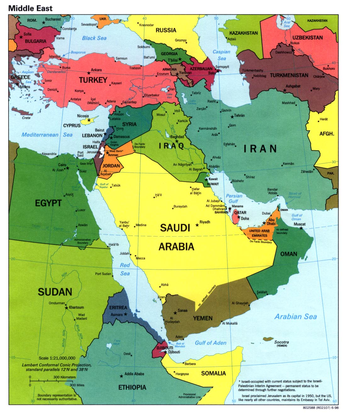
Middle
East
Political, 1998 Middle
East
Political, 1997 (pdf –1Mb)
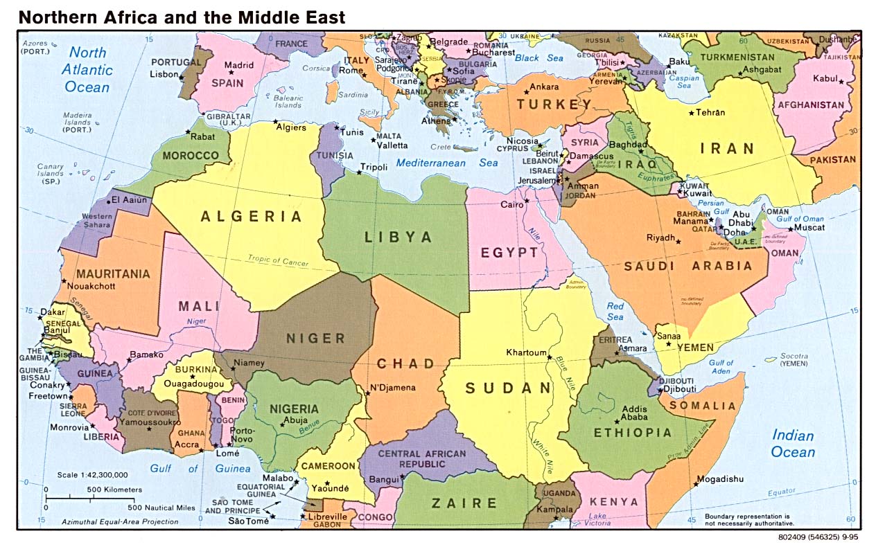
North
Africa and the Middle East
Political, 1995
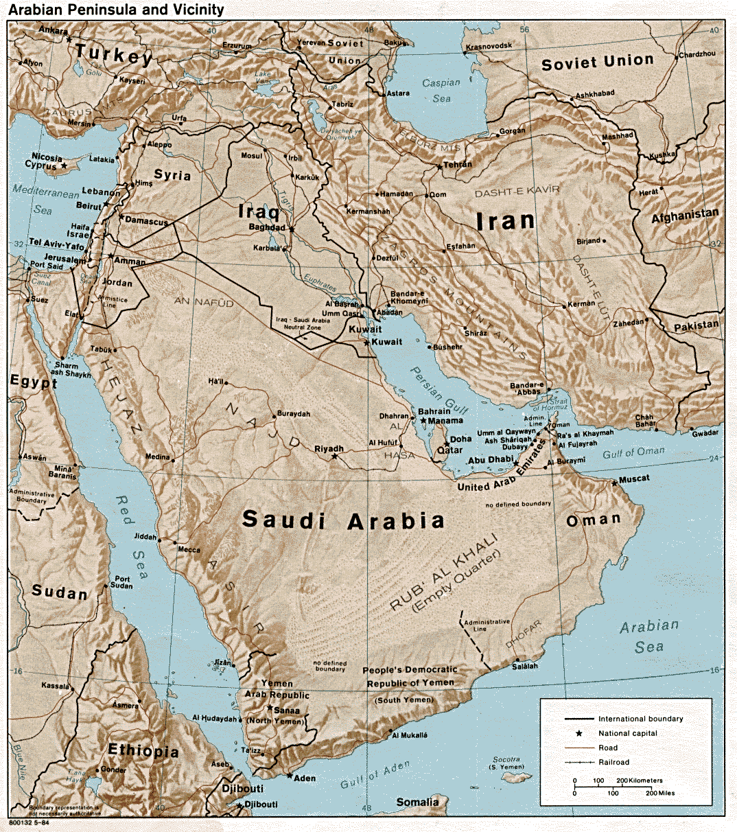
Arabian
Peninsula and vicinity
(shaded relief) 1984
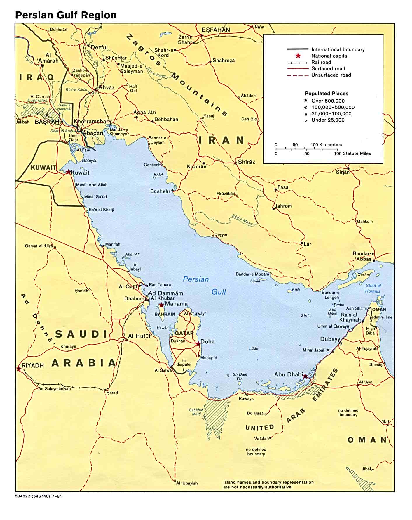
Gulf
region
Political, 1981
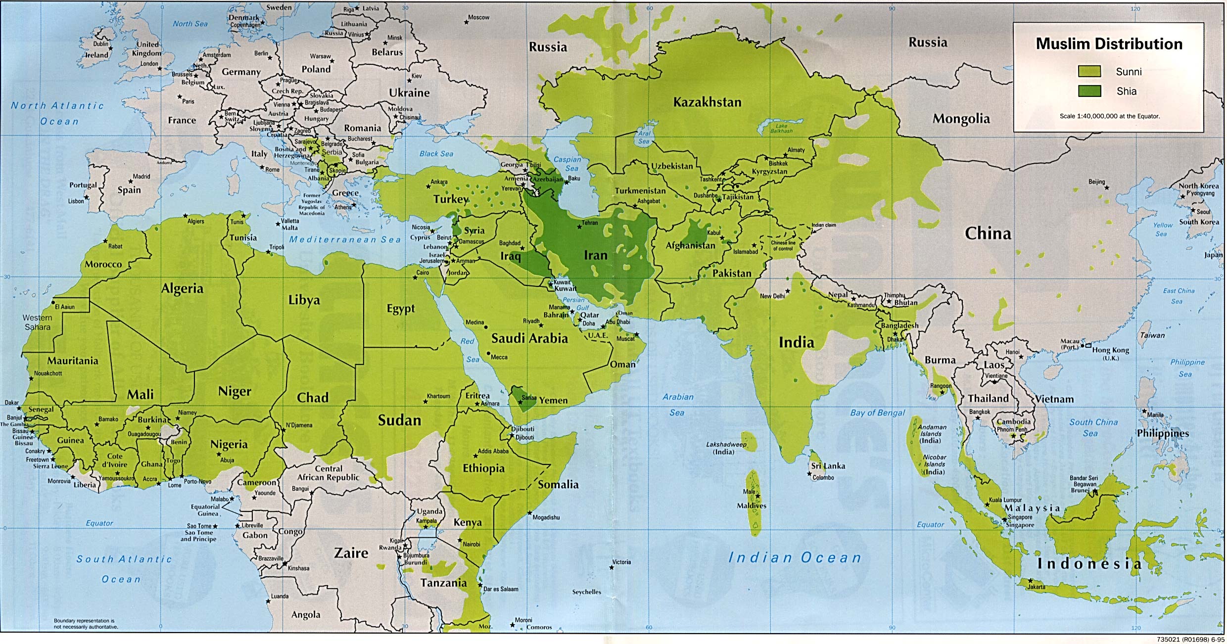
Muslim
distribution
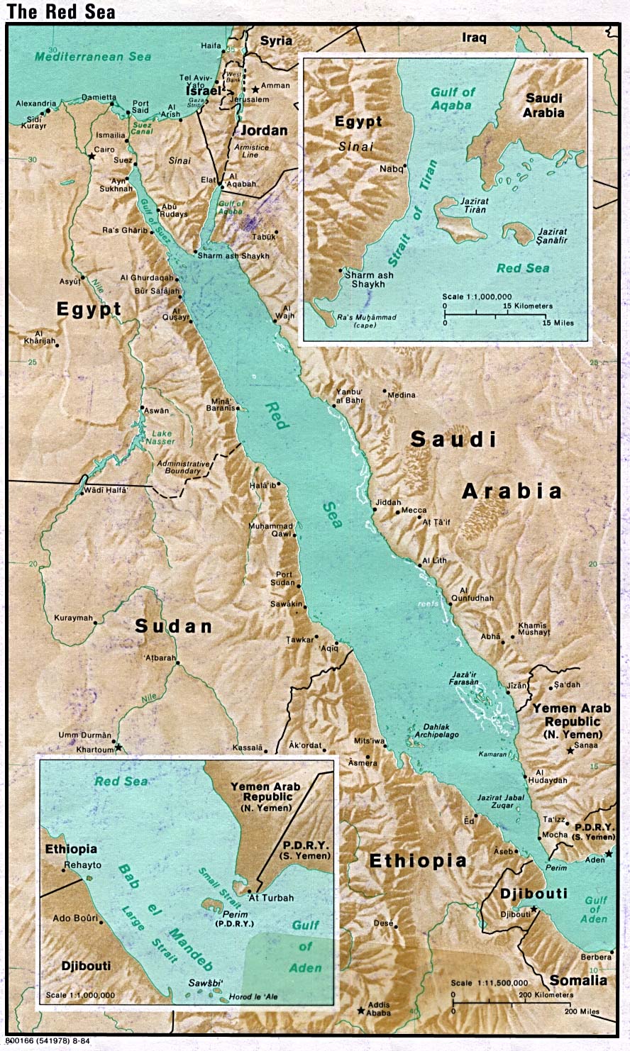
Red
Sea
Shaded relief, 1984
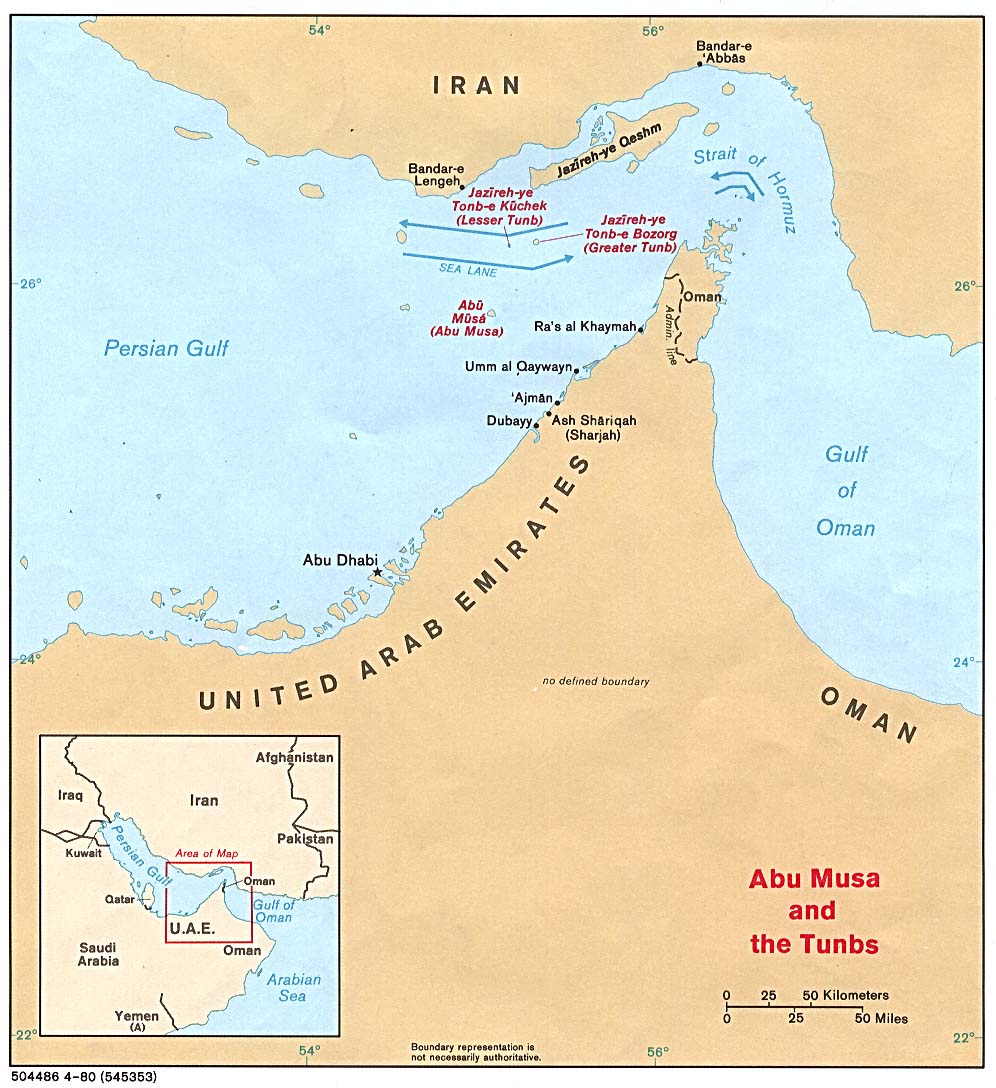
Strait
of Hormuz
Political, 1980
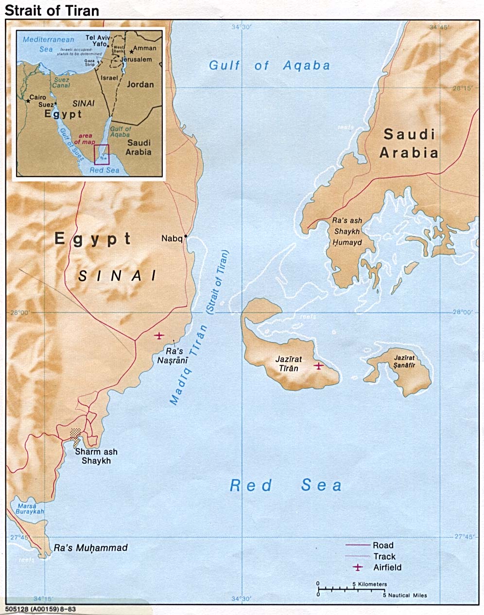
Strait
of Tiran
1983
Palestinian
refugee camps
1993
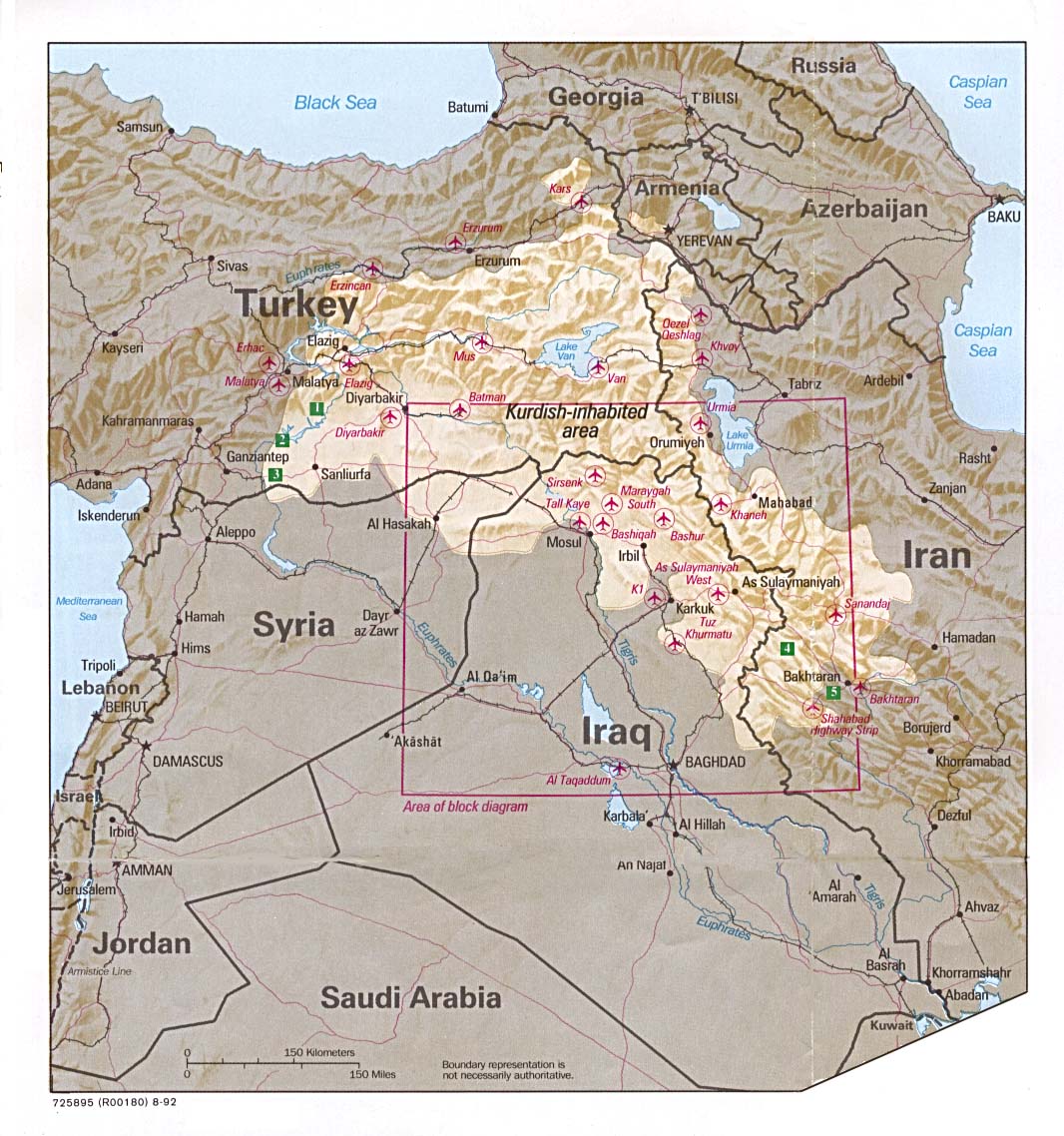
Kurdish
lands
Location map, 1992
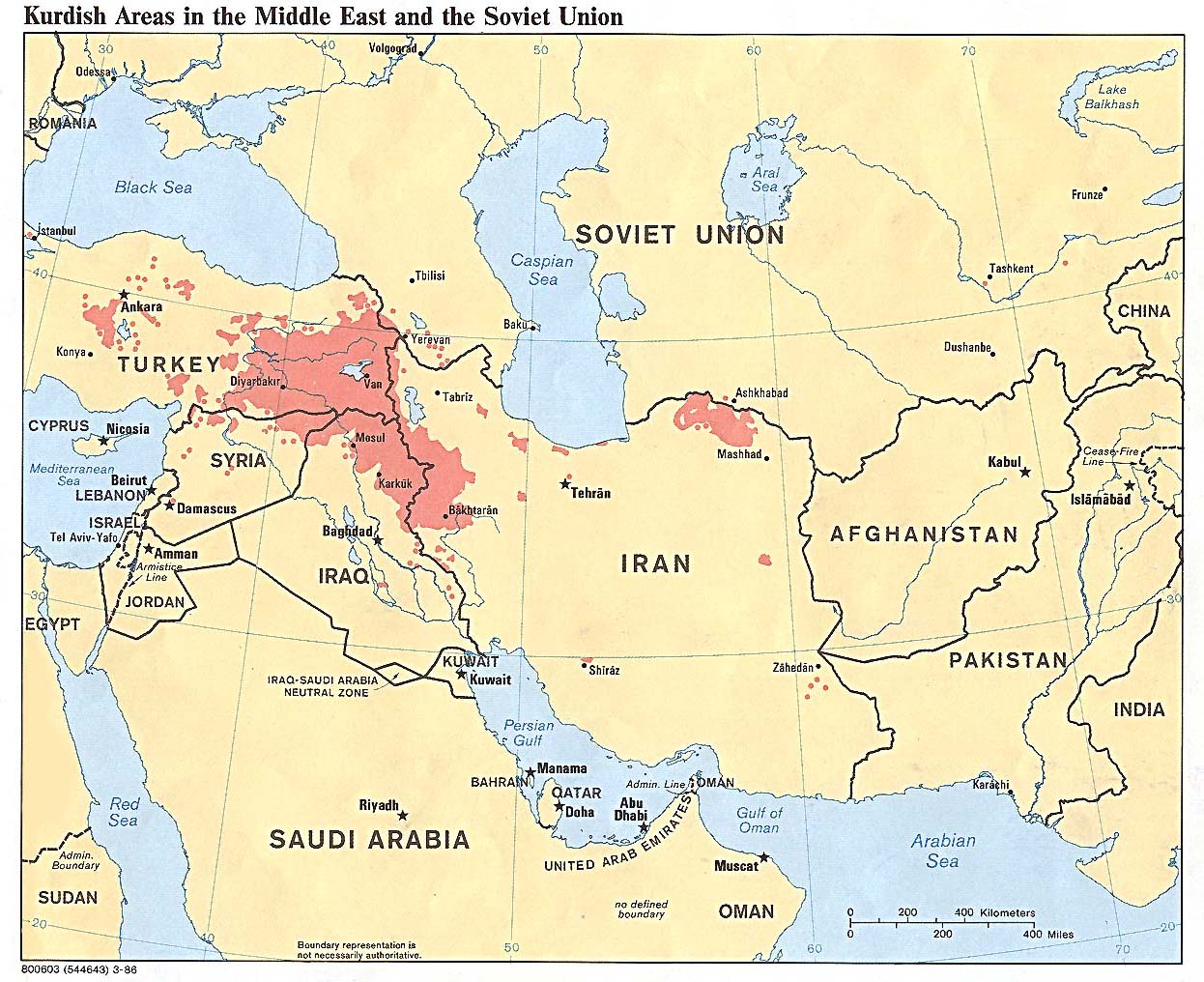
Kurdish
areas
Middle East and former Soviet Union, 1986
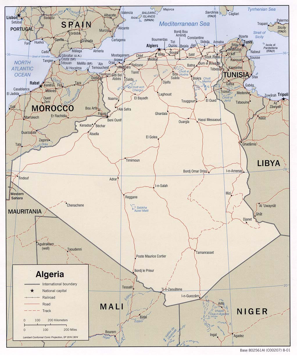
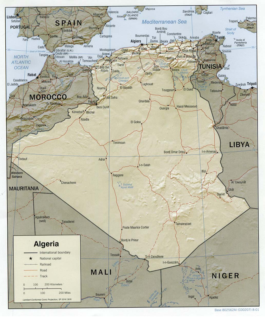
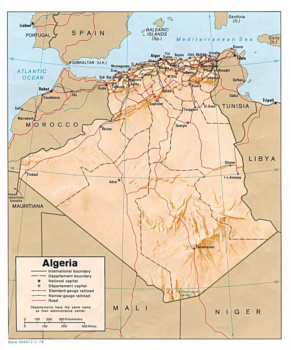
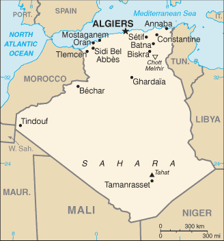
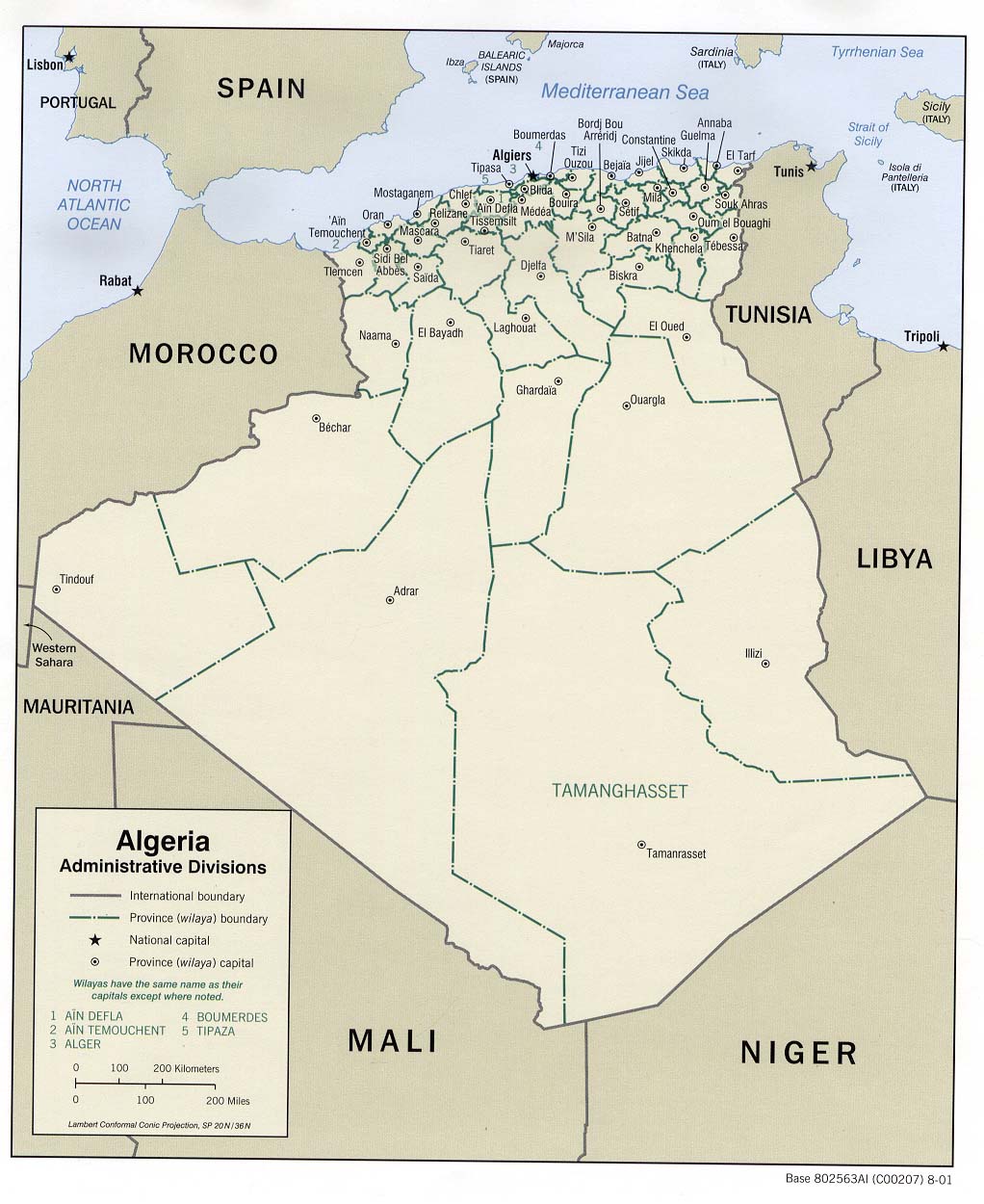
Algeria
Political
map 2001
(also pdf format)
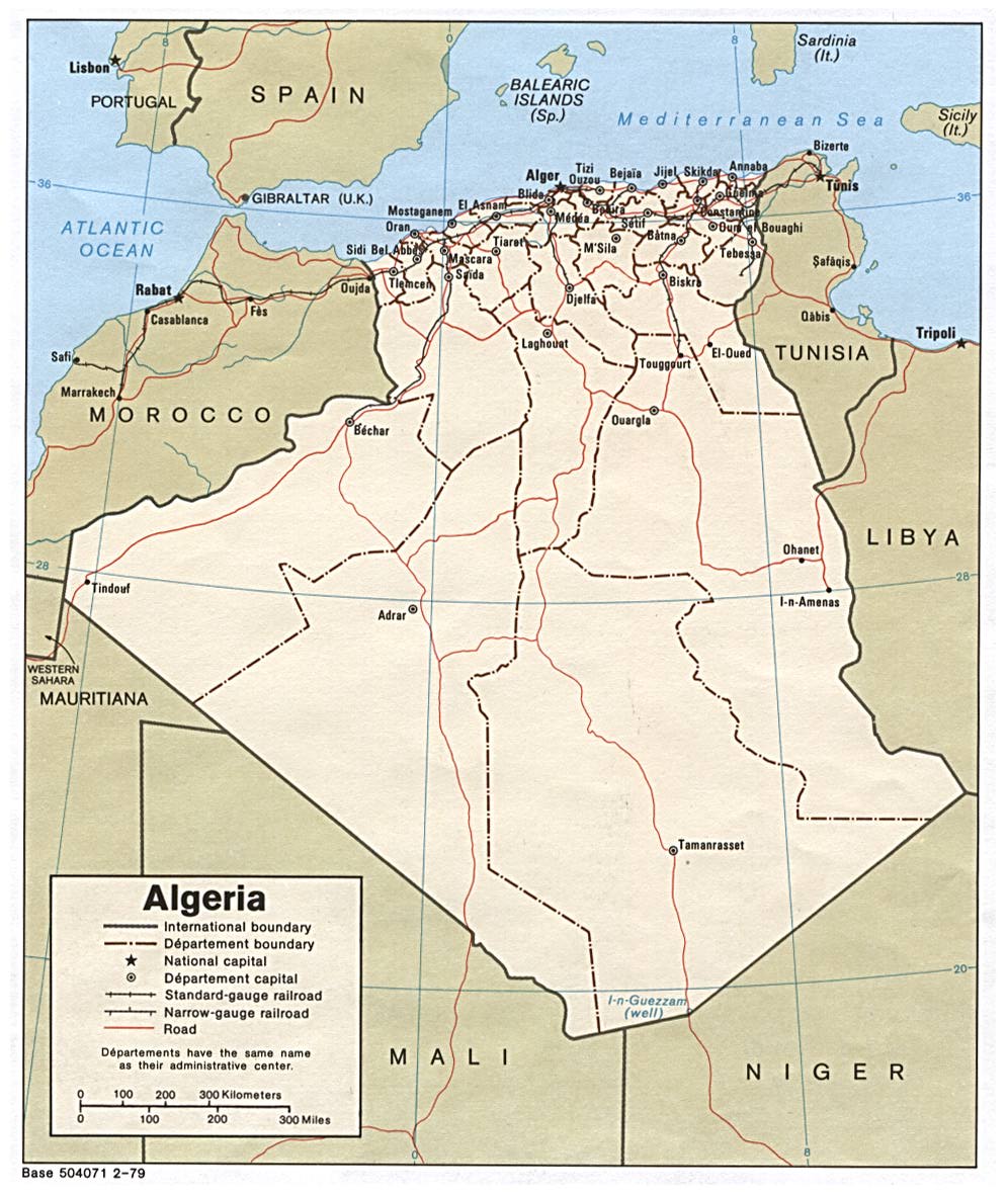
Political
map 1979
(also pdf format) Shaded
relief 2001
(also pdf format)
Shaded
relief 1979
(also pdf format)
Small
map 2011 Administrative
divisions 2001
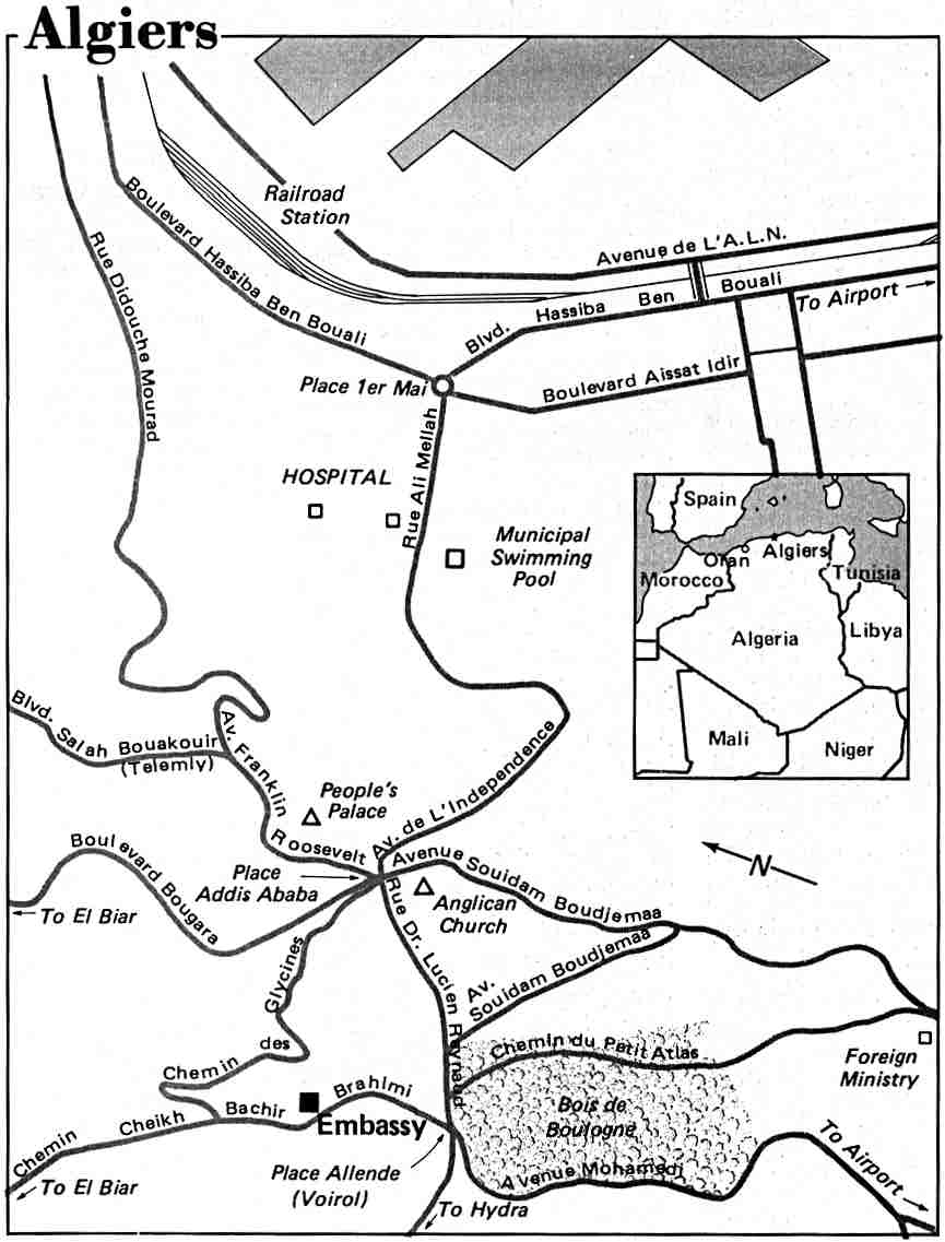
Algiers
US State Dept 1984
Algiers
US Army Map Service 1965
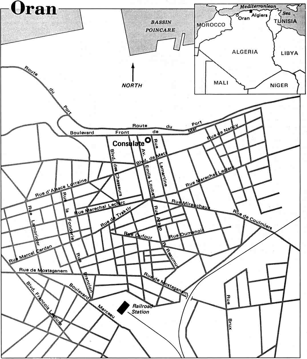
Oran US
State Dept 1984
Algeria
city plans
US Army Map Service, 1942-1943
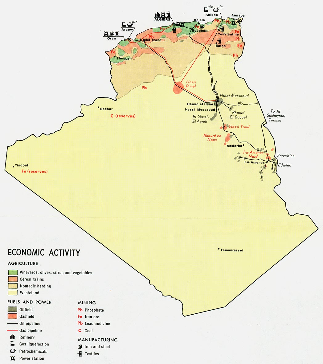
Economic
activity
1971
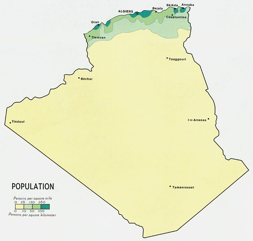
Population
1971
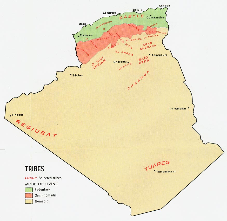
Tribes
1971
Algerian provinces
Map and information about each province, including local festivals.
(Algerian embassy)
Bahrain
Political
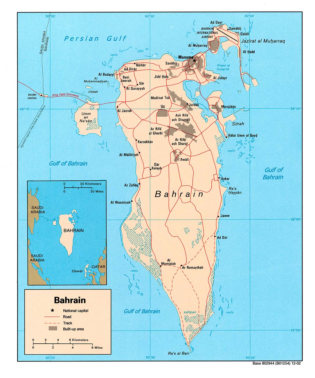
map 2003 (also pdf format)
Political
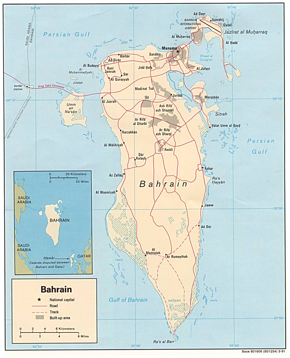
map 1991 (also pdf format)
Political
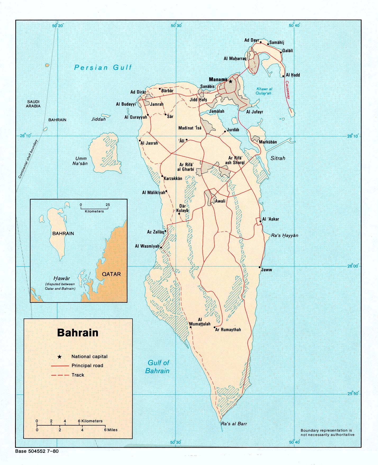
map 1980 (also pdf format)
Small
map 2011
Manama
city map (mappery.com)
Manama
interactive map (Yahoo Travel)
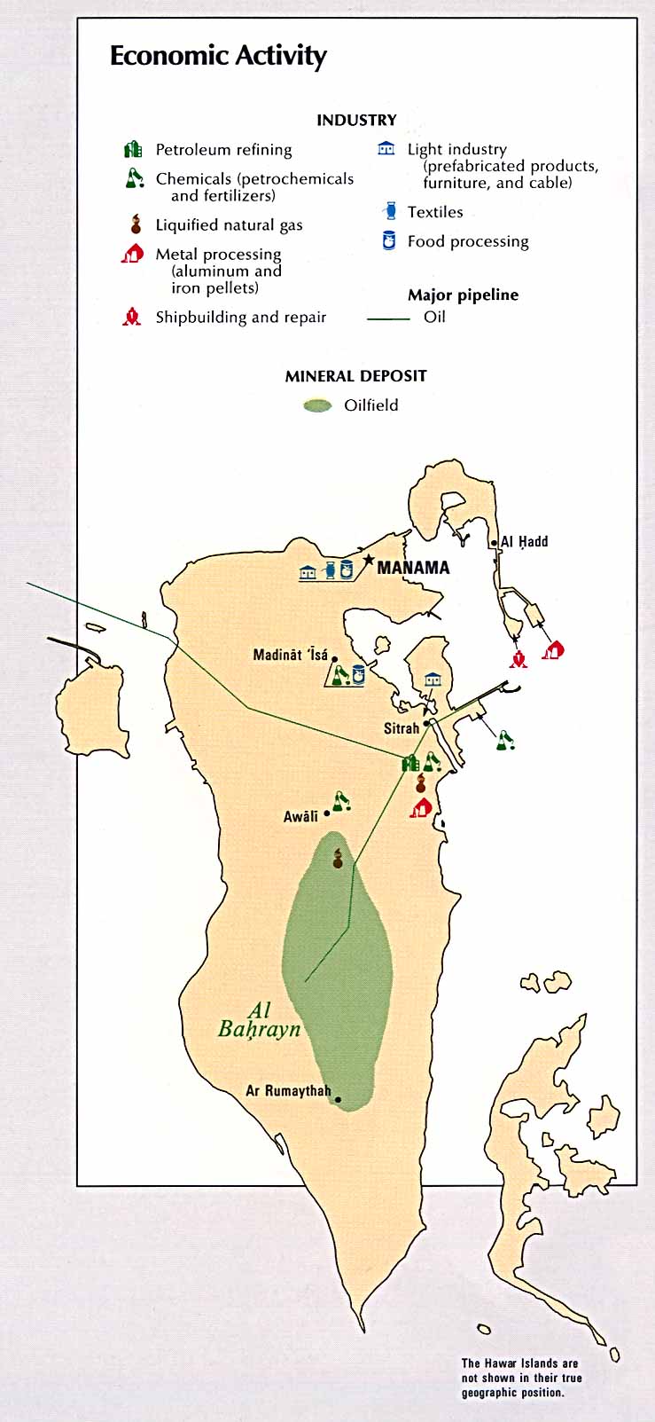
Economic
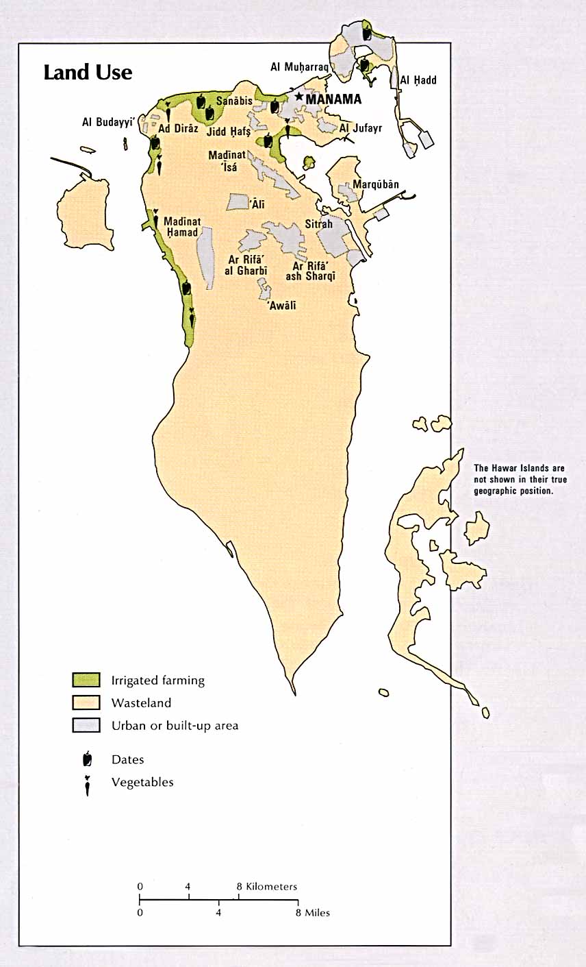
activity (CIA Atlas of the Middle East) 1993 Land
use (CIA Atlas of the Middle East) 1993
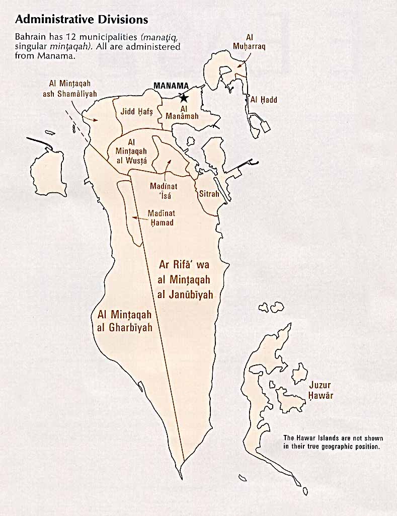
Administrative
divisions (98k)
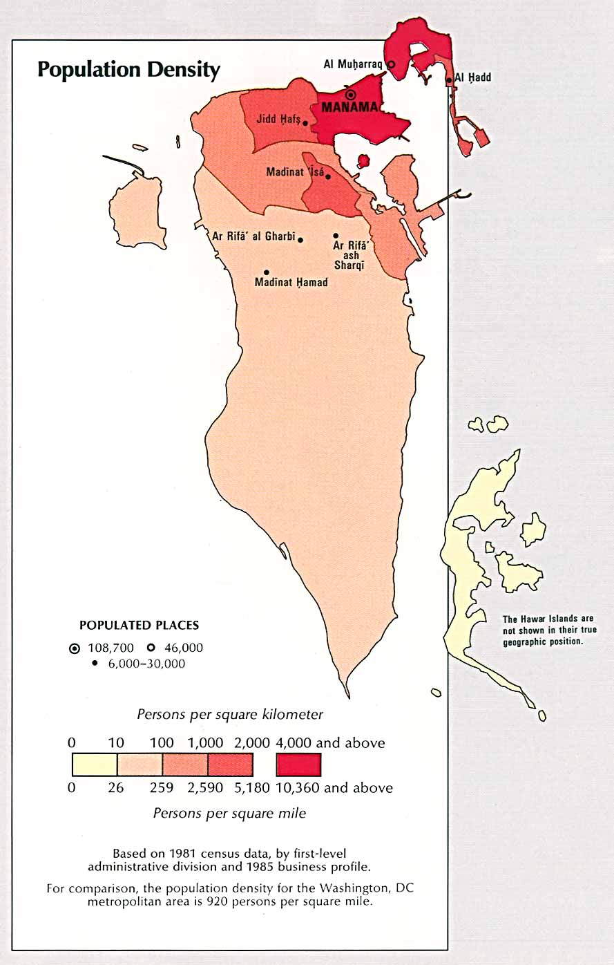
Population
density (110k)
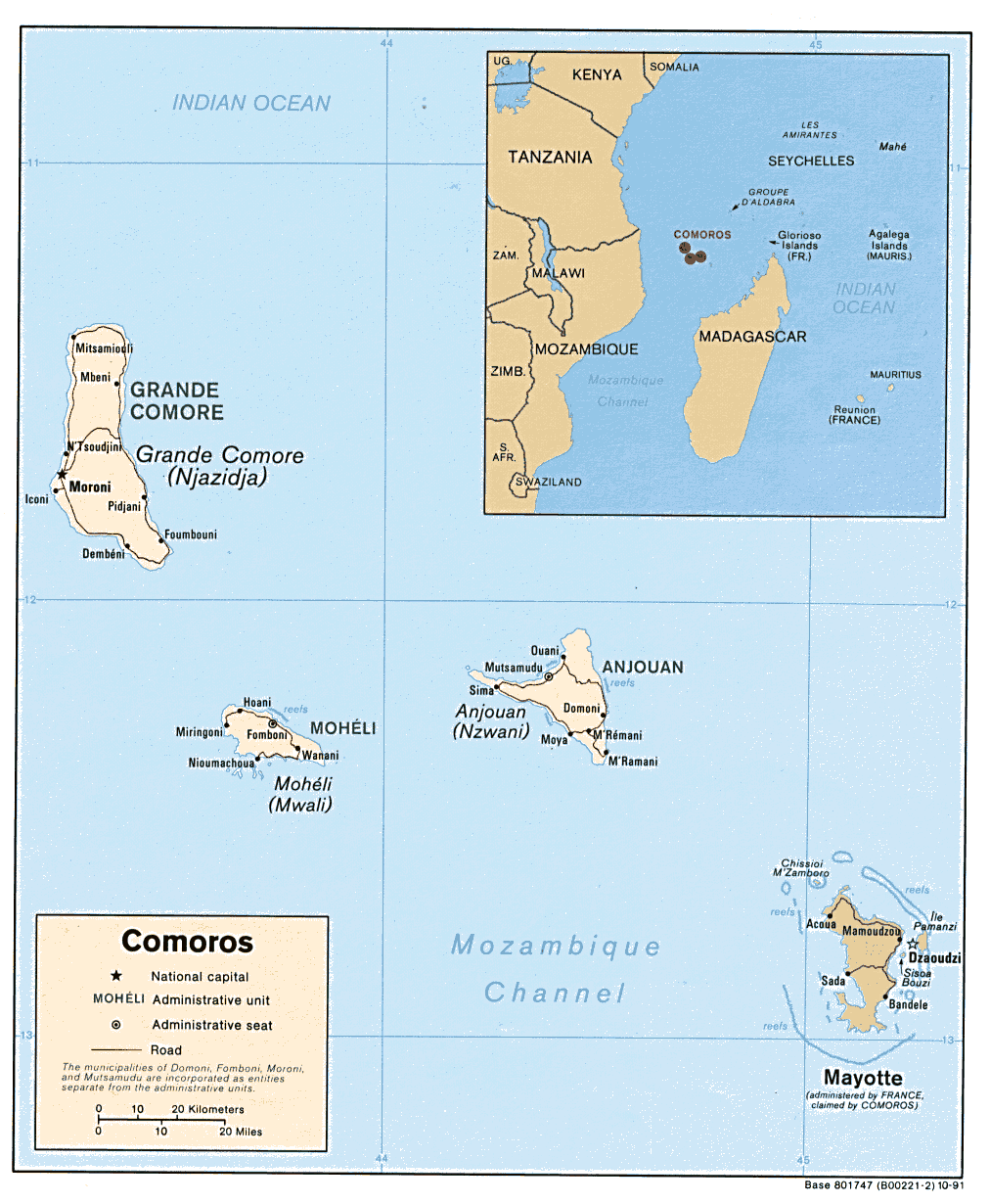
Comoros
Political
map (also pdf
format)
Shaded
relief map (also pdf
format)
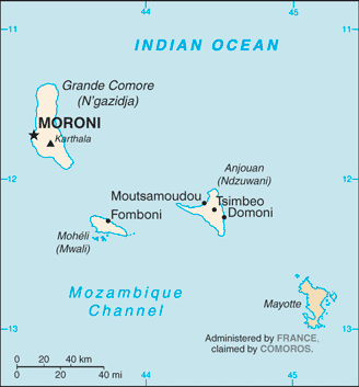
Small
map 2011
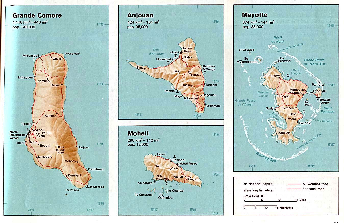
Comoros
(Grande Comore, Anjouan, Moheli, Mayotte) Indian Ocean Atlas, 1976
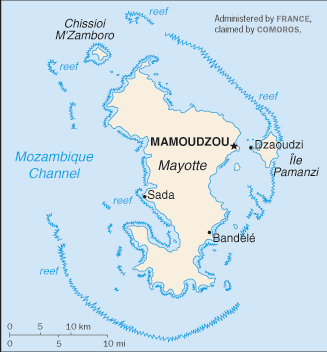
Mayotte
(small map) 2010
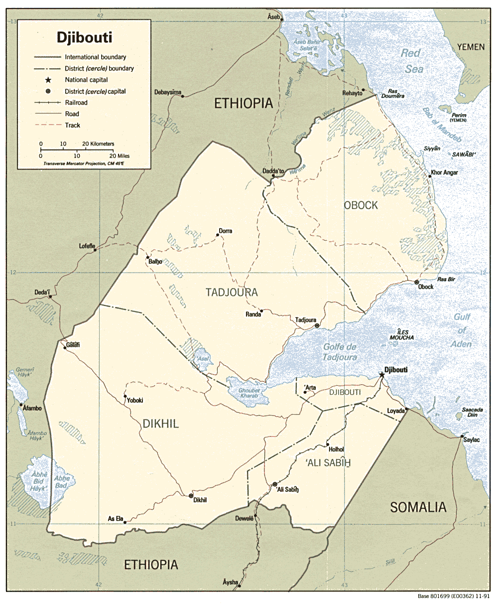
Djibouti
Political
map 1991 (also pdf format)
Shaded
relief map 1991 (also pdf format)
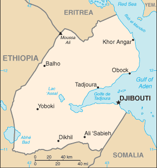
Small
map (Small Map) 2011 Djibouti
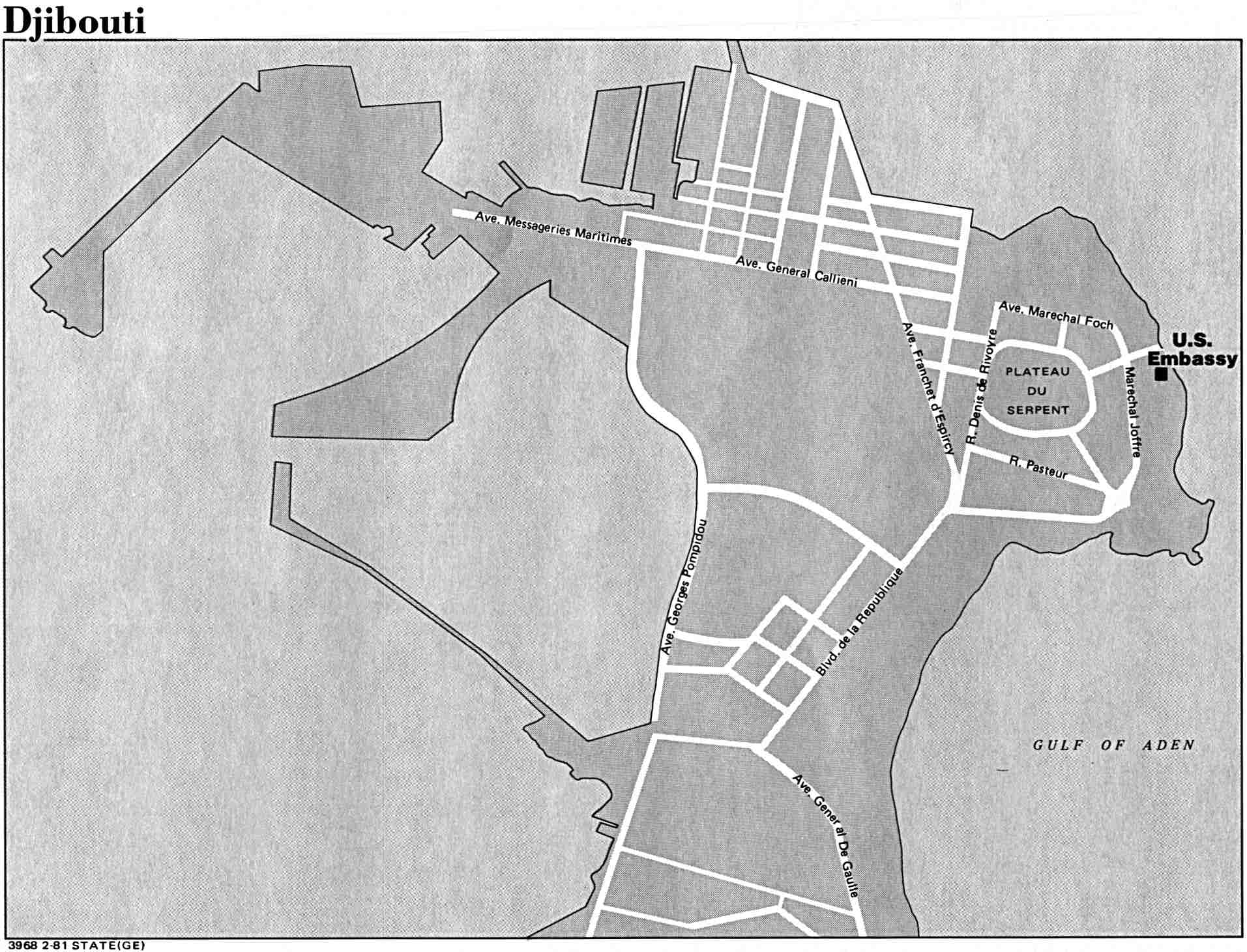
city US State Dept. 1981
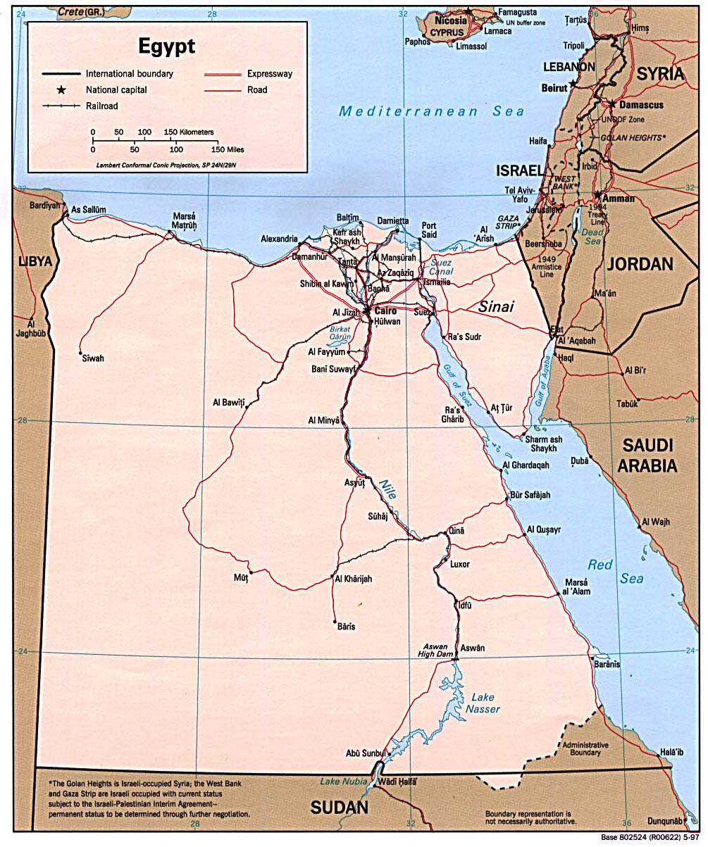
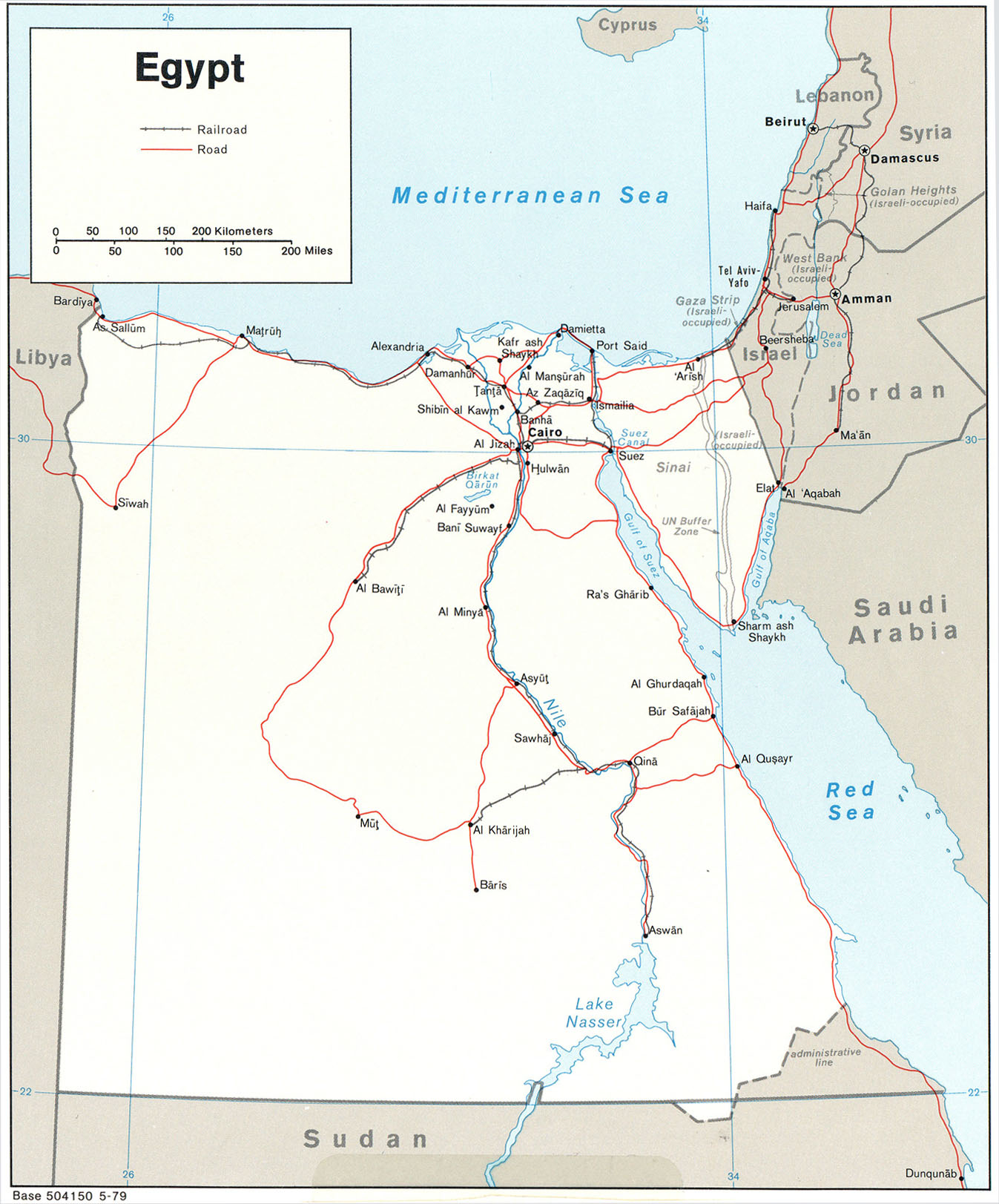
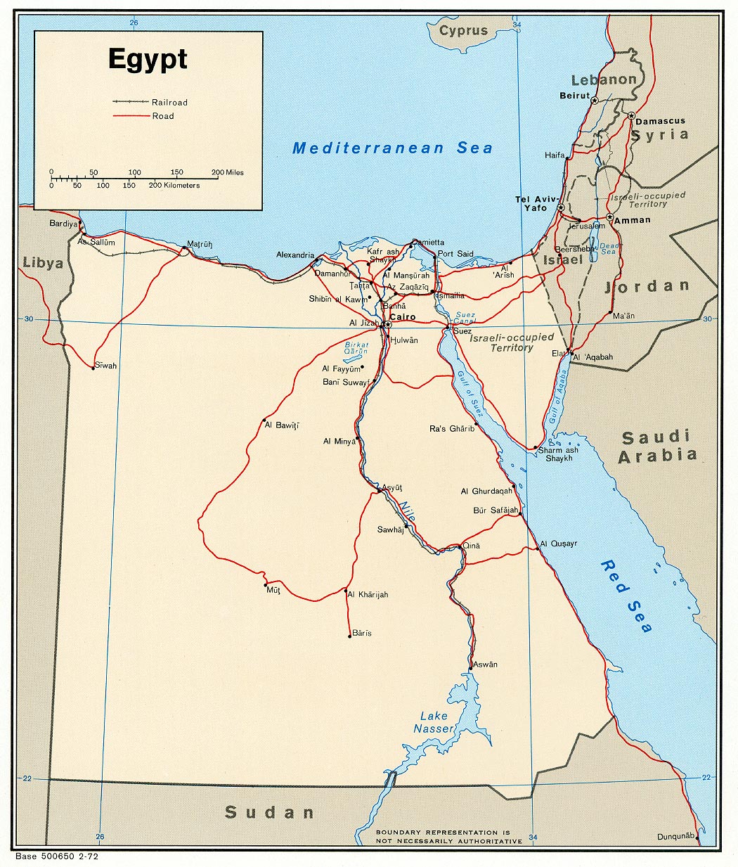
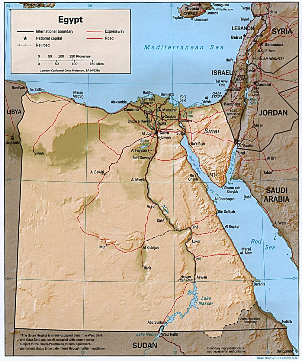
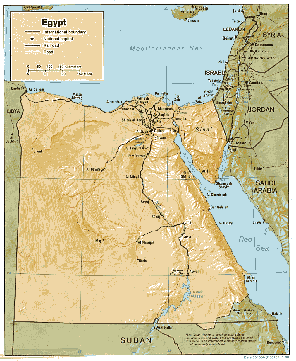
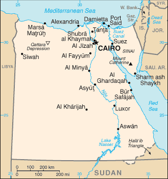
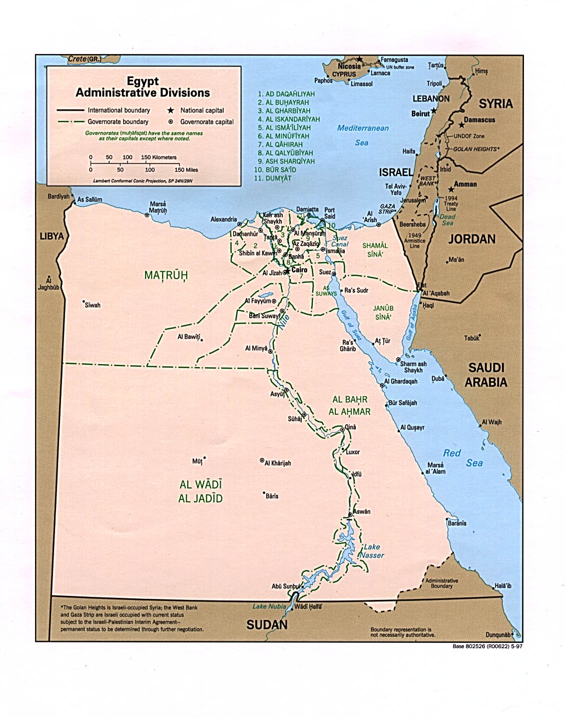
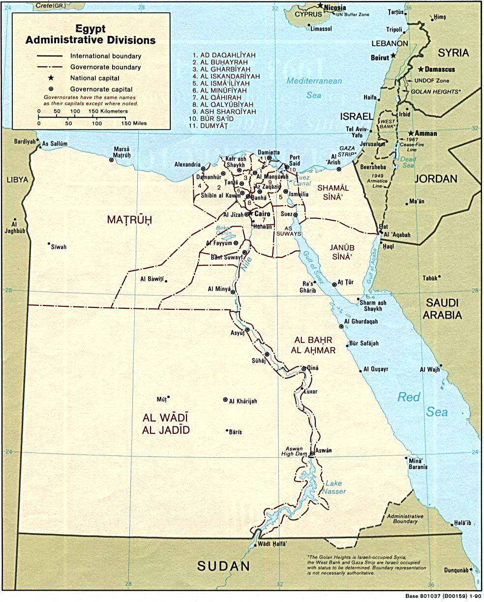
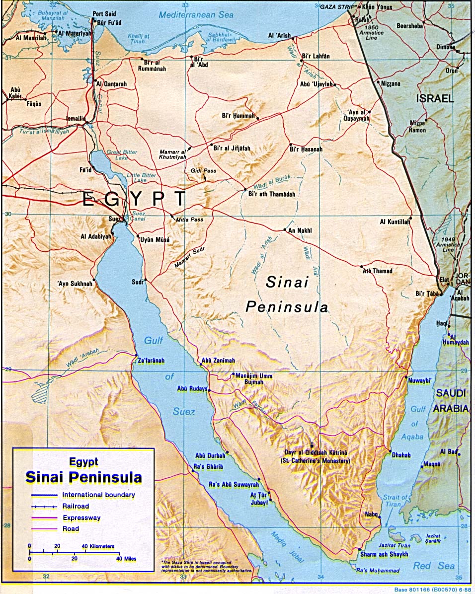
Egypt
Political
map 1997 (also pdf format)
Political
map 1979
Political
map 1972 (also pdf format
Shaded
relief map 1997 (also pdf format)
Shaded
relief map 1988 (also pdf format)
Small
map 2011 Administrative
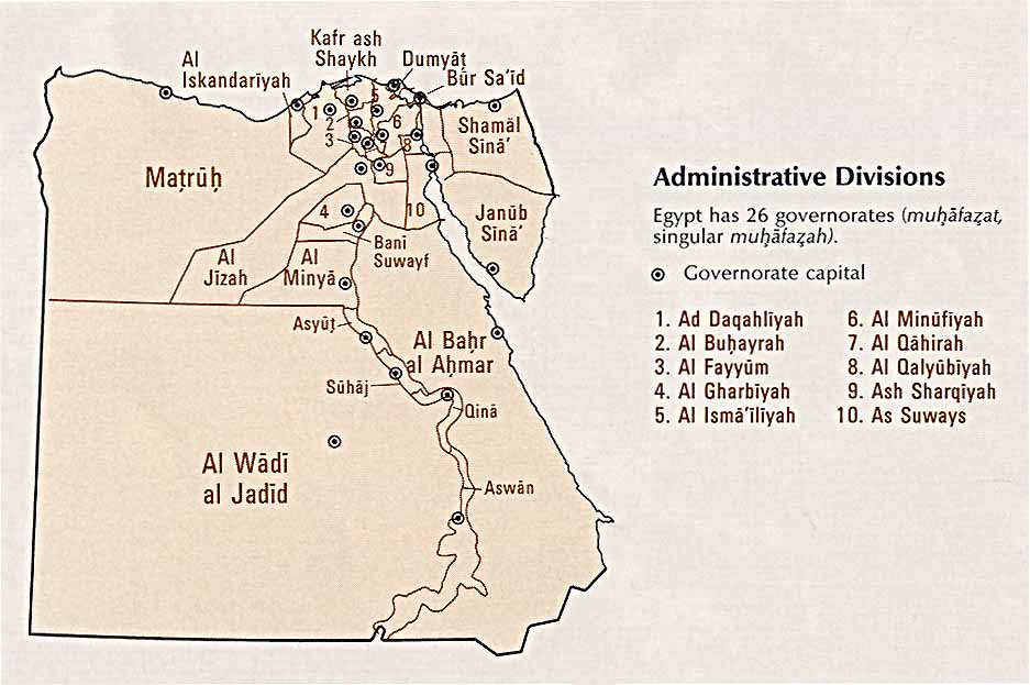
divisions 1997 (also pdf format) Administrative
divisions 1990 (also pdf format)
Sinai Peninsula
(shaded relief) 1992
Strait of Tiran 1983
Administrative
divisions 1997
Administrative
divisions (CIA Atlas of the Middle East) 1993
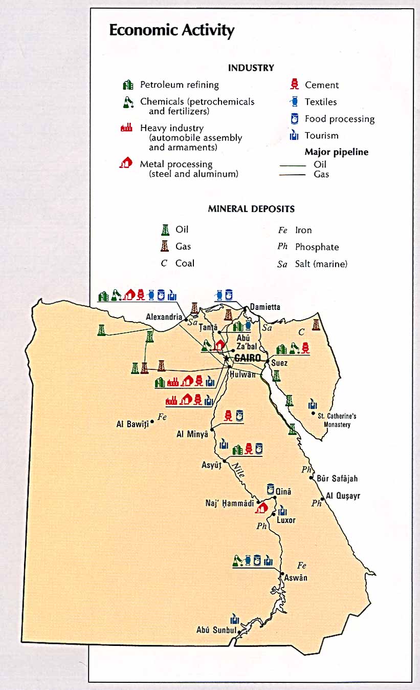
Economic
activity ( CIA Atlas of the Middle East) 1993
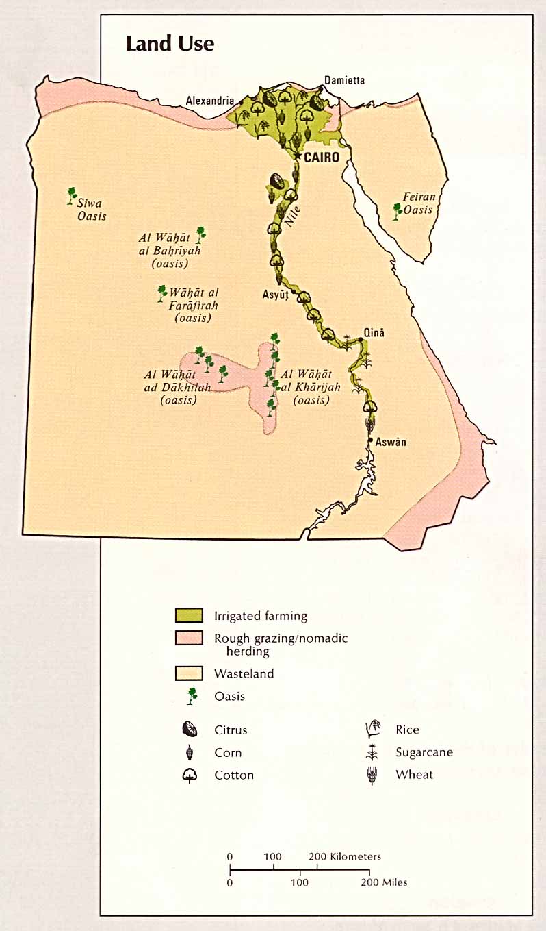
Land
use ( CIA Atlas of the Middle East) 1993
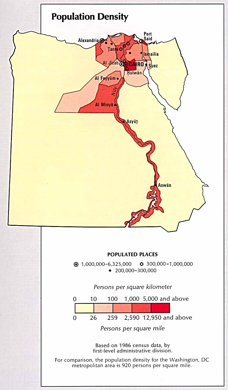
Population
density ( CIA Atlas of the Middle East) 1993
Iraq
See special page
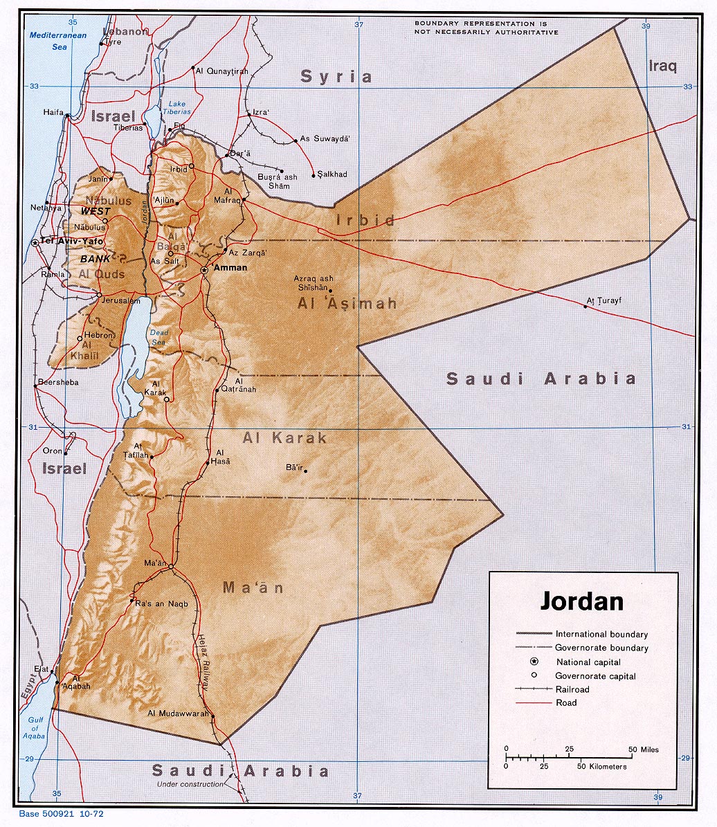
Jordan
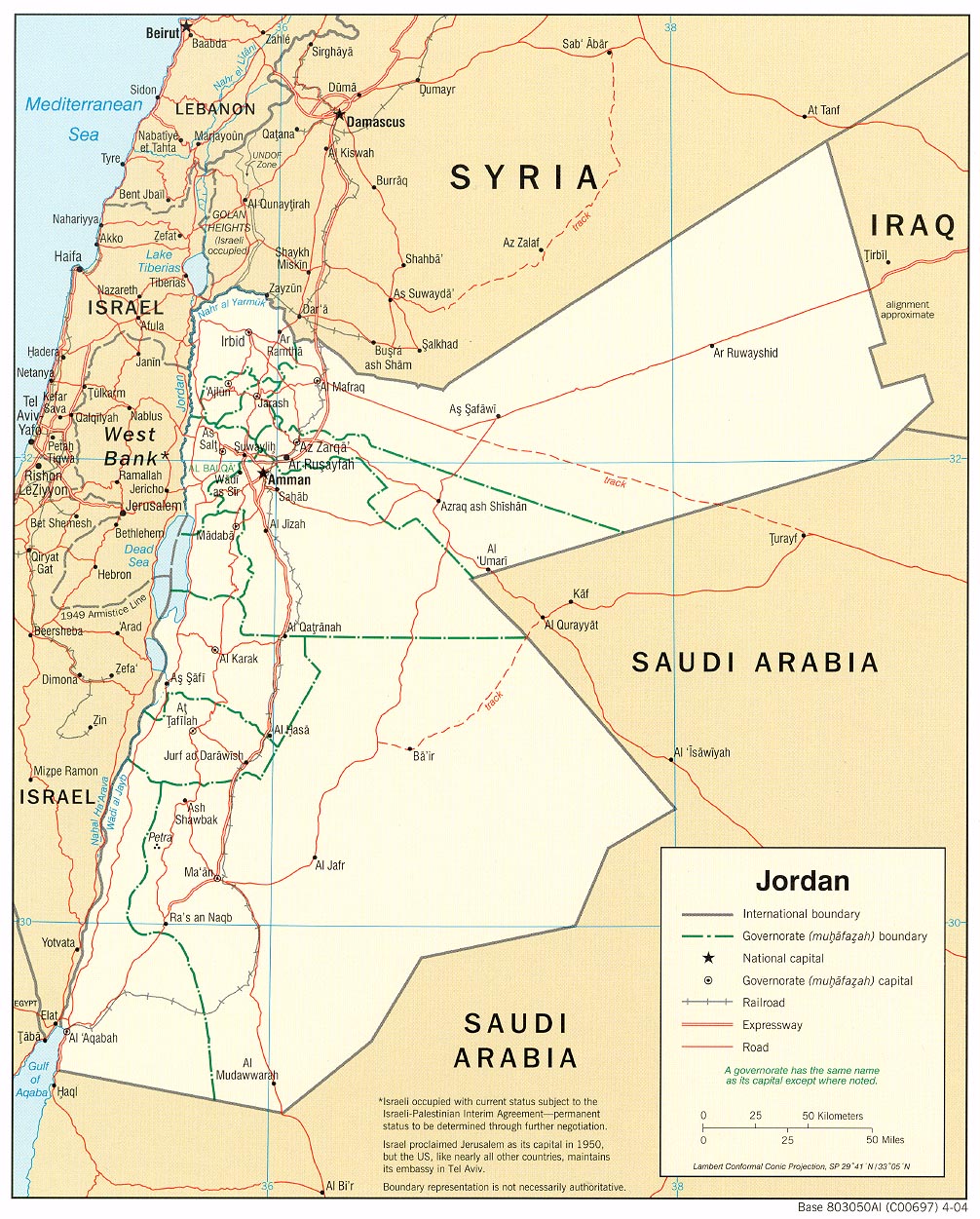
Political
map 2004 (also pdf format)
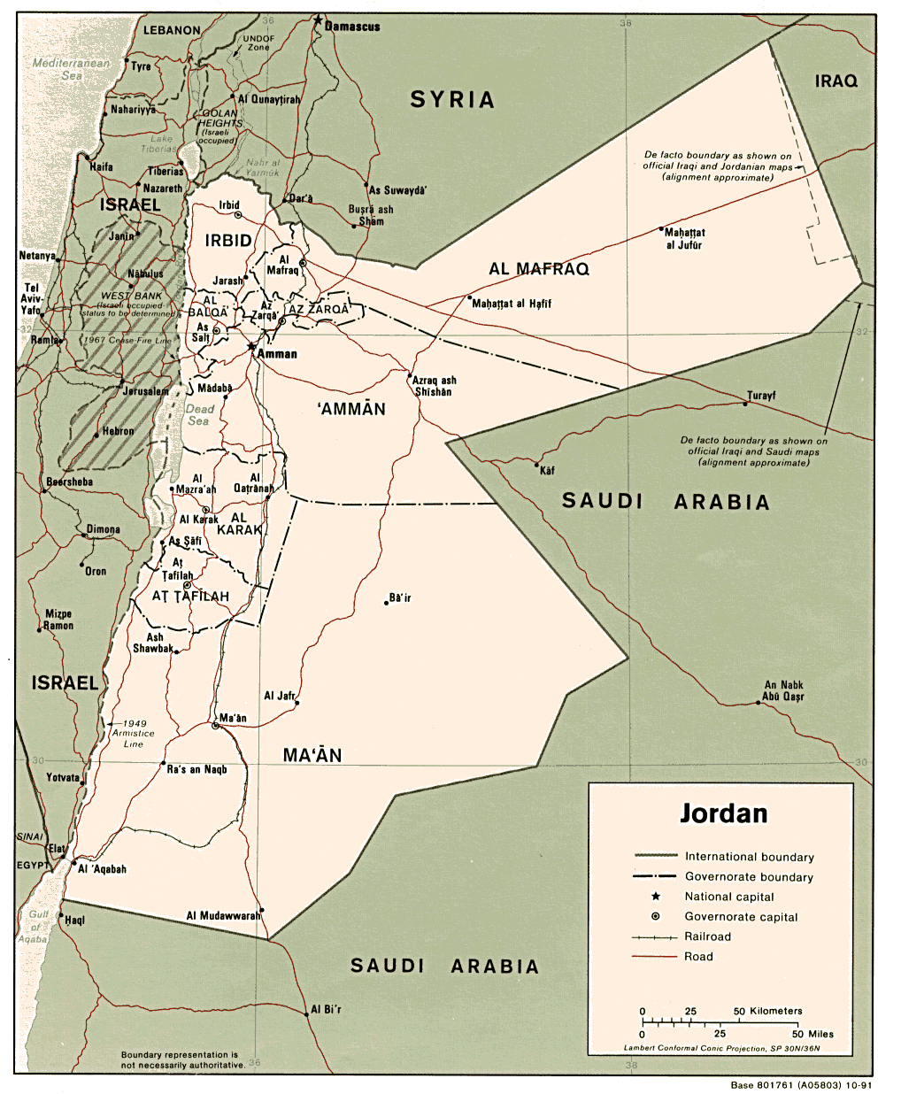
Political
map 1991 (also pdf format)
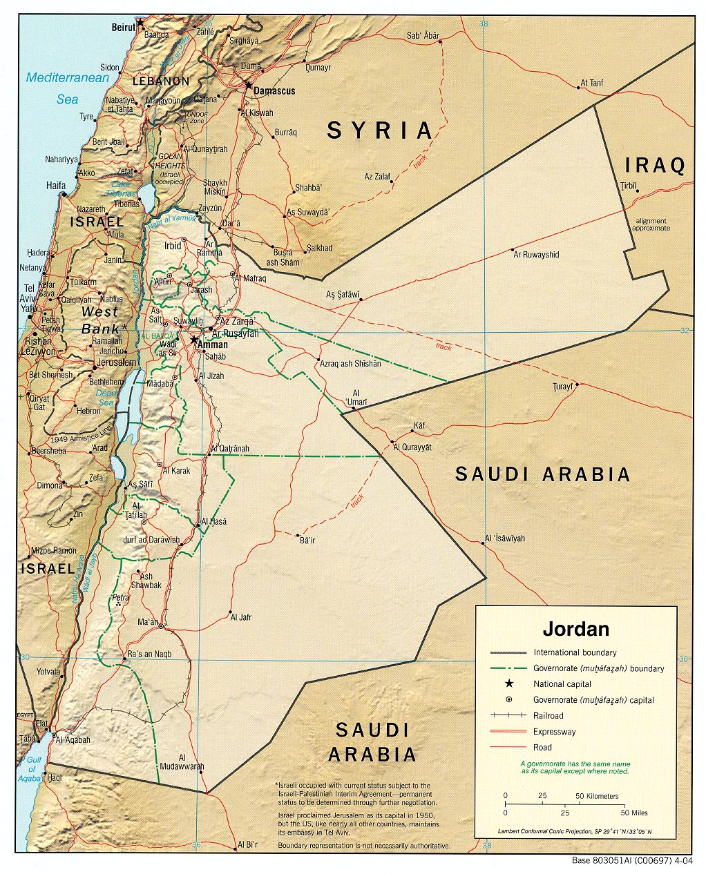
Shaded
relief map 2004 (also pdf format) Shaded
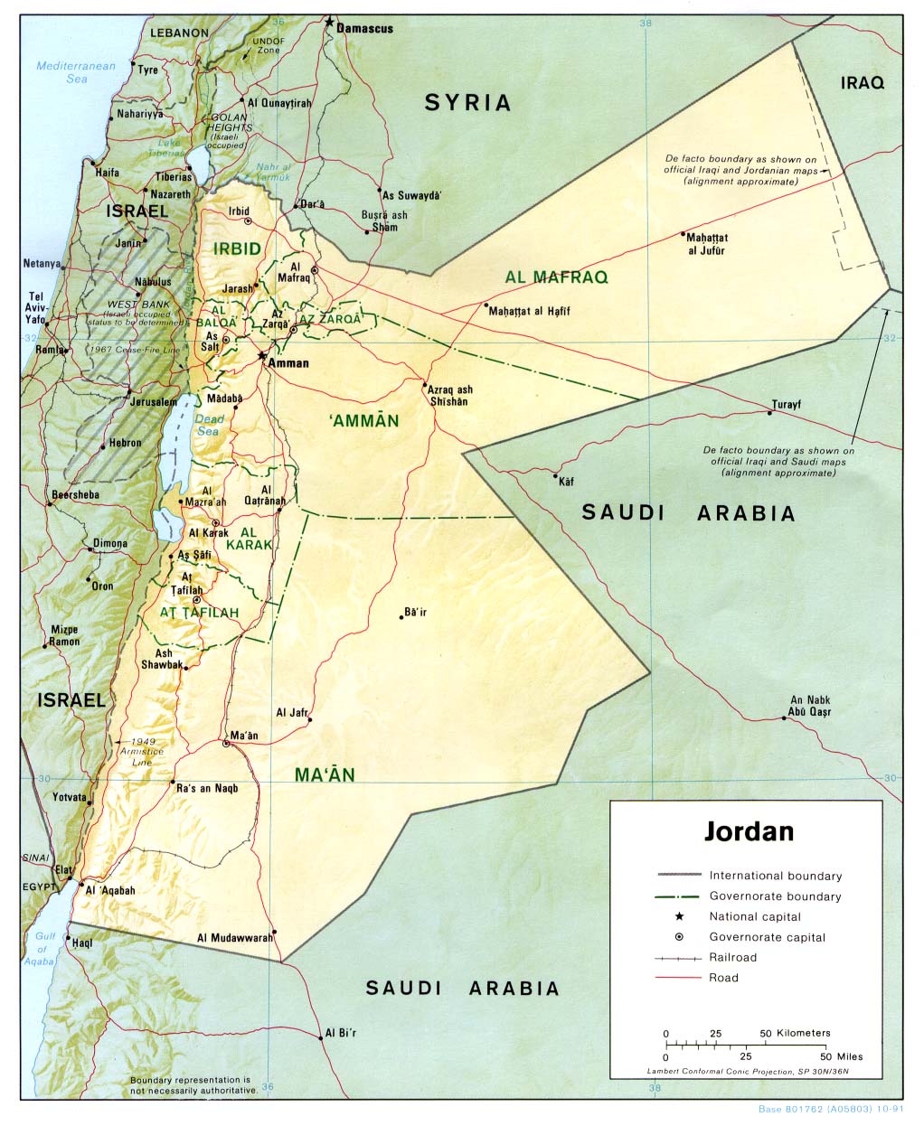
relief map 1991 (also pdf format)
Shaded
relief map 1972 (also pdf format)
Small
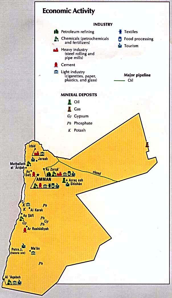
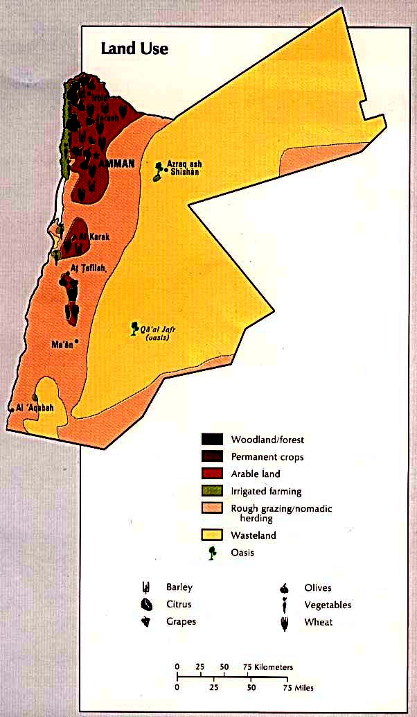
map 2011 Economic
activity ( CIA Atlas of the Middle East) 1993 Land
use ( CIA Atlas of the Middle East) 1993 Land
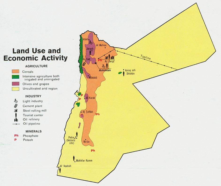
use and economic activity 1978 Population
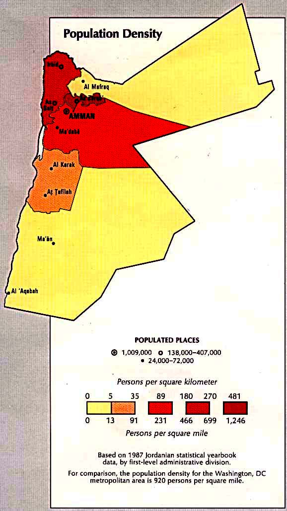
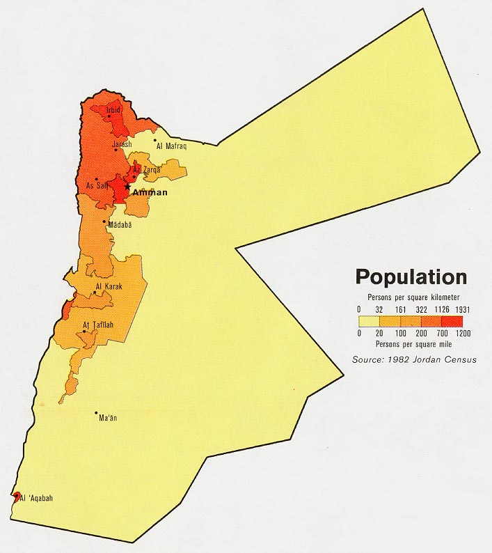
density ( CIA Atlas of the Middle East) 1993 Population 1978
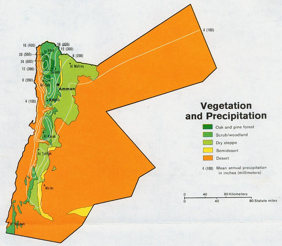
Vegetation and
precipitation 1978
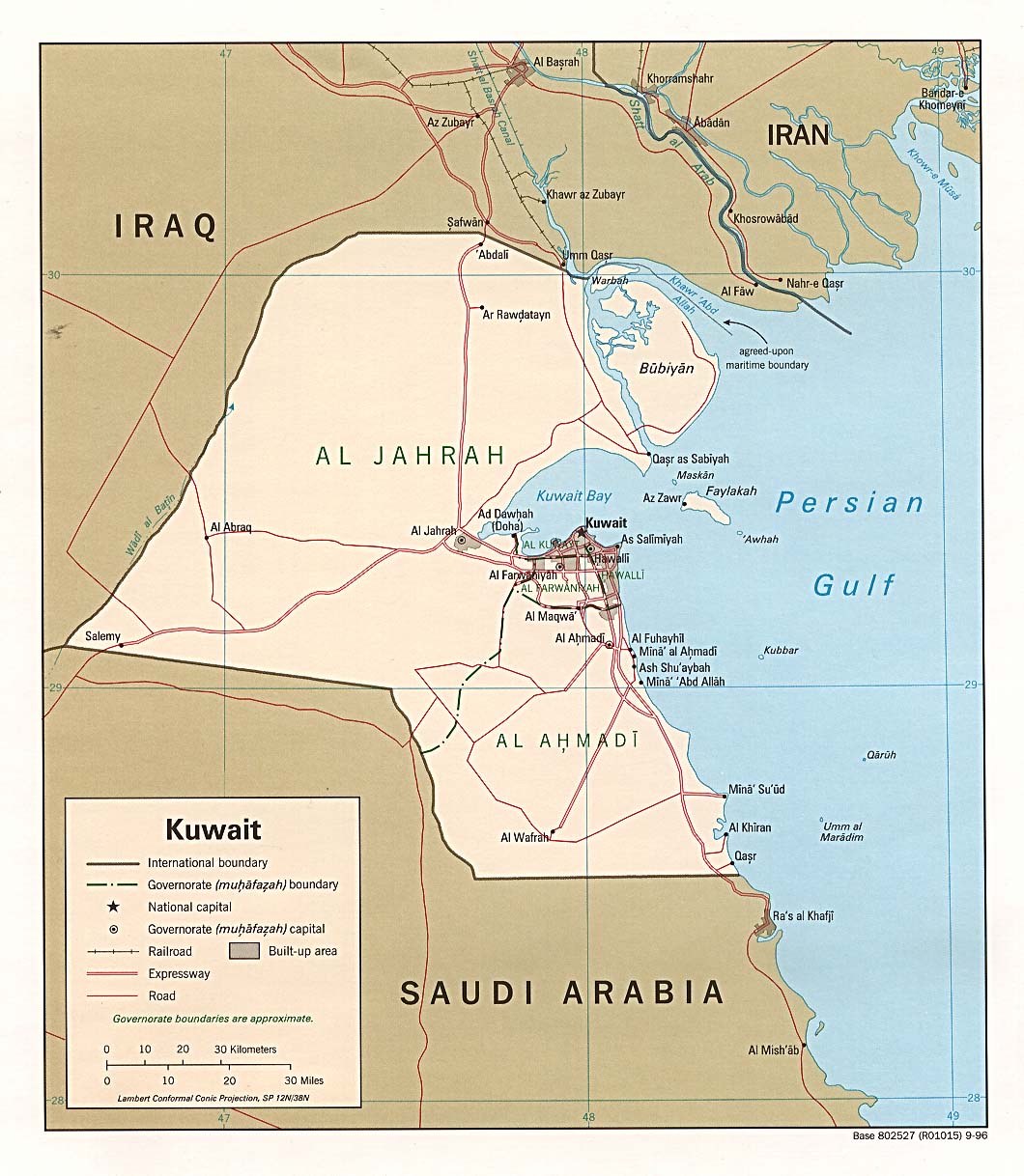
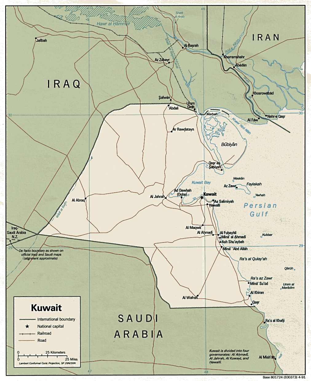
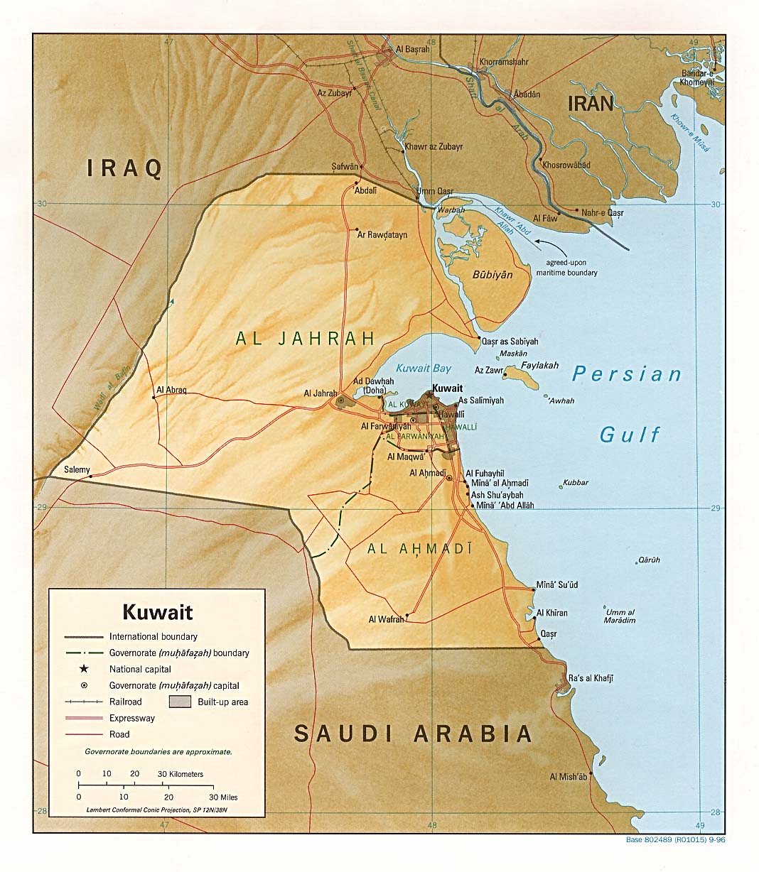
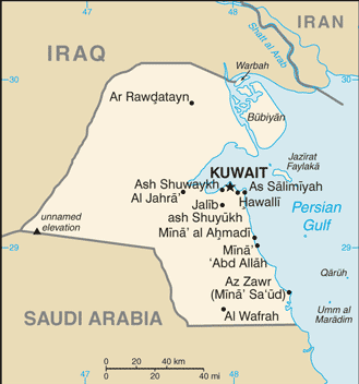
Kuwait
Political
map 2006 (also pdf format)
Political
map 1996 (also pdf format)
Political
map 1991 (also pdf format)
Shaded
relief map 1996 (also pdf format)
Small
map 2011
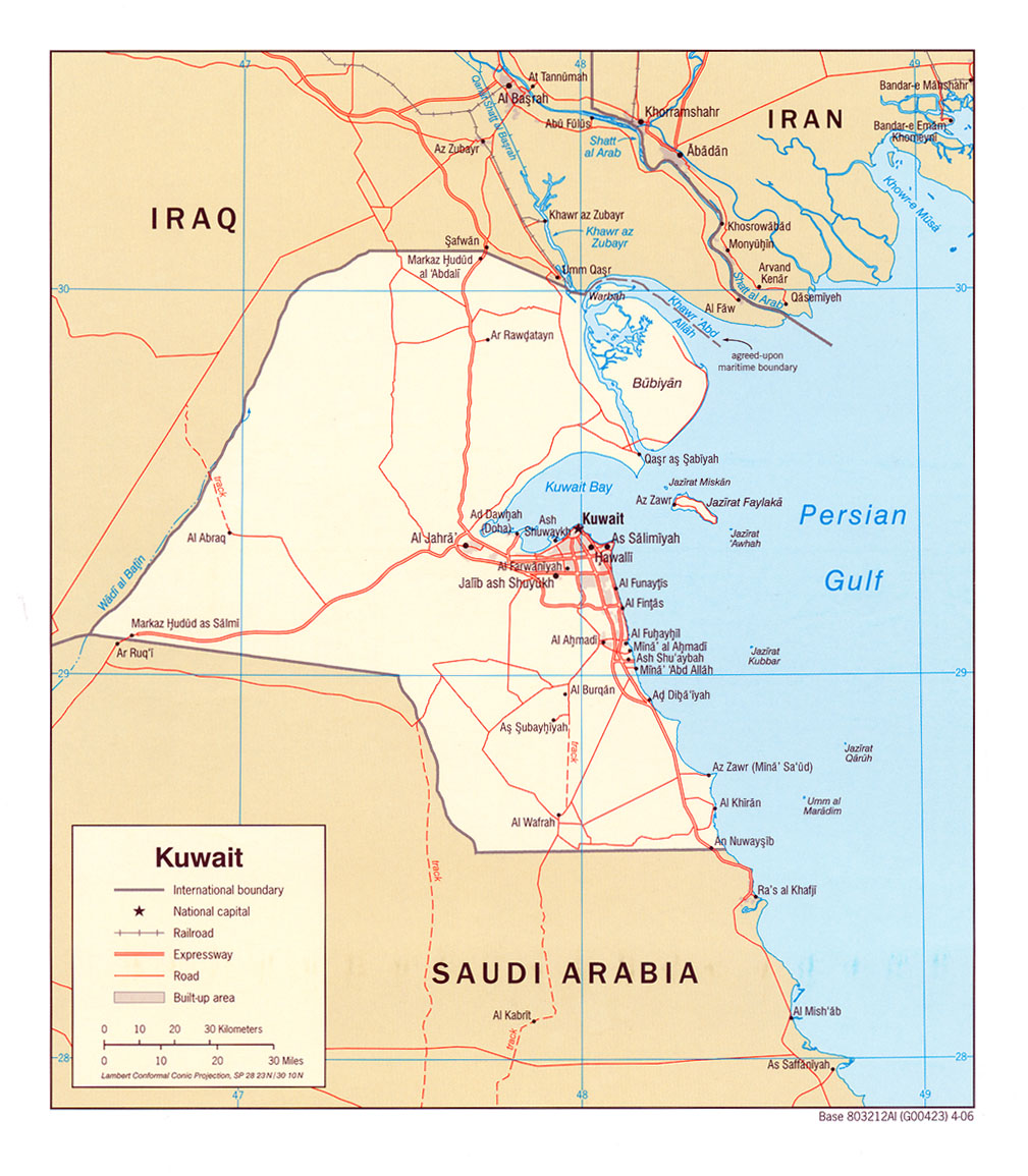
Northern
Kuwait and Basra
CIA 1980
Administrative
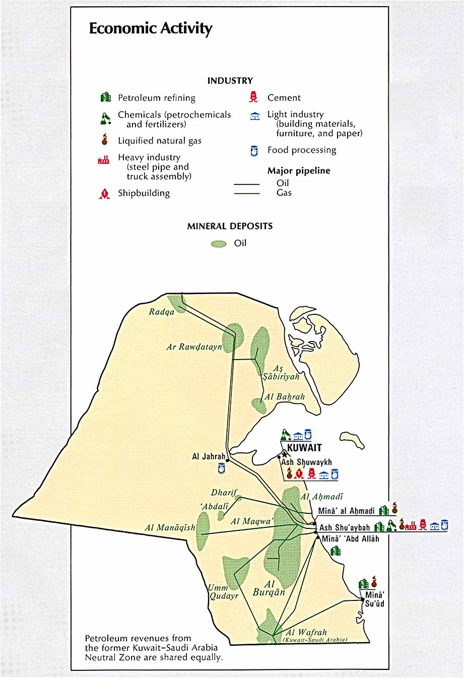
divisions Economic
activity
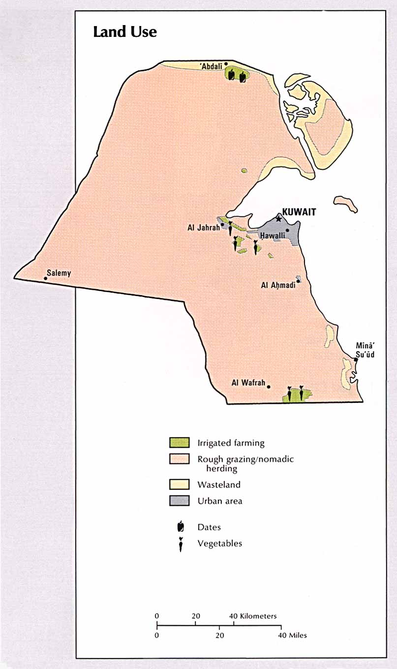
Land
use
Population
density
Kuwait
(Lonely Planet)
Operation Desert
Storm
Ground campaign map, 1991
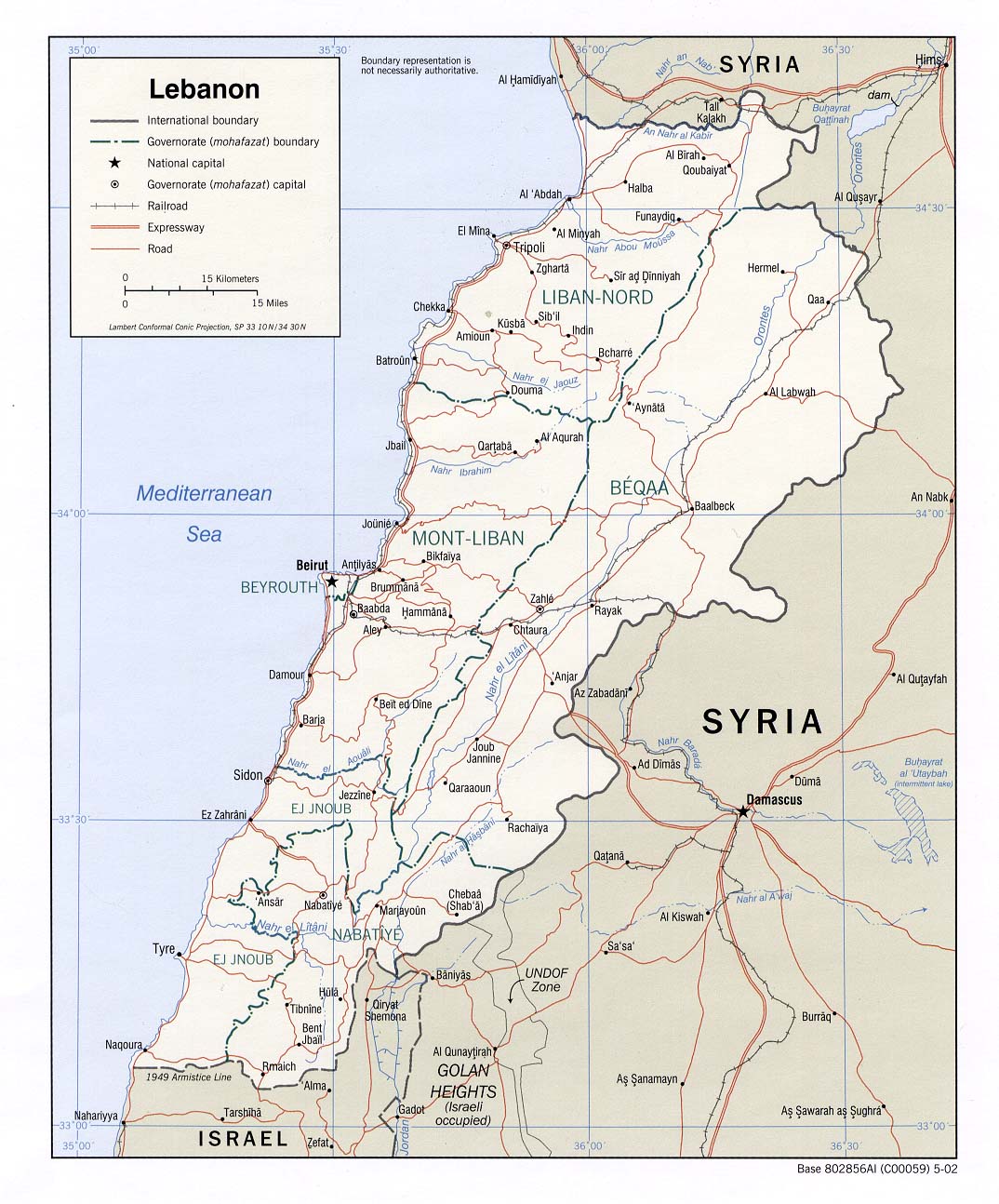
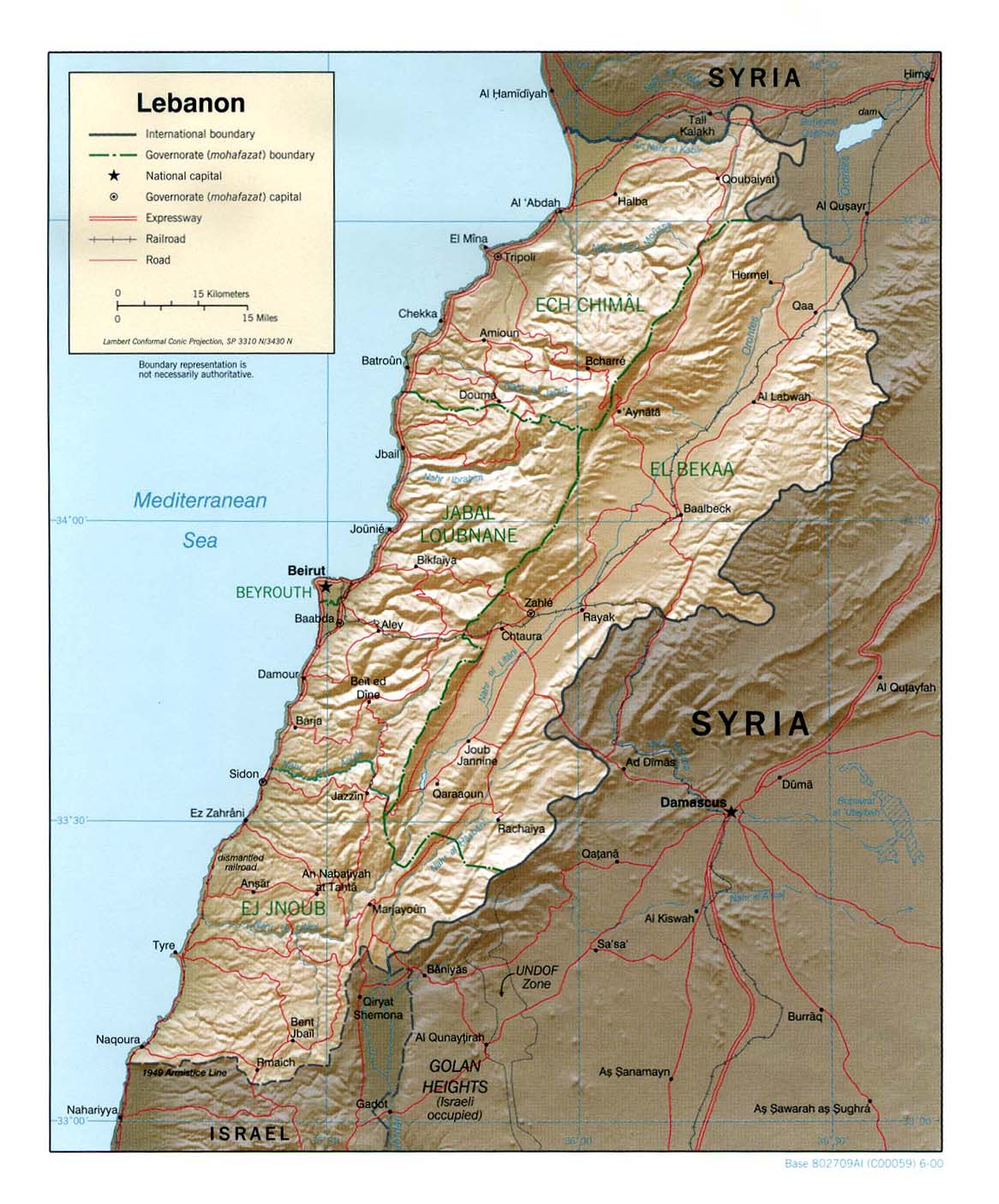
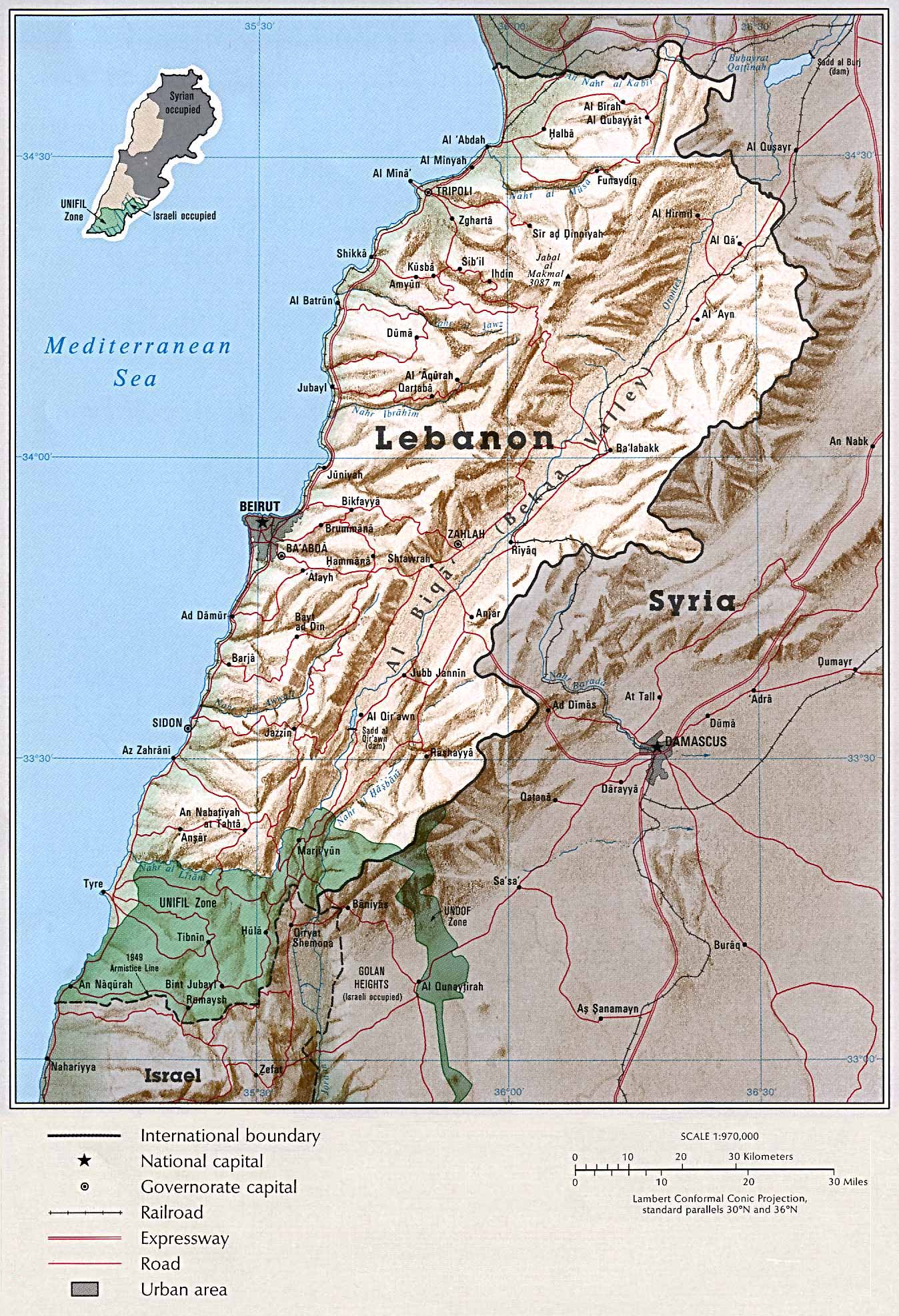
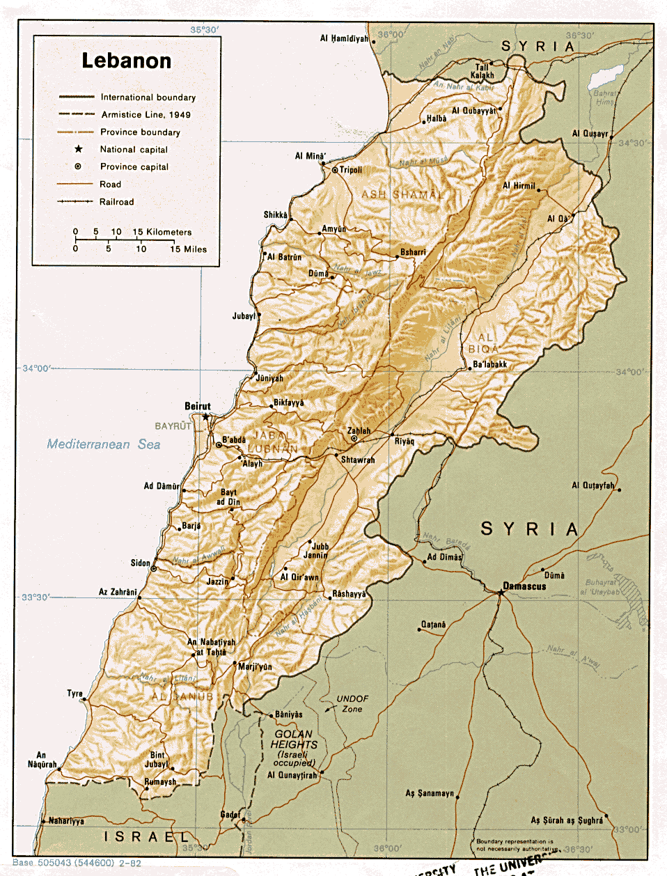
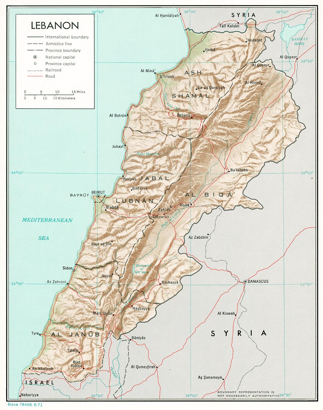
Lebanon
Political
map 2002 (also pdf format)
Political
map 2000
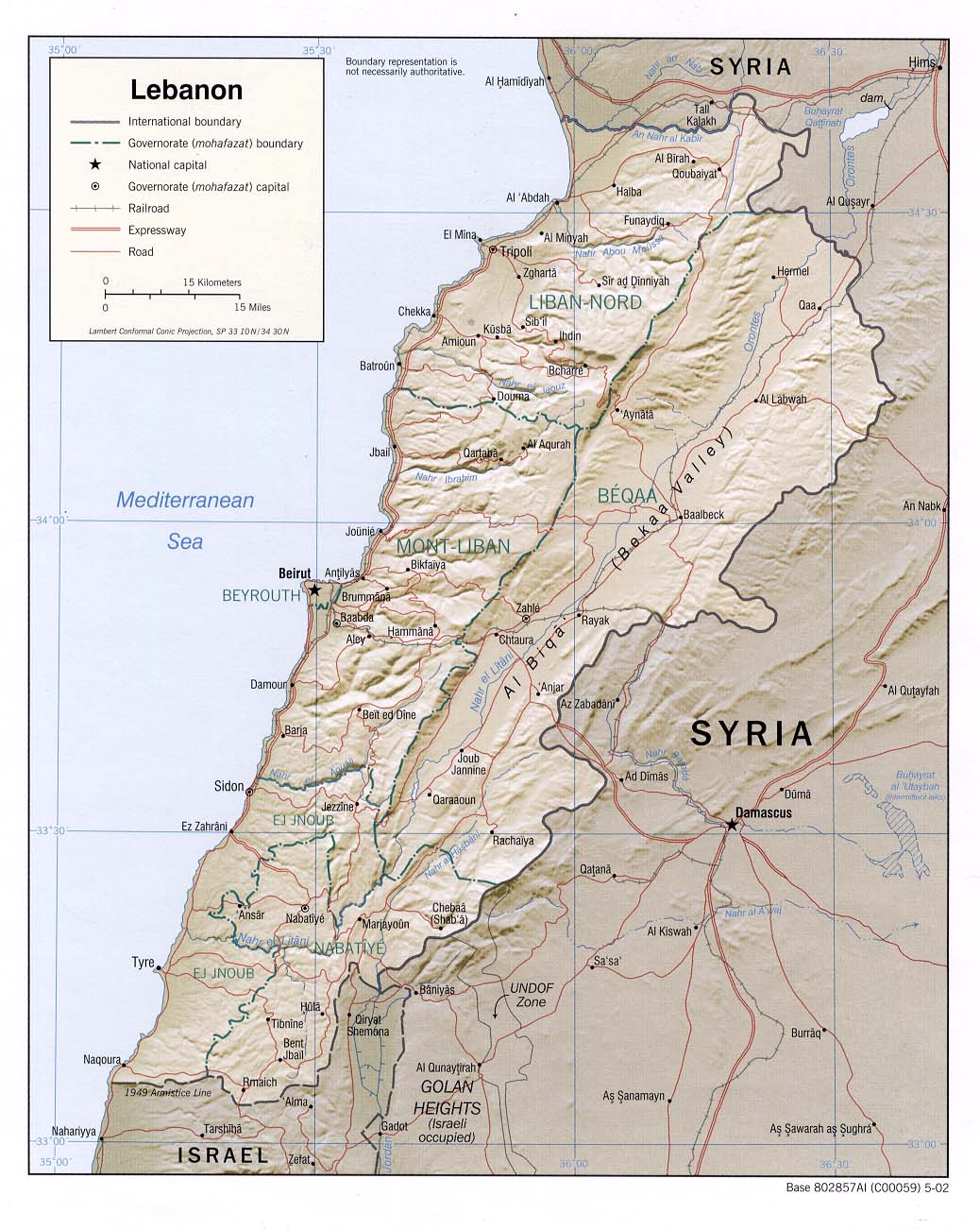
Shaded
relief map 2002 (also pdf format)
Shaded
relief map 2000
Shaded
relief map ( CIA Atlas of the Middle East) 1993
Shaded
relief map 1982 (also pdf format)
Shaded
relief map 1971 (also pdf format)
Small
map 2011
Beirut 1980
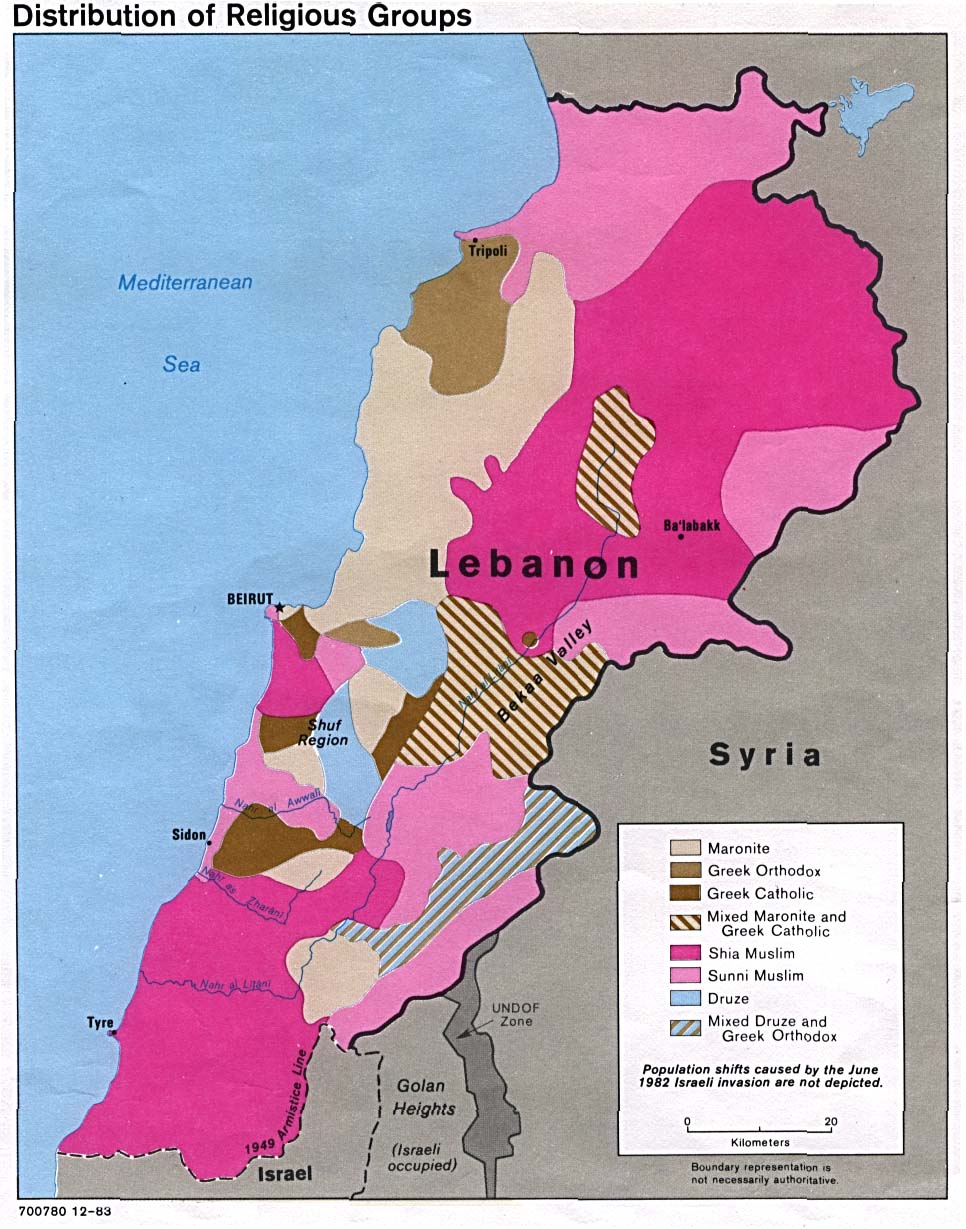
Distribution of
religious groups 1983
Administrative
divisions ( CIA Atlas of the Middle East) 1993
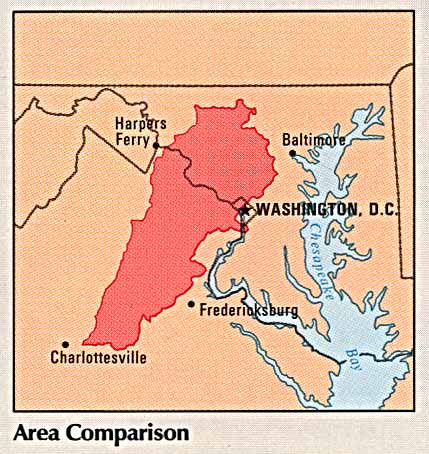
Area
comparison ( CIA Atlas of the Middle East) 1993
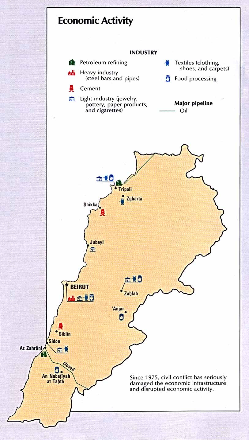
Economic
activity ( CIA Atlas of the Middle East) 1993
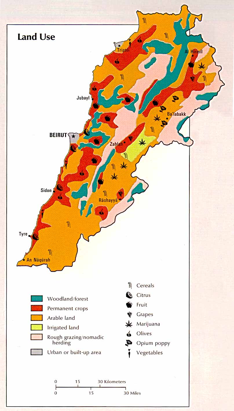
Land
use ( CIA Atlas of the Middle East) 1993
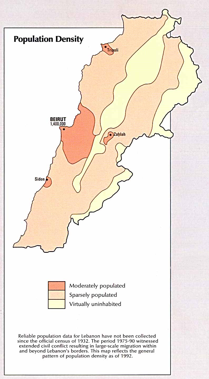
Population
density ( CIA Atlas of the Middle East) 1993 Israeli
withdrawal line
Official UN map, June 2000 (pdf)
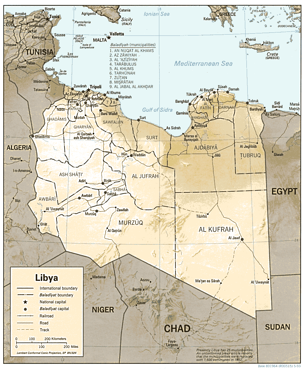
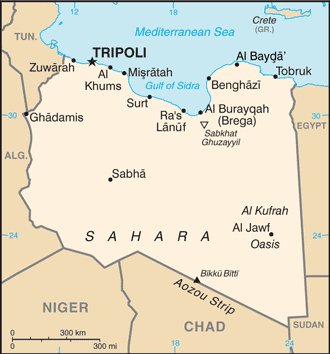
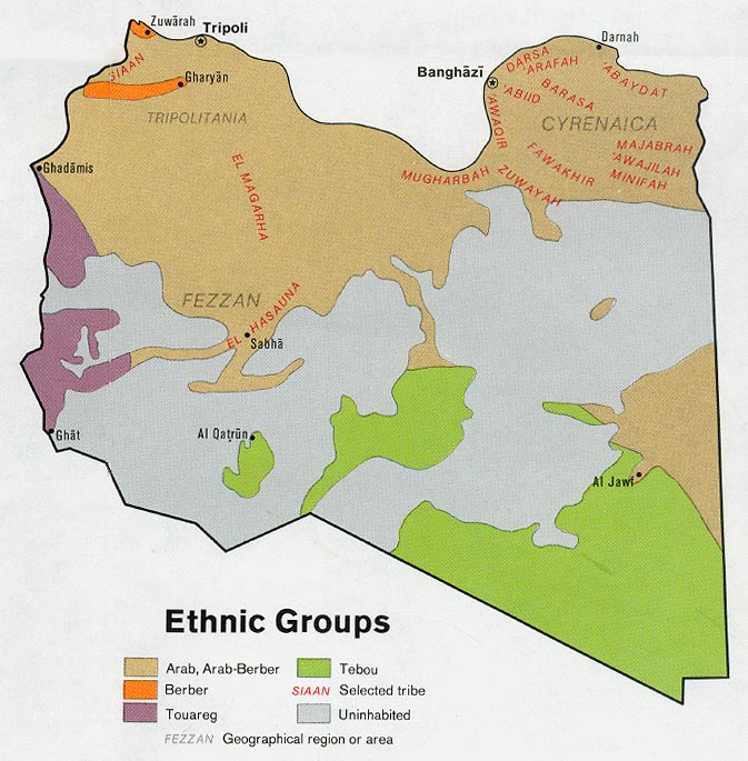
Libya
Political
map 1993 (also pdf format)
Shaded
relief map 1993 (also pdf format)
Small
map 2011
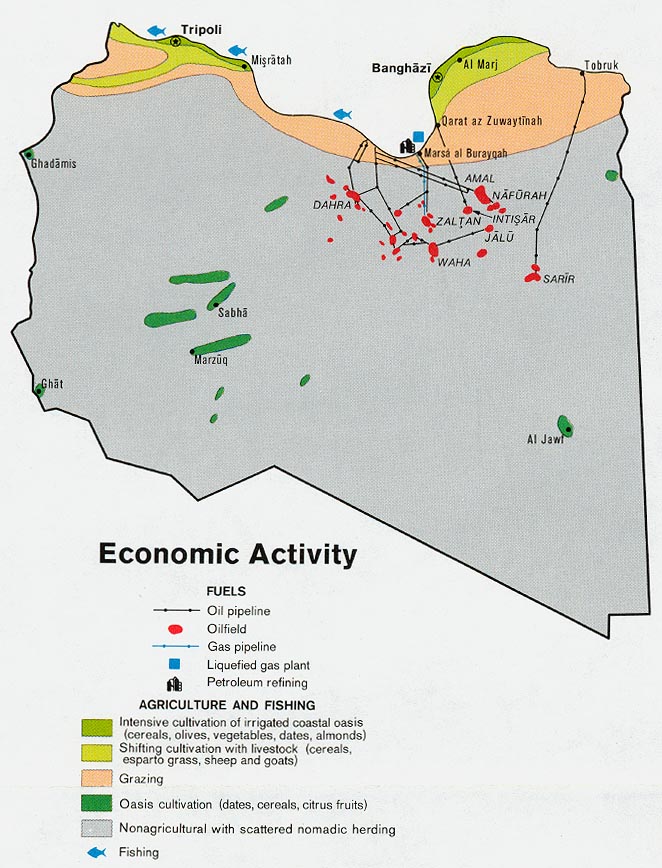
Economic
activity 1974 Ethnic
groups 1974
Population 1974
Libya
crisis maps 2011
A collection of maps relating to the overthrow of Colonel Gaddafi
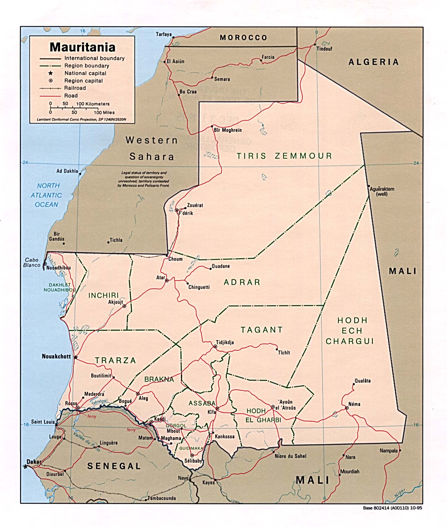
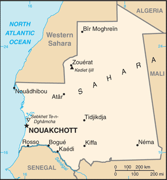
Mauritania
Political
map 1995 (also pdf format)
Political
map 1982 (also pdf format)
Shaded
relief map 1995 (also pdf format)
Small
map 2011
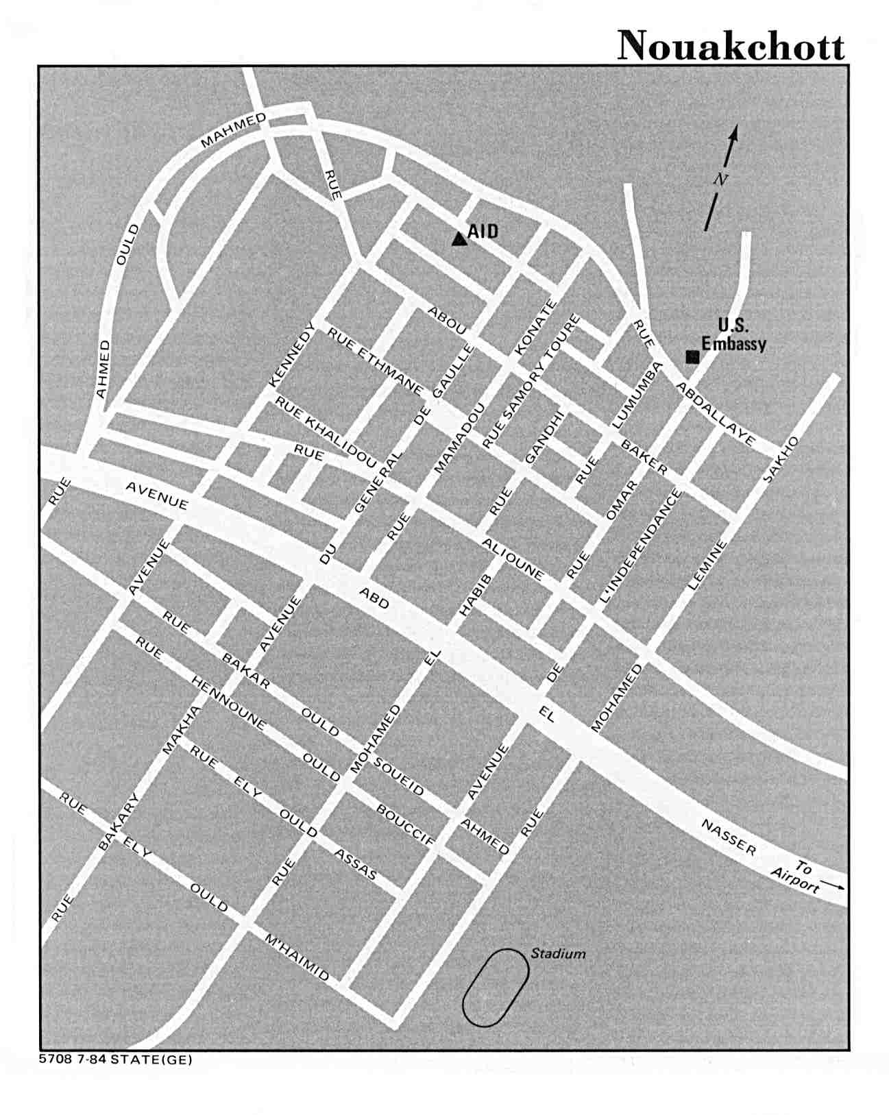
Nouakchott
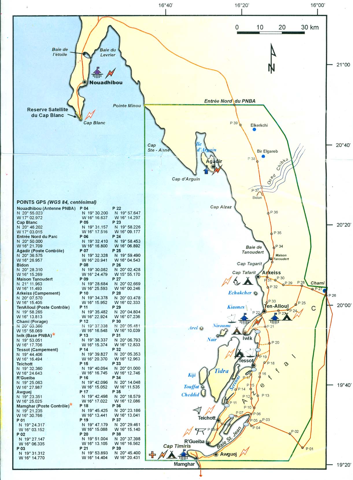
US State Dept. 1984 Parc National du Banc d'Arguin
( and map
legend) PNBA
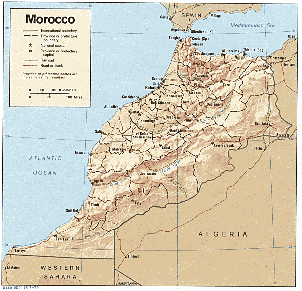
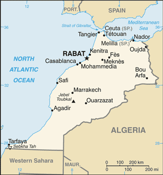
Morocco (and Western Sahara)
Shaded
relief map 1979 (also pdf format) Small
map 2011 Morocco
- West
From Rabat to Sidi Ifni (Nationmaster)
Economic
activity 1973
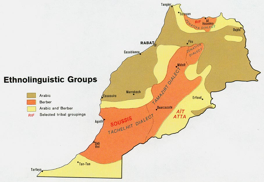
Ethnolinguistic
groups 1973
Population 1973
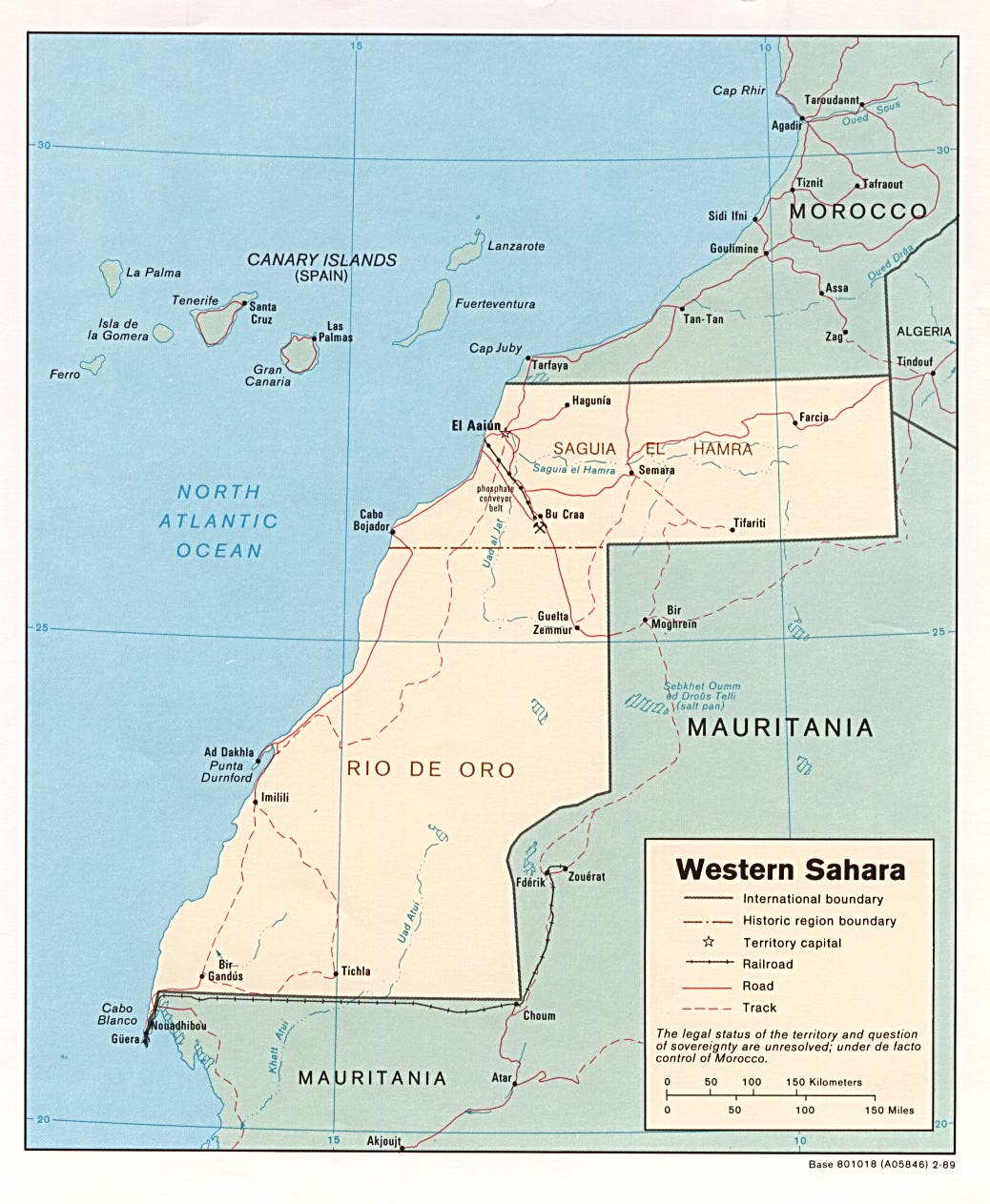
Western
Sahara
Political, 1989
Morocco
1830 (Nationmaster)
Morocco
1861-1864 (Nationmaster)
Northwestern
Africa French Colonisation (Nationmaster)
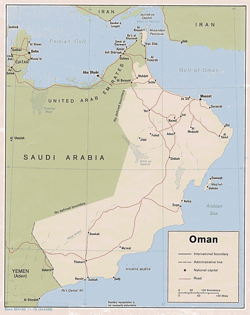
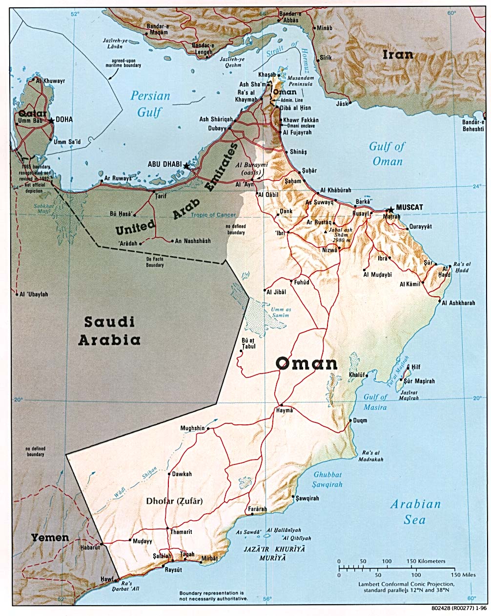
Oman
Political
map 1979 (also pdf format)
Shaded
relief map 1996 (also pdf format)
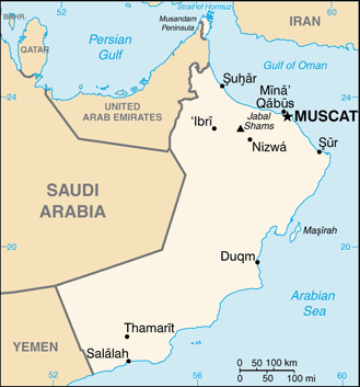
Small
map 2011
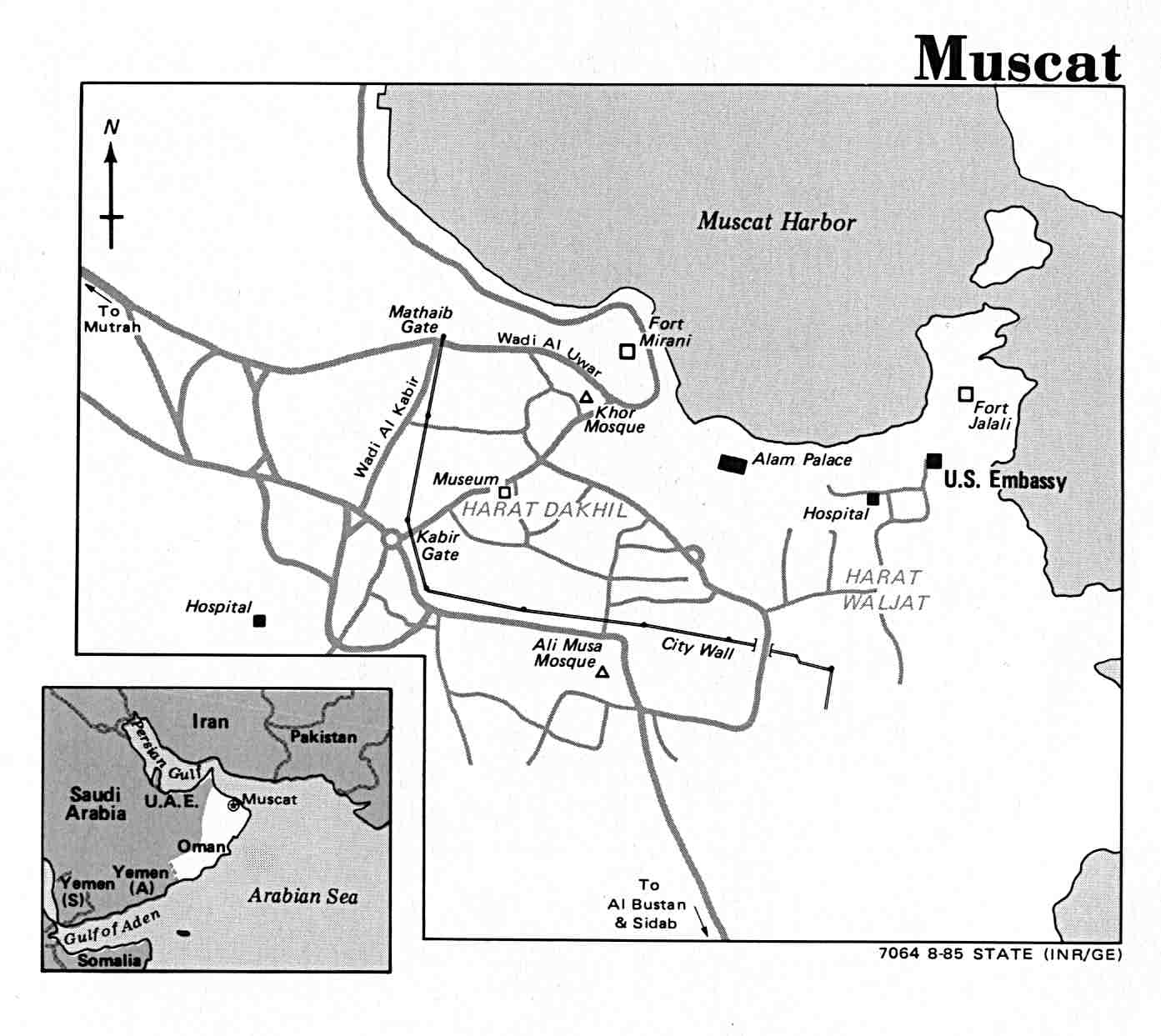
Muscat
US State Dept. 1985
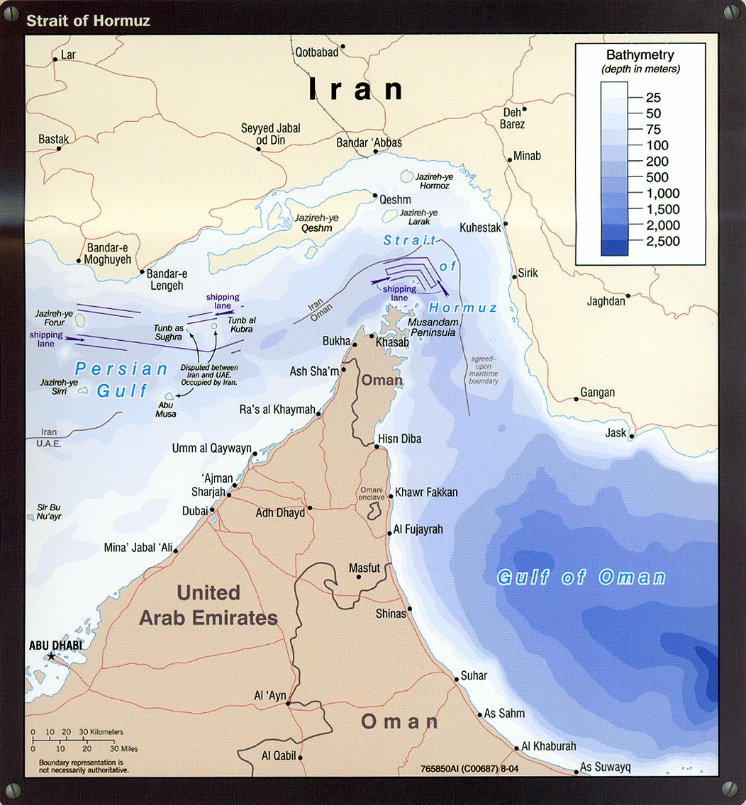
Strait of Hormuz
(political) 1980
Strait of Hormuz
(detailed) 2004
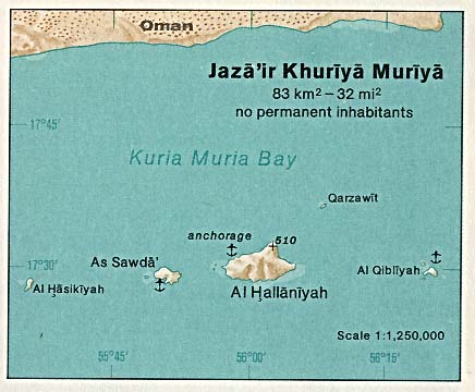
Jaza'ir Khuriya Muriya 1976
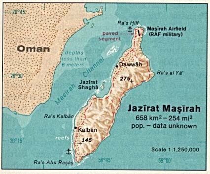
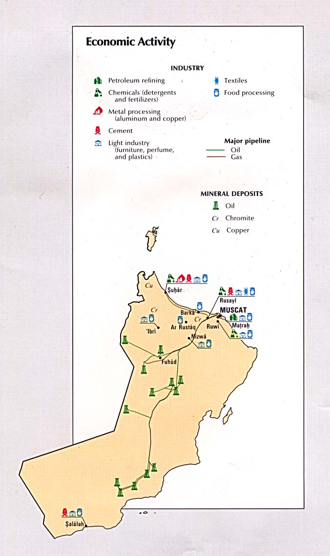
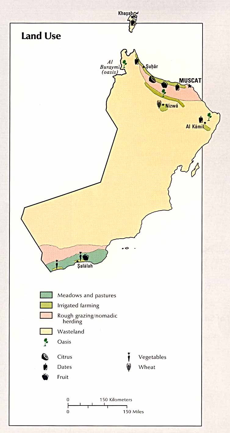
Jazirat Masirah 1976 Economic
activity ( CIA Atlas of the Middle East) 1993 Land
use ( CIA Atlas of the Middle East) 1993
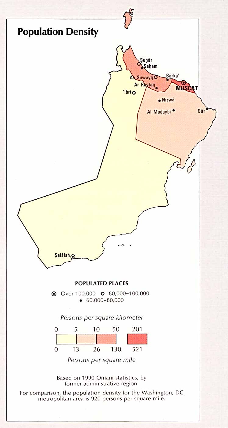
Population
density ( CIA Atlas of the Middle East) 1993
Palestine/Israel
See special page
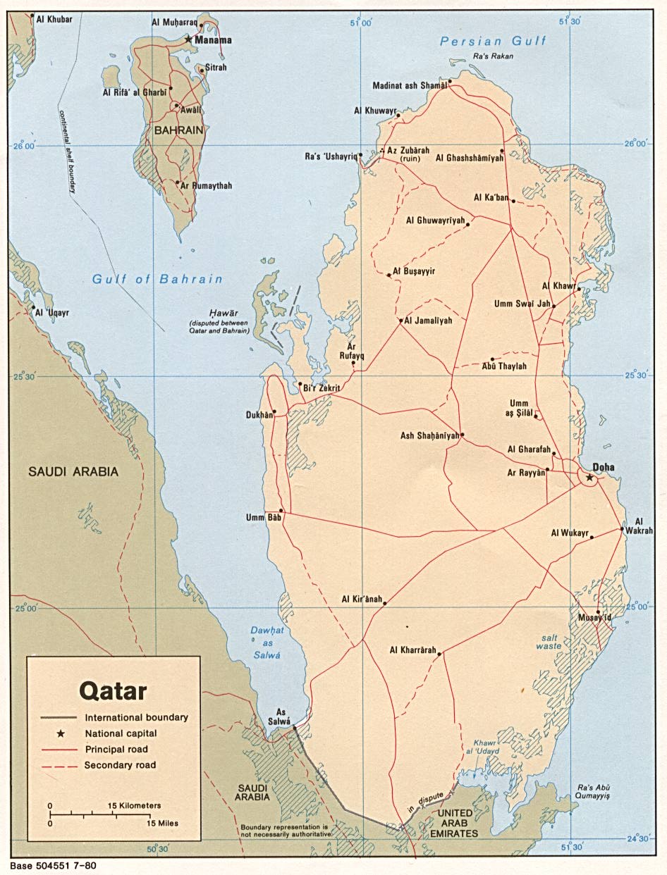
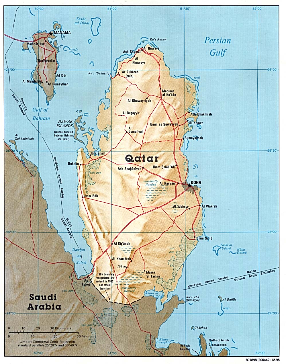
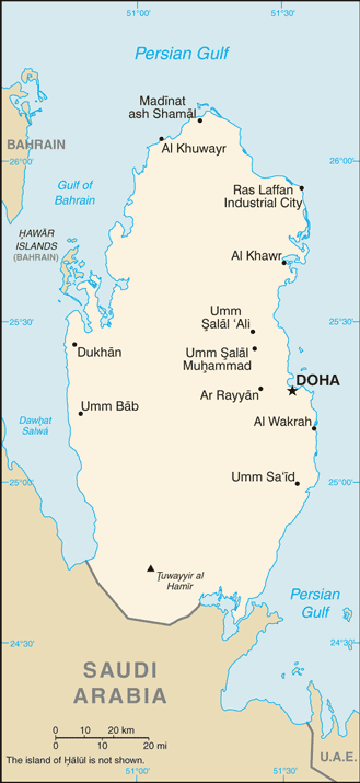
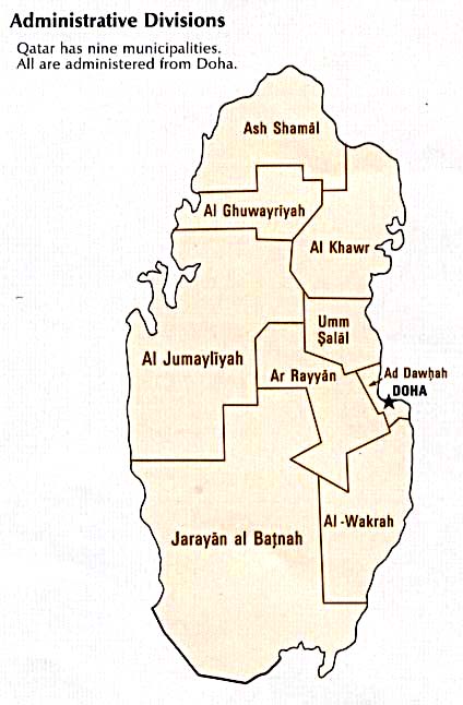
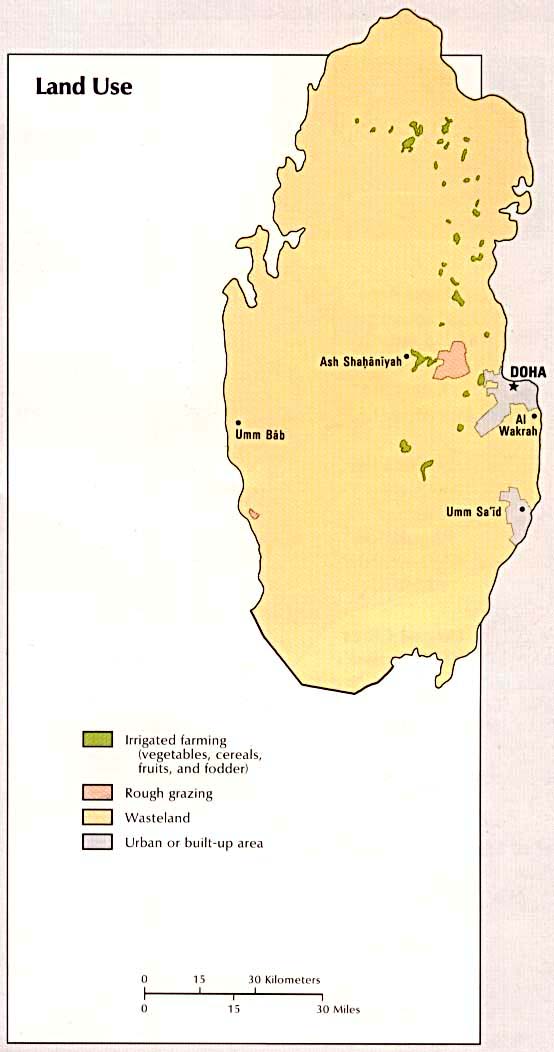
Qatar
Political
map 1980 (also pdf format)
Shaded
relief map 1995 (also pdf format)
Small
map 2011
Doha
US State Dept. 1983
Administrative
divisions (CIA Atlas of the Middle East) 1993
Economic
activity (CIA Atlas of the Middle East) 1993
Land
use (CIA Atlas of the Middle East) 1993
Population
density (CIA Atlas of the Middle East) 1993
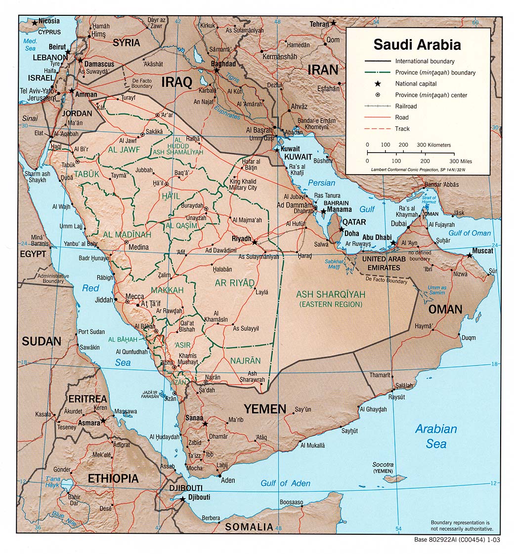
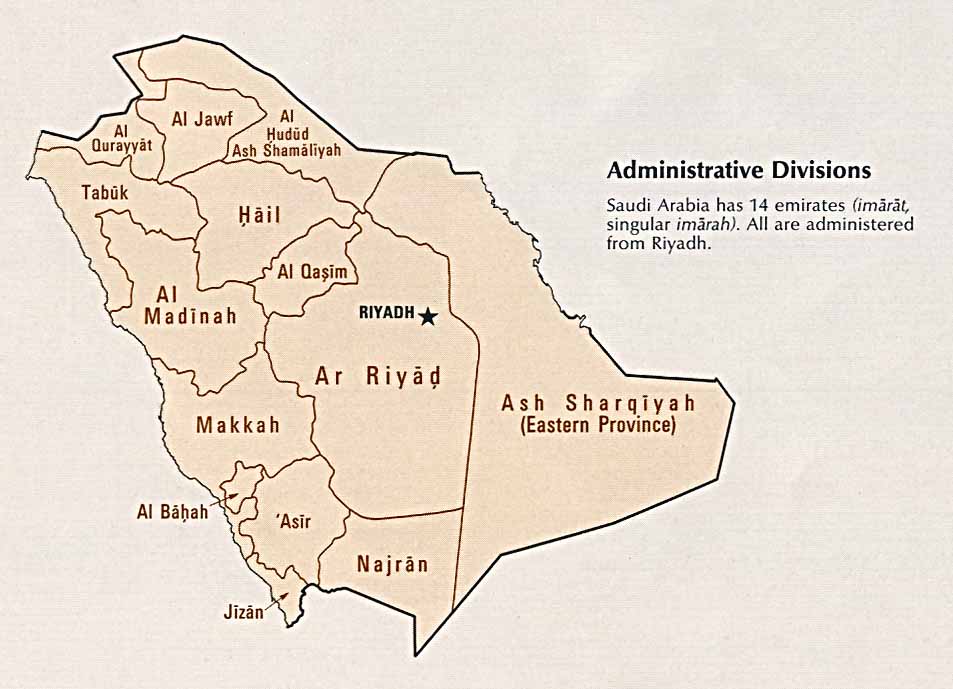
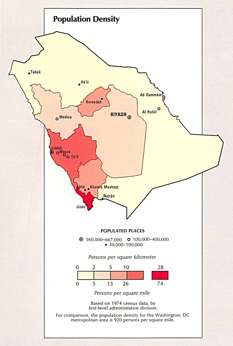
Saudi Arabia
Political
map 2003 (also pdf format)
Political
map 1991 (also pdf format)
Shaded
relief map 2003 (also pdf format)
Shaded
relief map 1991 (also pdf format)
Shaded
relief map 1974 (also pdf format)
Small
map 2011
Administrative
divisions (CIA Atlas of the Middle East) 1993
Economic
activity (CIA Atlas of the Middle East) 1993
Land
use (CIA Atlas of the Middle East) 1993
Population
density (CIA Atlas of the Middle East) 1993
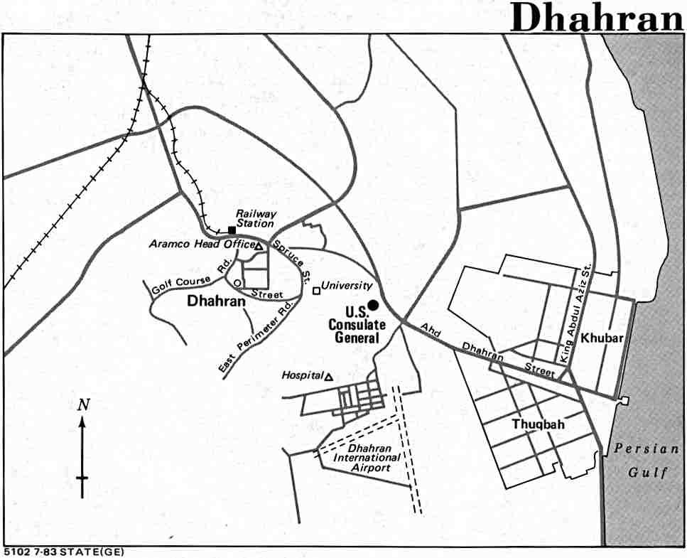
Dhahran
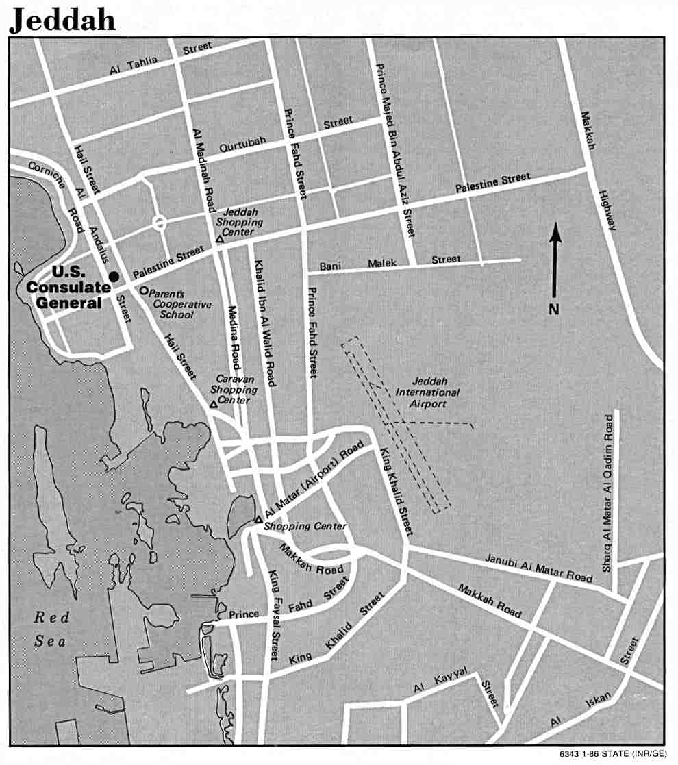
Jeddah
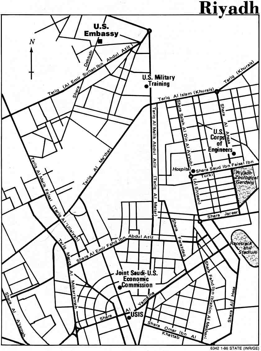
Riyadh
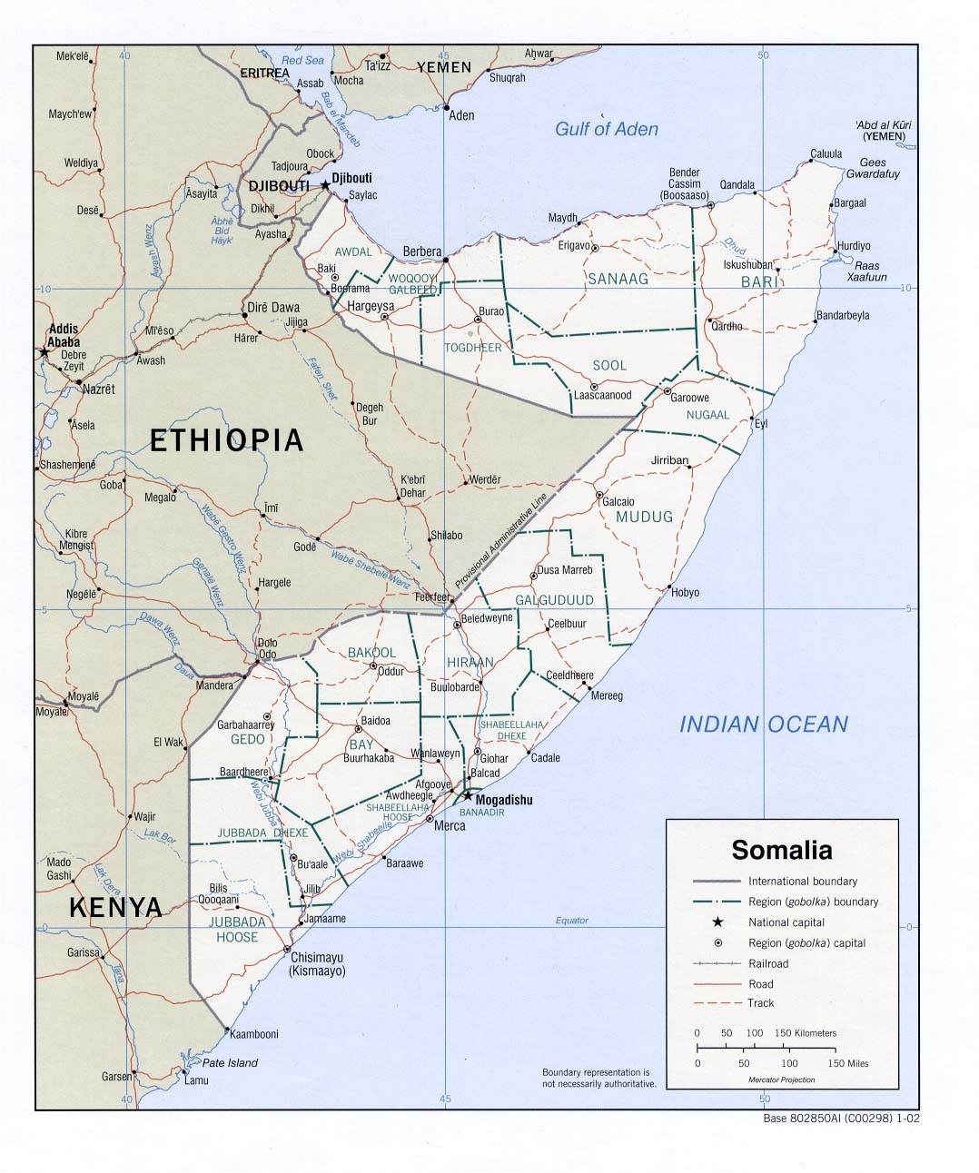
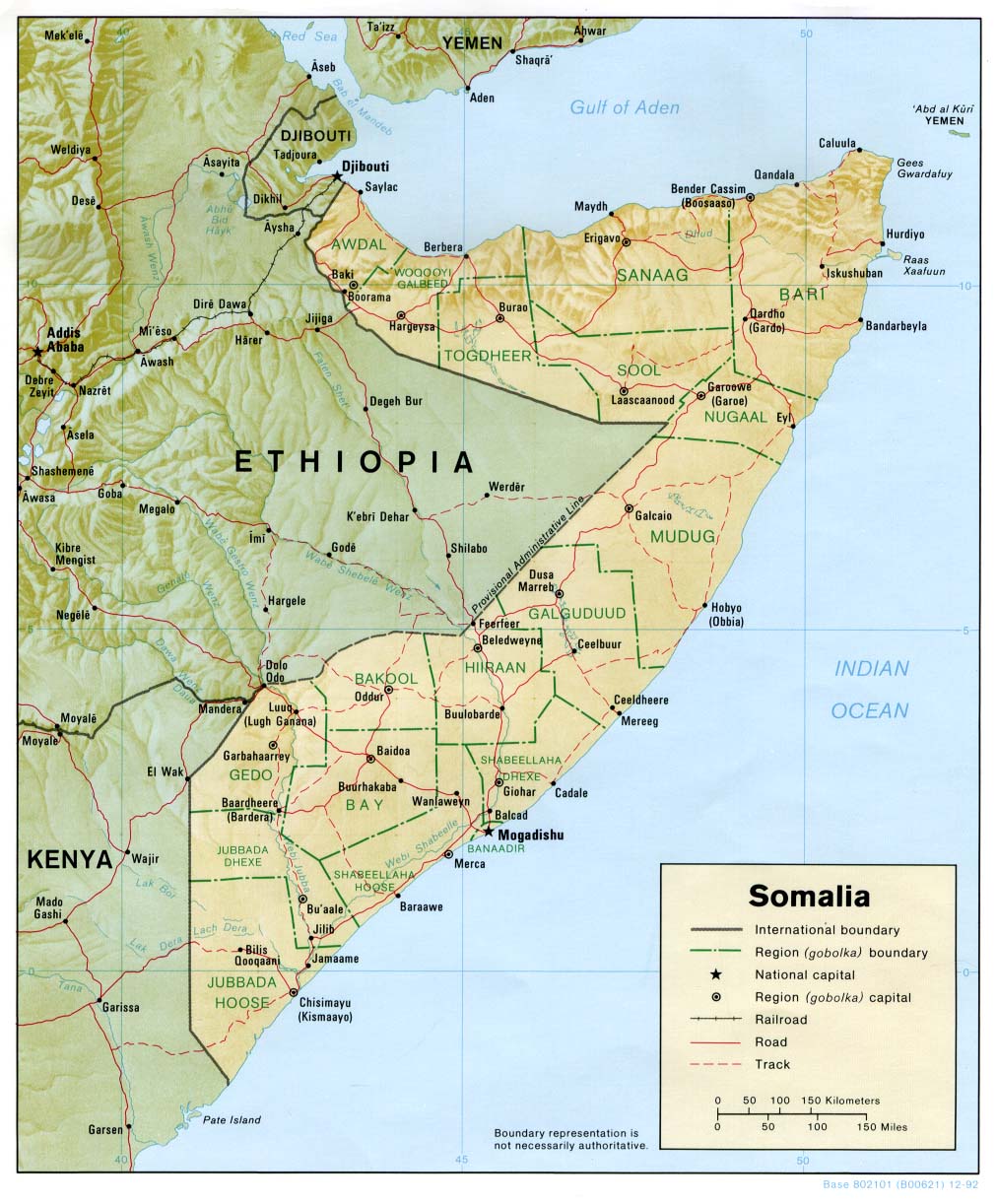
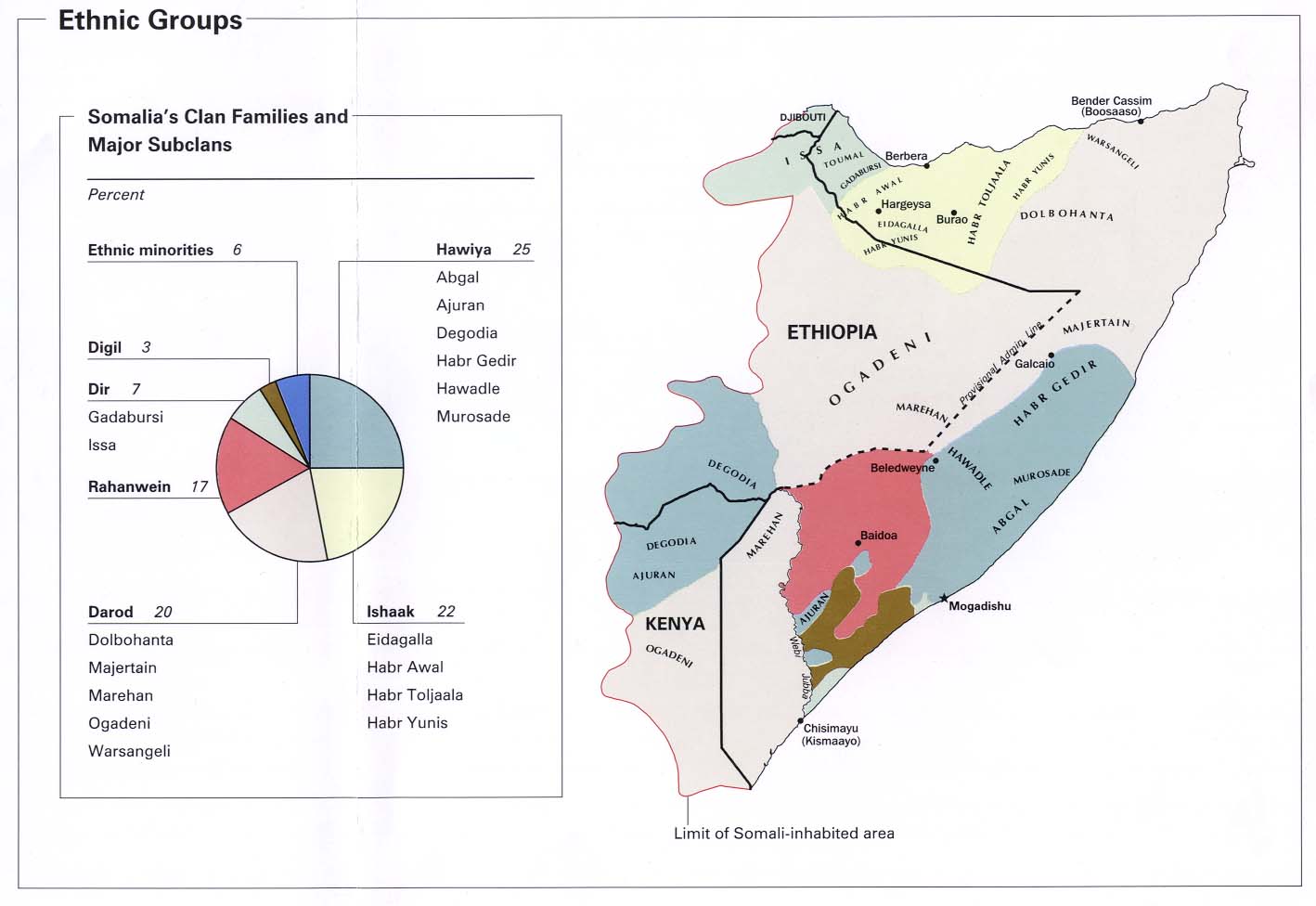
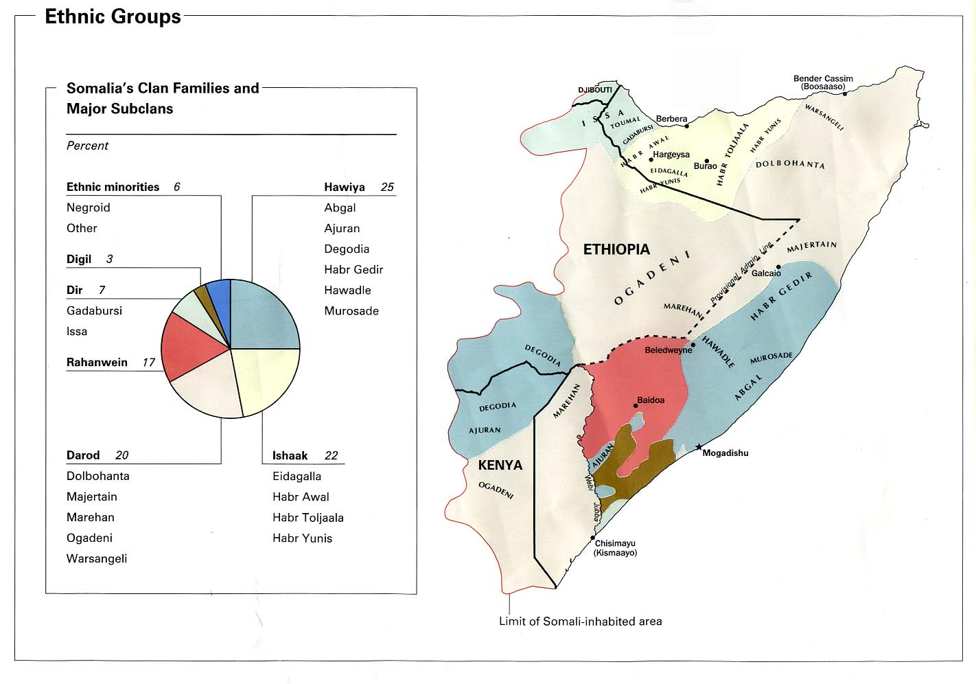
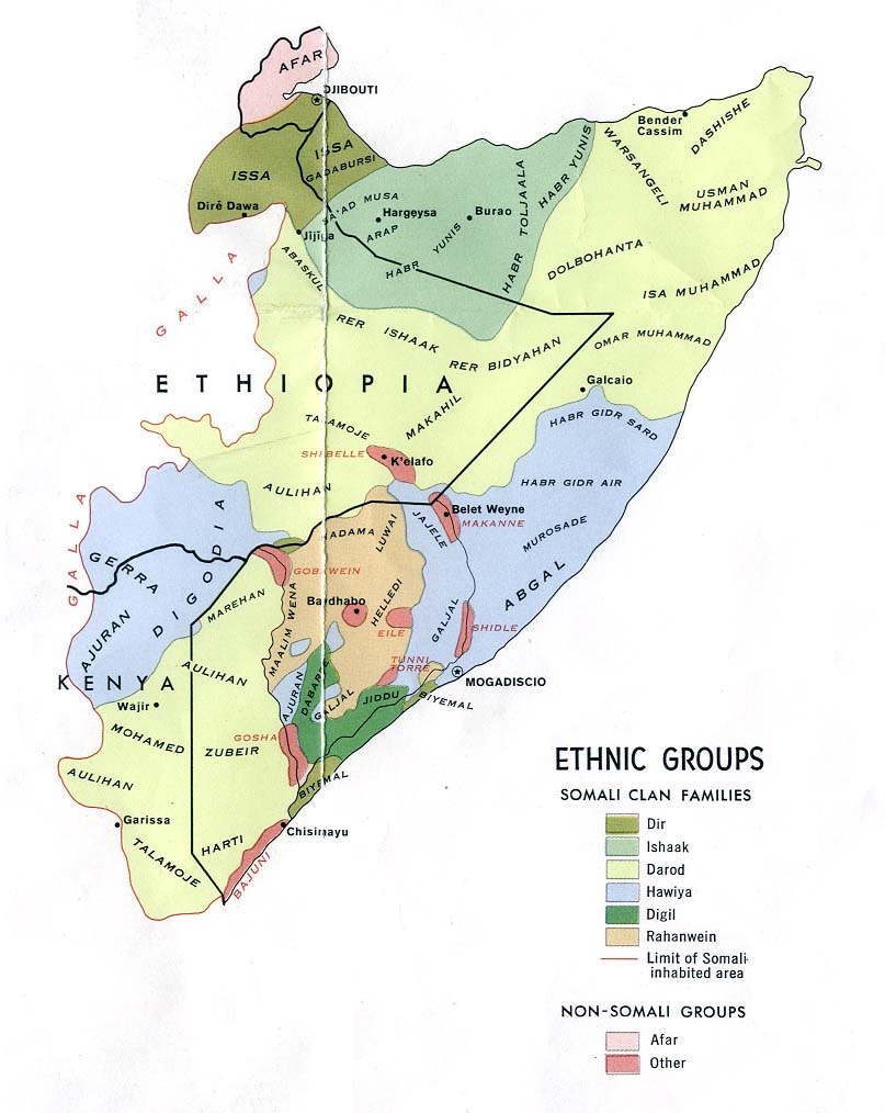
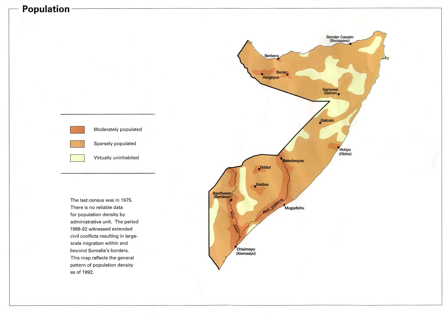
Somalia
Political map 2002
(also pdf format)
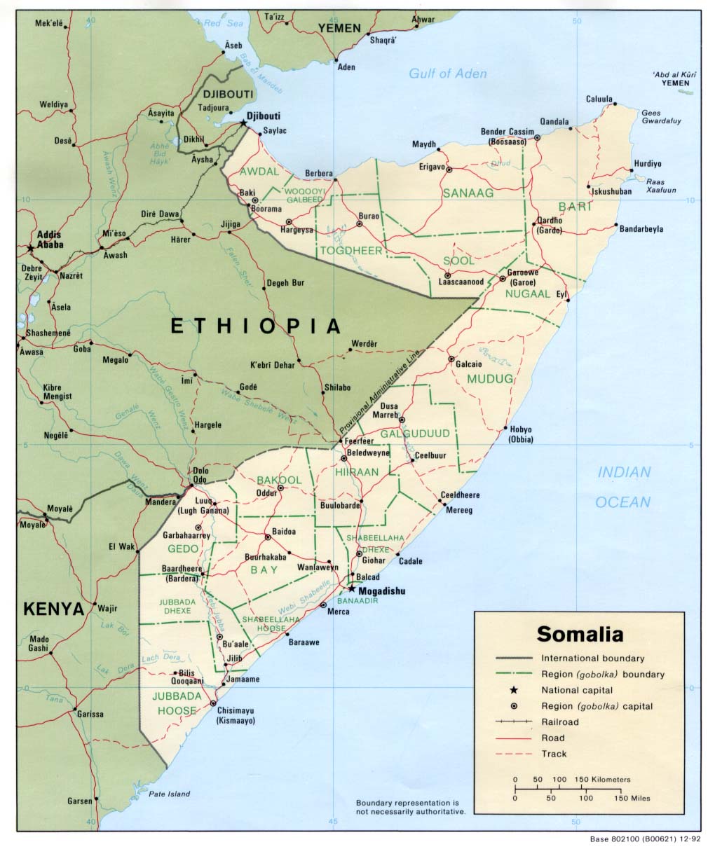
Political map 1992
(also pdf format)
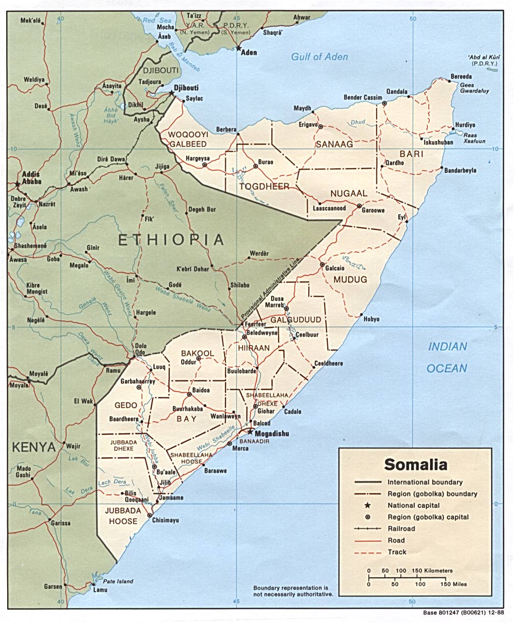
Political map 1988
(also pdf format)
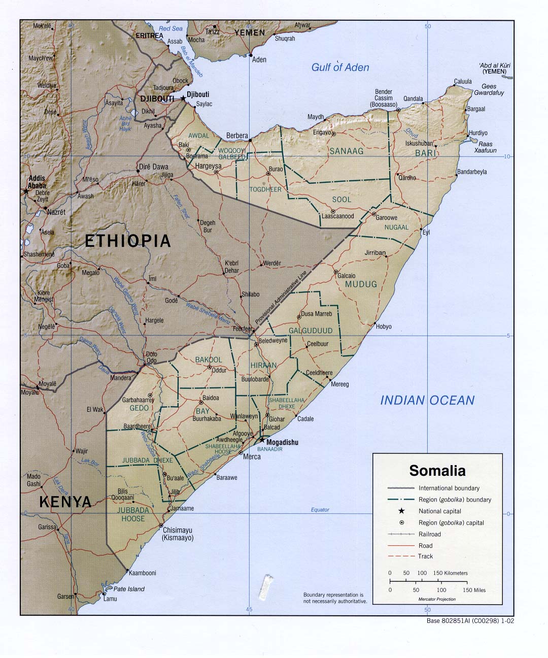
Shaded relief map 2002
(also pdf format)
Shaded relief map 1992
(also pdf format)
Small map 2011
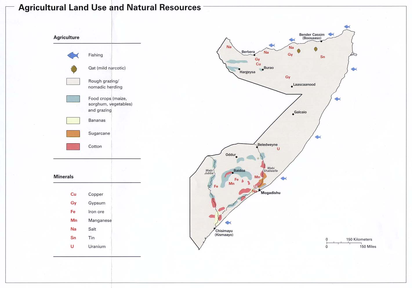
Agricultural
land use and natural resources CIA 2002
Agricultural
land use and natural resources CIA 1992
Area
comparison CIA 1977
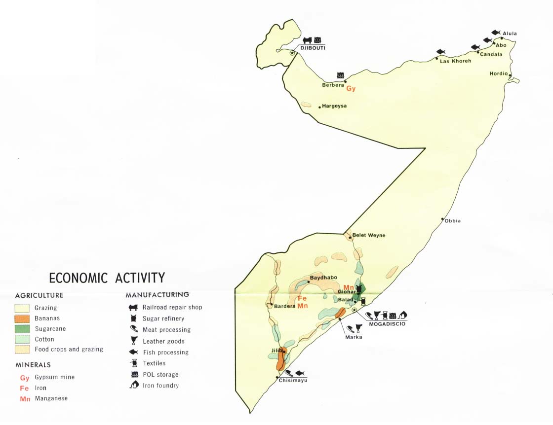
Economic
activity CIA 1977
Ethnic
groups CIA 2002
Ethnic
groups CIA 1992
Ethnic
groups CIA 1977
Ethnic
groups - Horn of Africa 1980
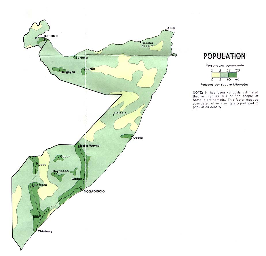
Population CIA 2002
Population CIA 1992
Population CIA 1977
Sudan
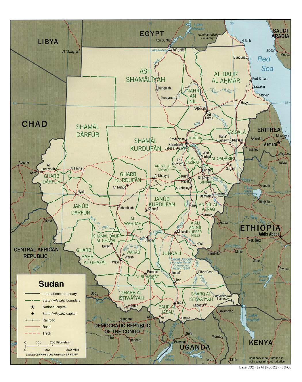
Political map 2007 (1.1MB)
Political map 2000
(also pdf format)
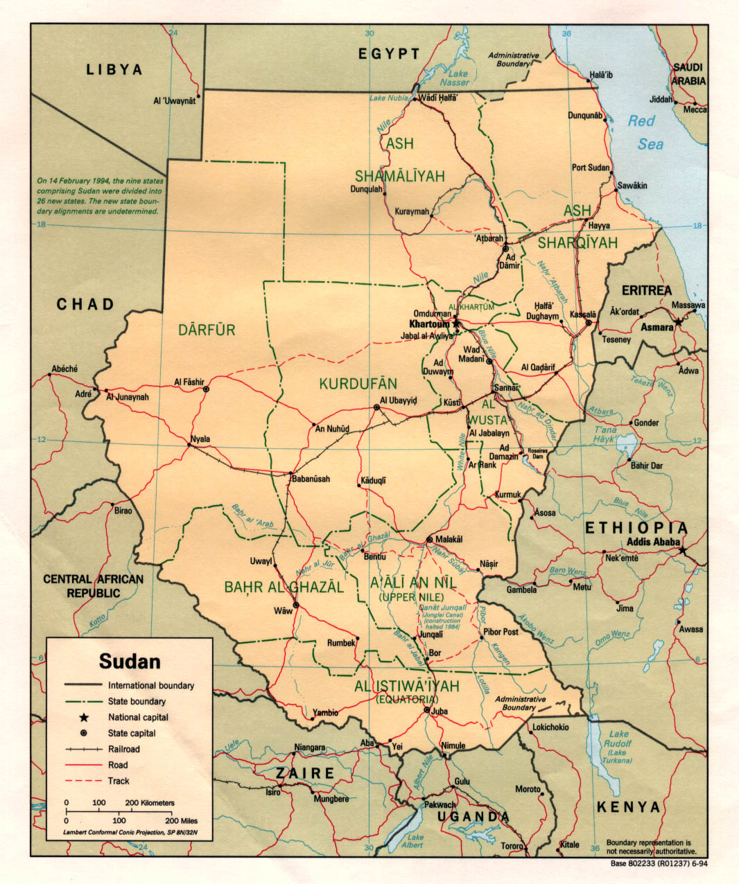
Political map 1994
(also pdf format)
Political map 1989
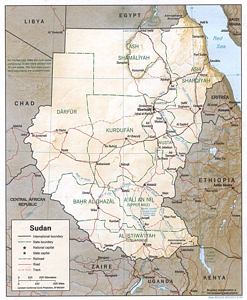
Shaded relief map 2000
(also pdf format)
Shaded relief map 1994
(also pdf format)
Shaded relief map 2011 Oil and
gas concession holders in Sudan
USAID 2001 (pdf – 1.1MB)
Air
access in Southern Sudan July 2002
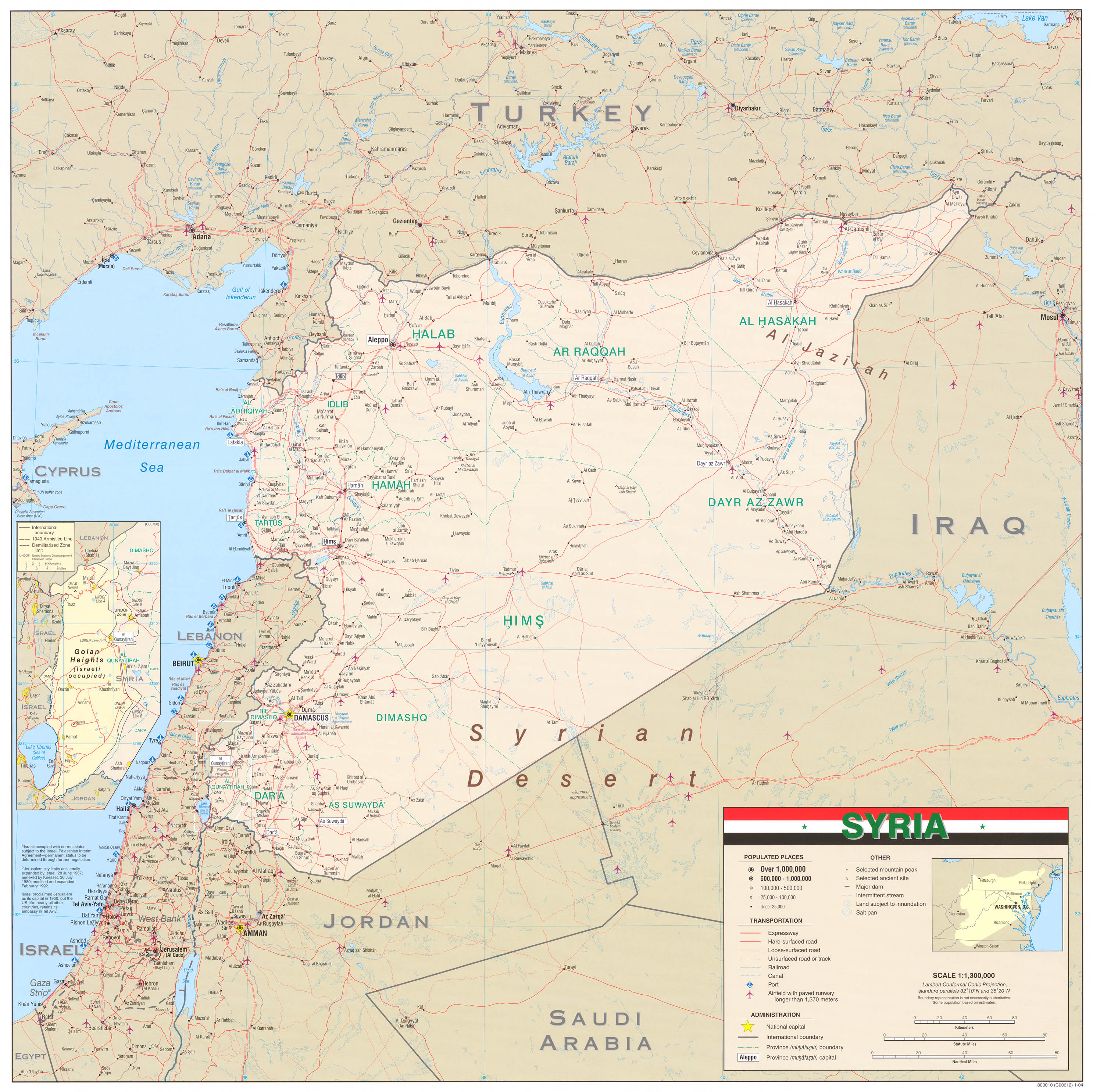
Syria
Political
map 2007
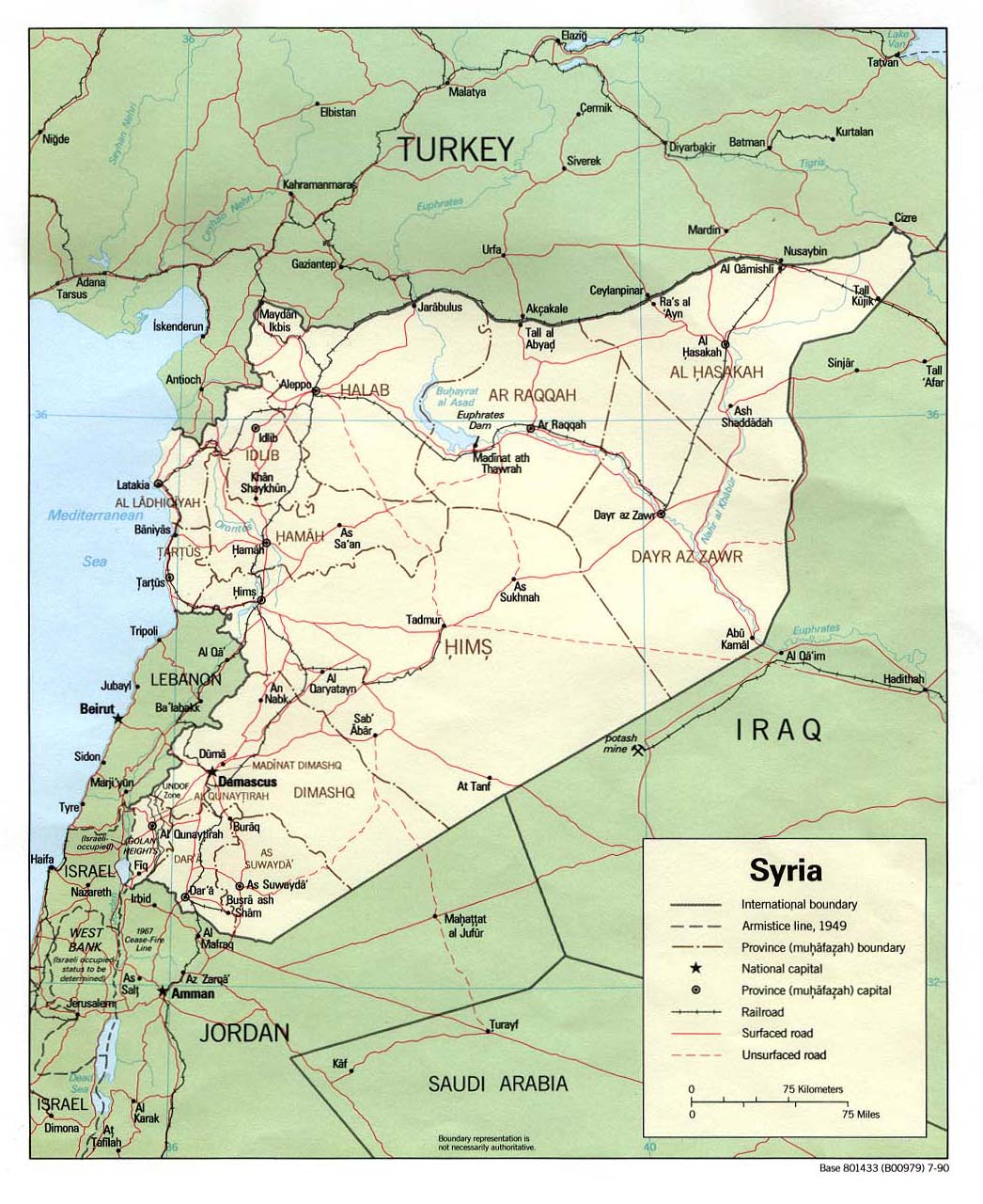
Political
map 1990
(also pdf format)
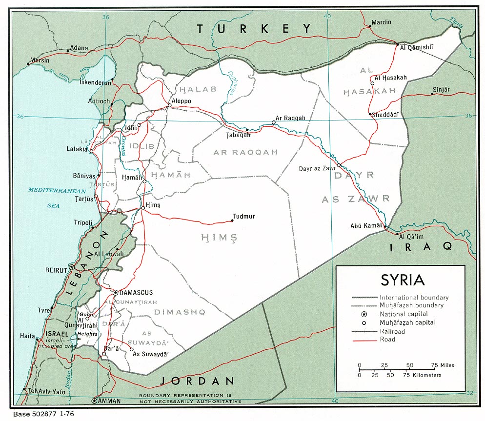
Political
map 1976
(also pdf format)
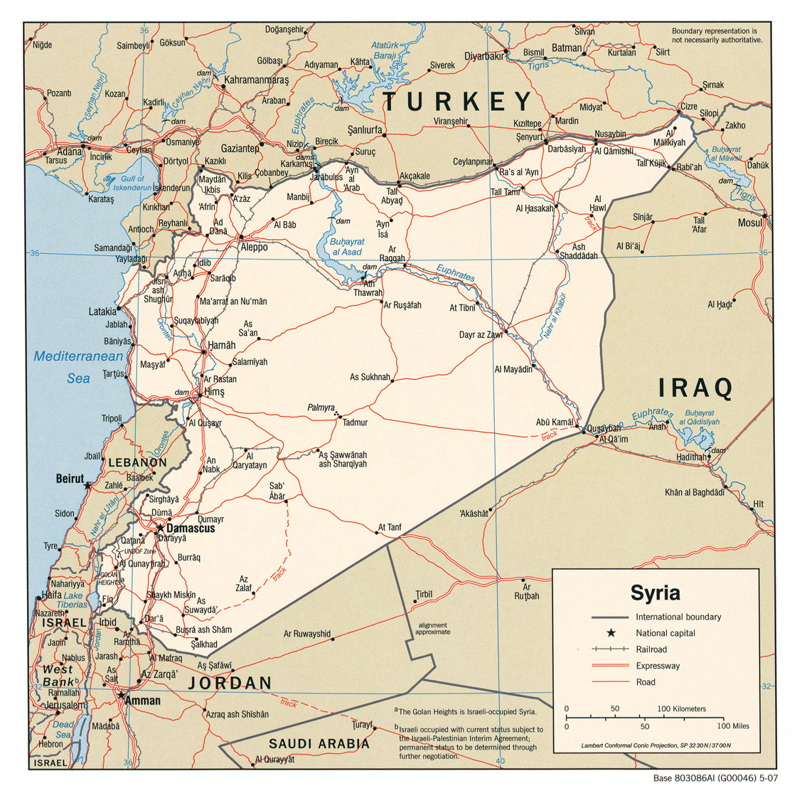
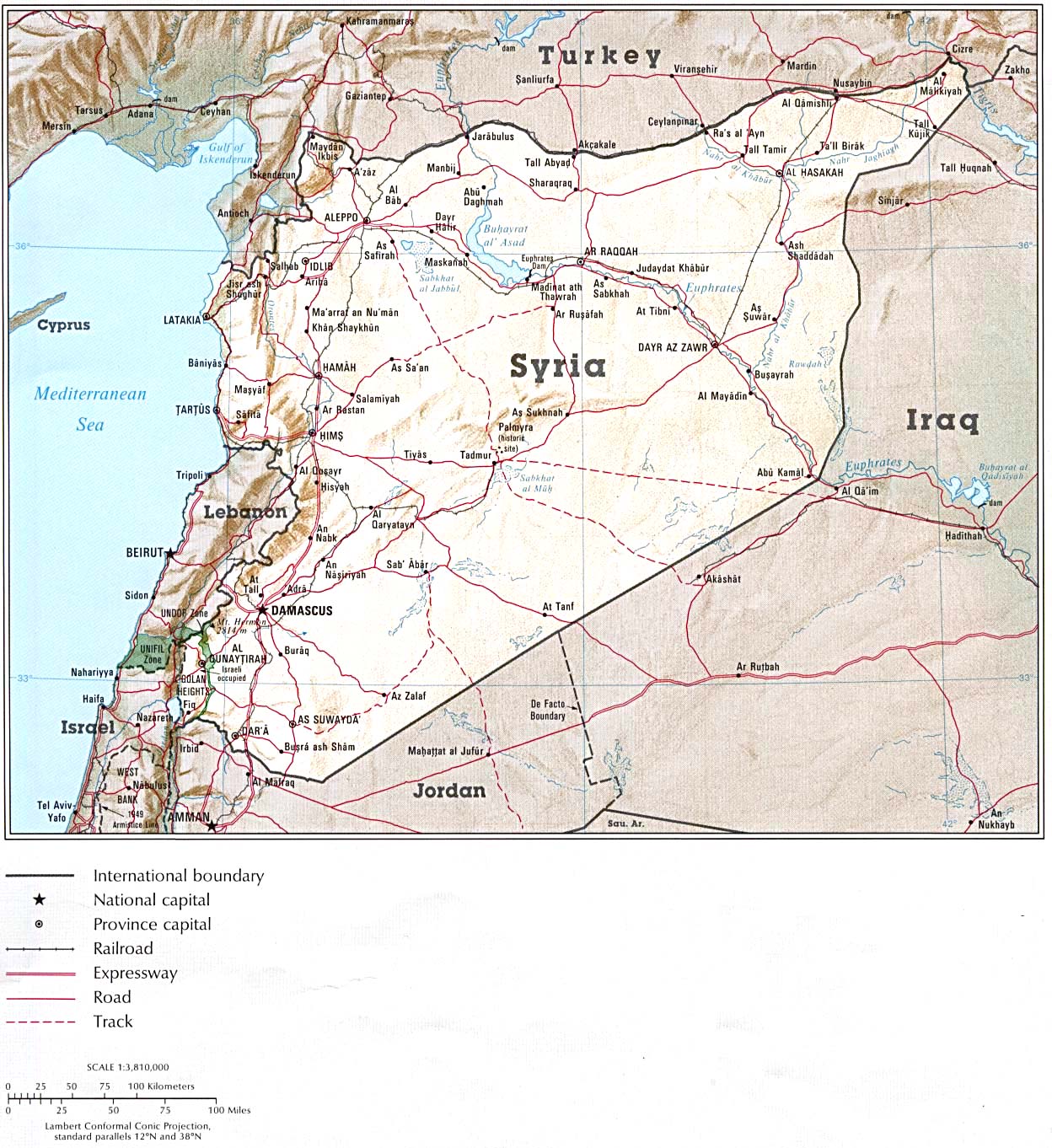
Detailed
map showing roads and towns (click to enlarge) 2004 (1.3MB) Shaded
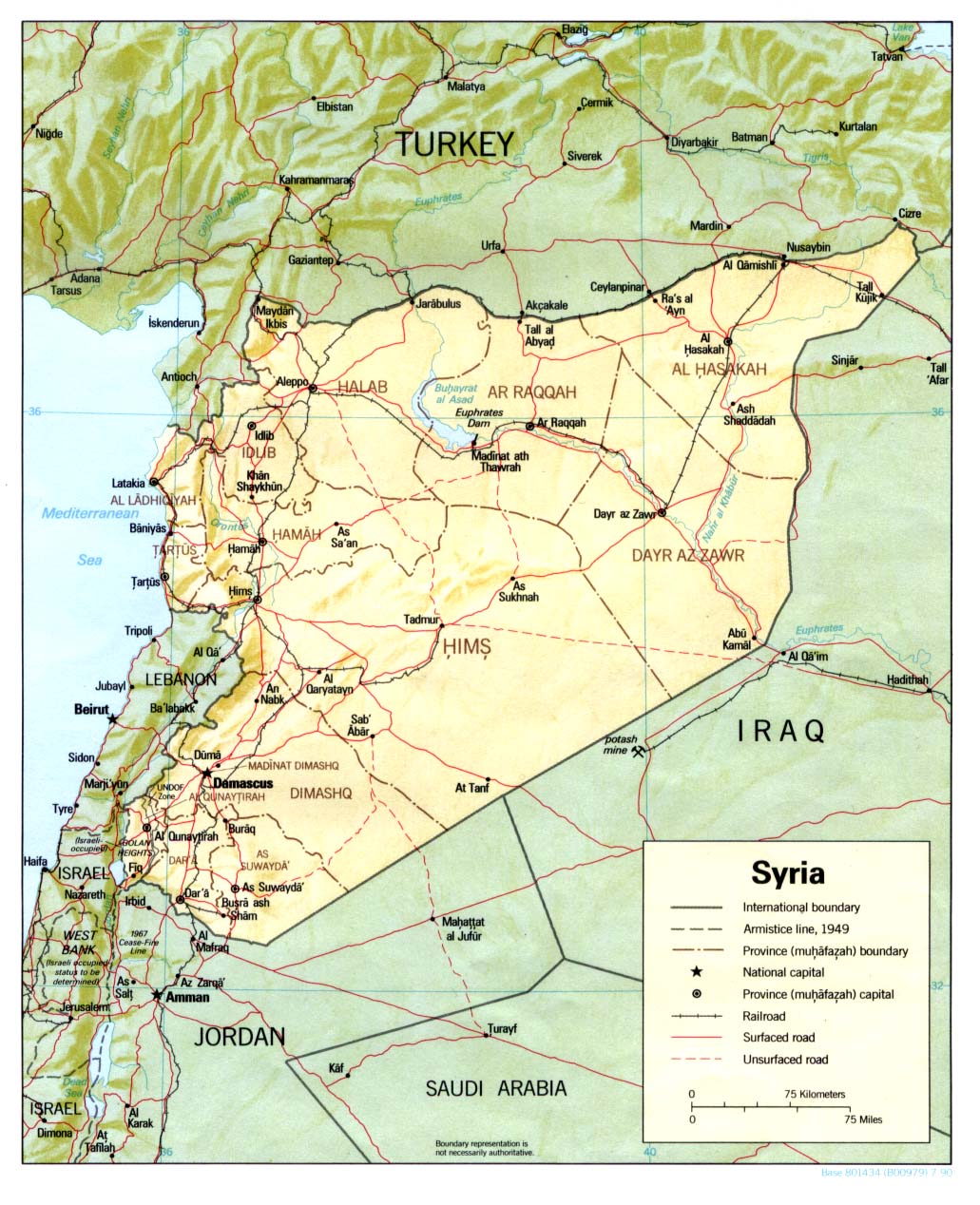
relief map From Atlas of the Middle East 1993 (also pdf format)
Shaded
relief map 1990
(also pdf format)
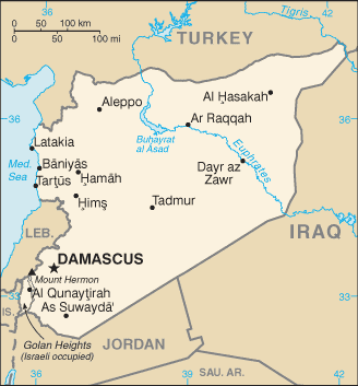
Small map
2011
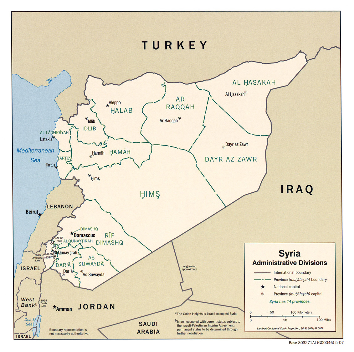
Syria
(administrative divisions) 2007
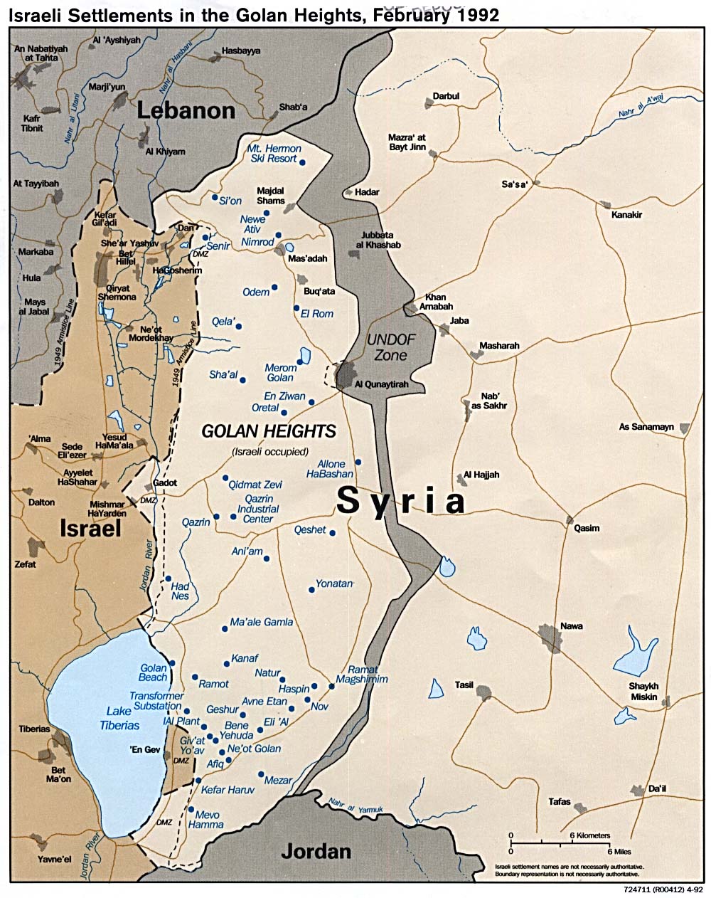
Israeli
settlements in the Golan Heights 1992
Israeli
settlements in the Golan Heights (shaded relief) 1989
Economic
activity (CIA Atlas of the Middle East) 1993
Land
use (CIA Atlas of the Middle East) 1993
Population
density (CIA Atlas of the Middle East) 1993
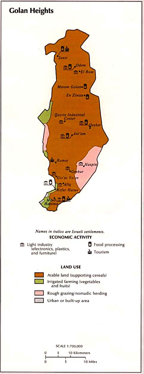
Golan
Heights
Land use and economic activity
Golan
Heights under occupation
(passia.org)
Israel-Syria
demilitarised zones (passia.org)
Maps from the Syrian Ministry of
Tourism:
Syria
Tourist map
Aleppo
- street plan
Damascus
- street plan
Daraa
- street plan
Der
Ezzor - street plan
Hama
- street plan
Hasakeh
- street plan
Homs
- street plan
Idleb
- street plan
Lattakia
- street plan
Quneitra
- street plan
Raqqa
- street plan
Sweyda
- street plan
Tartous
- street plan
Key
to street plans
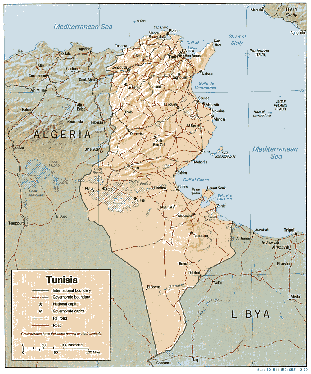
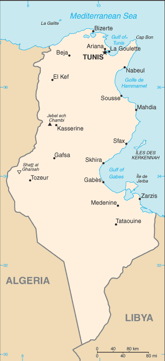
Tunisia
Political map 1990 (also pdf format)
Shaded relief map 1990 (also pdf format)
Small map 2011
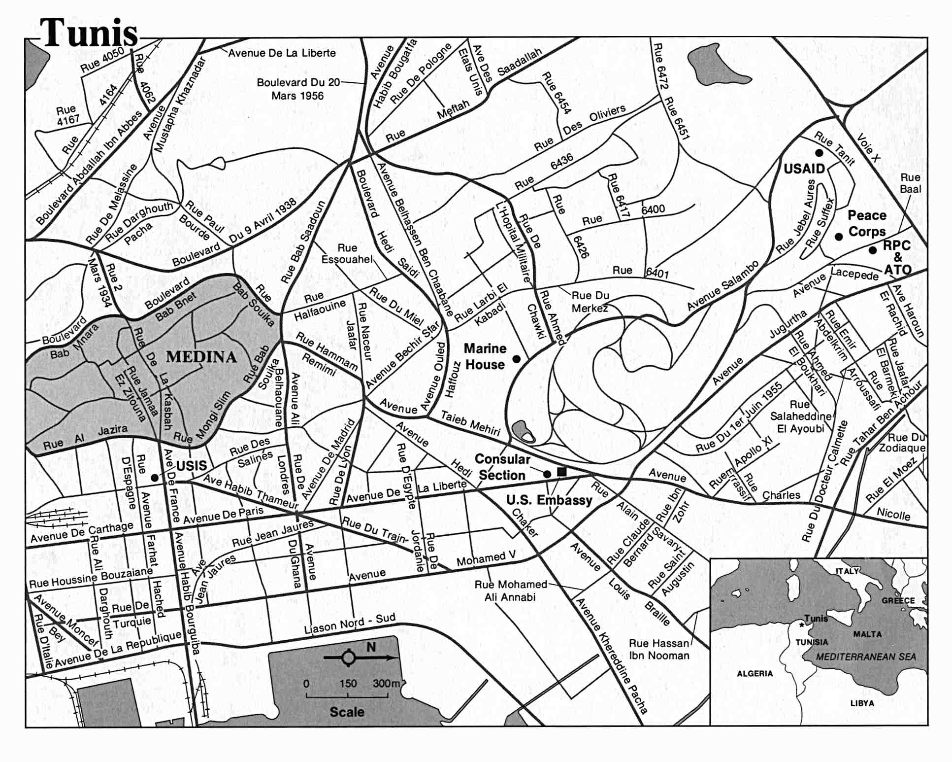
Tunis US State Dept.
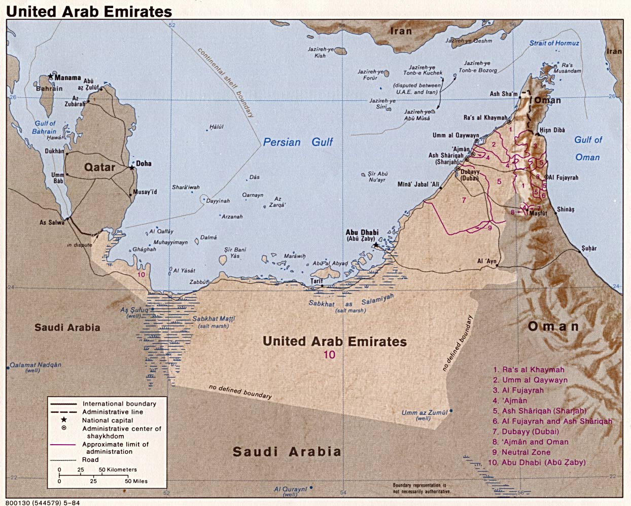
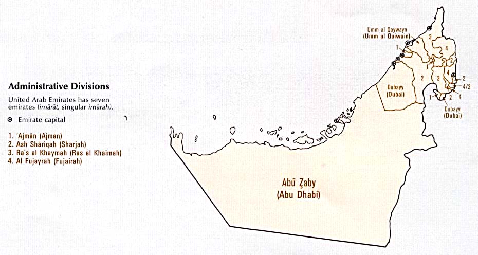
United Arab Emirates
Shaded
relief map 1995 (also pdf format) Shaded
relief map 1984 (also pdf format)
Small
map 2011
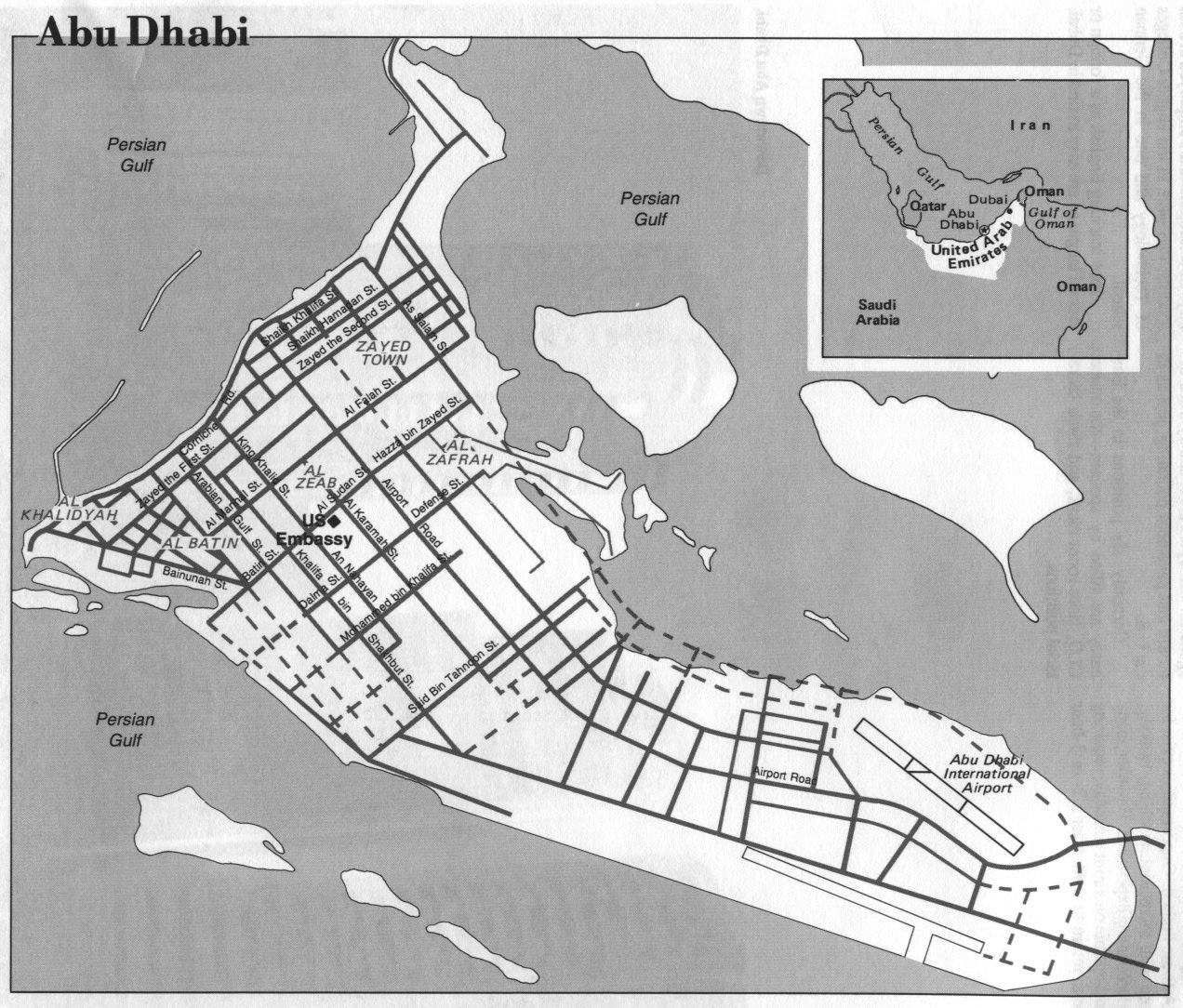
Abu Dhabi
US State Dept. 1994
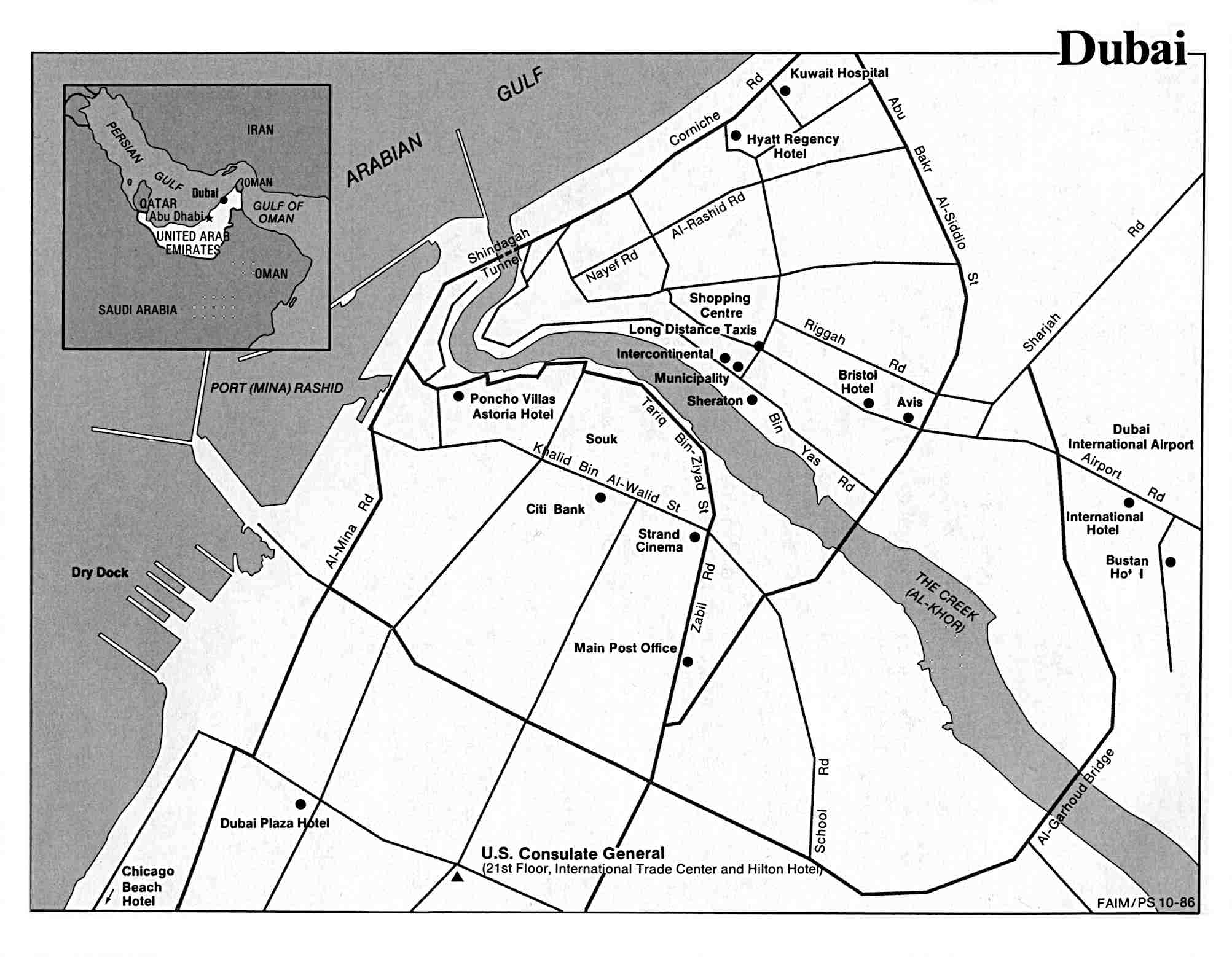
Dubai
US State Dept. 1986
Strait of Hormuz
(political map) 1980
Strait of Hormuz
(detailed map) 2004
Country
map ( CIA Atlas of the Middle East) 1993
Administrative
divisions ( CIA Atlas of the Middle East) 1993
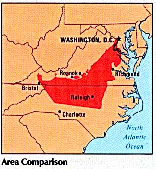
Area
comparison ( CIA Atlas of the Middle East) 1993
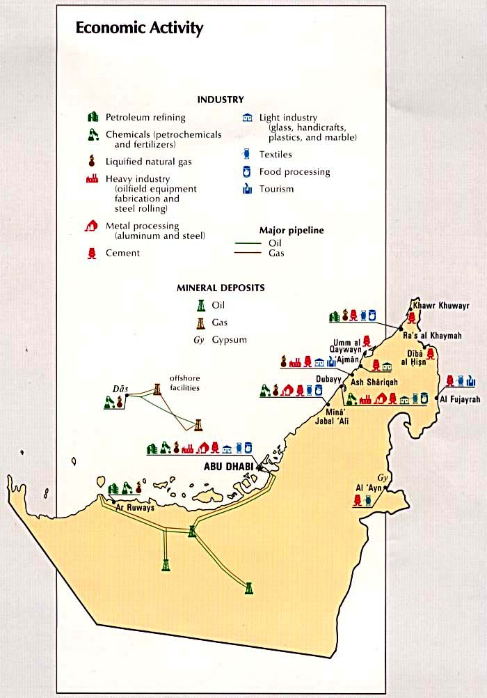
Economic
activity ( CIA Atlas of the Middle East) 1993
Land
use ( CIA Atlas of the Middle East) 1993
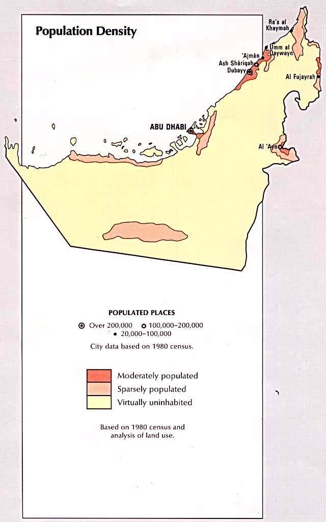
Population
density ( CIA Atlas of the Middle East) 1993
Yemen
See special
page
|
