|
Political
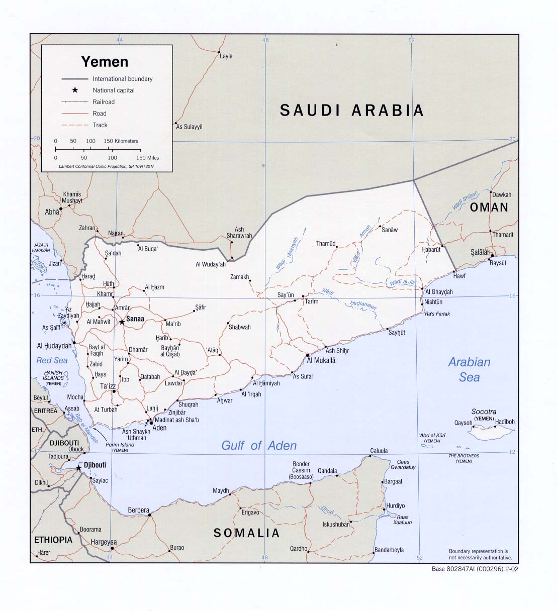
map 2002 (also pdf format) Political
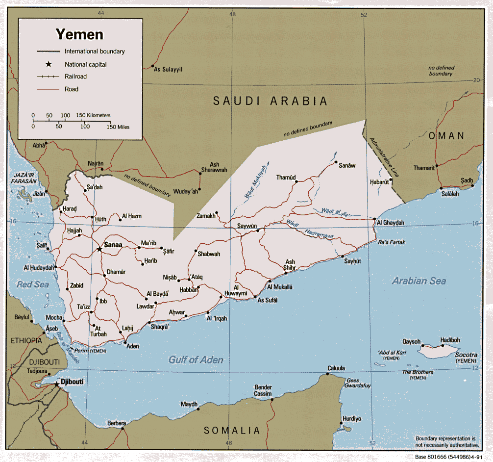
map 1991
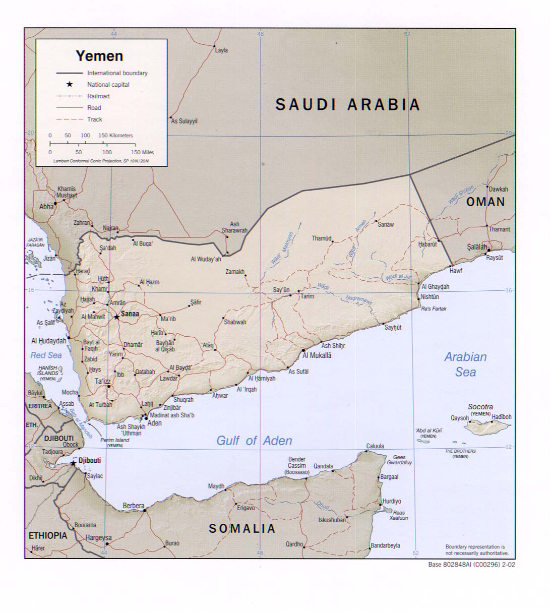
Shaded
relief map 2002 (also pdf format)
Shaded
relief map Atlas of the Middle East, 1993 Small
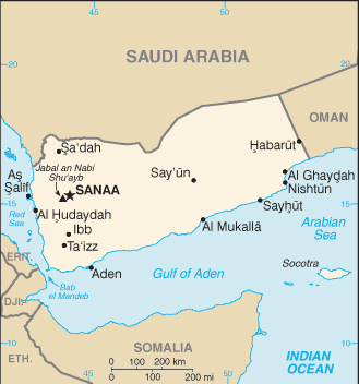
map 2011 Yemen
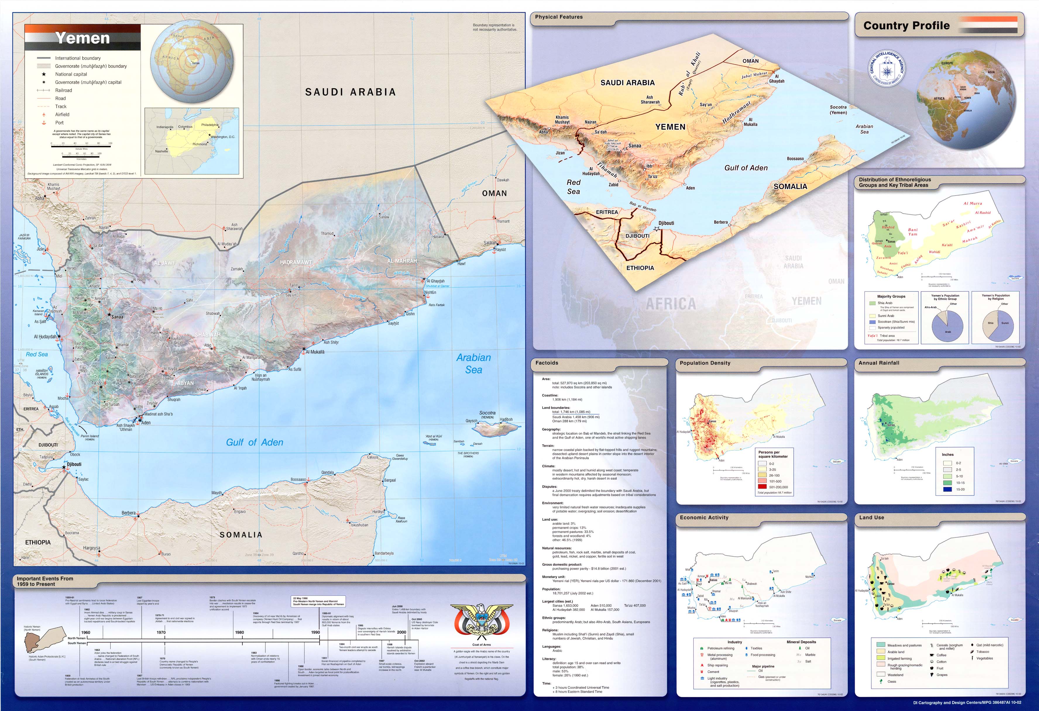
wall chart 2002
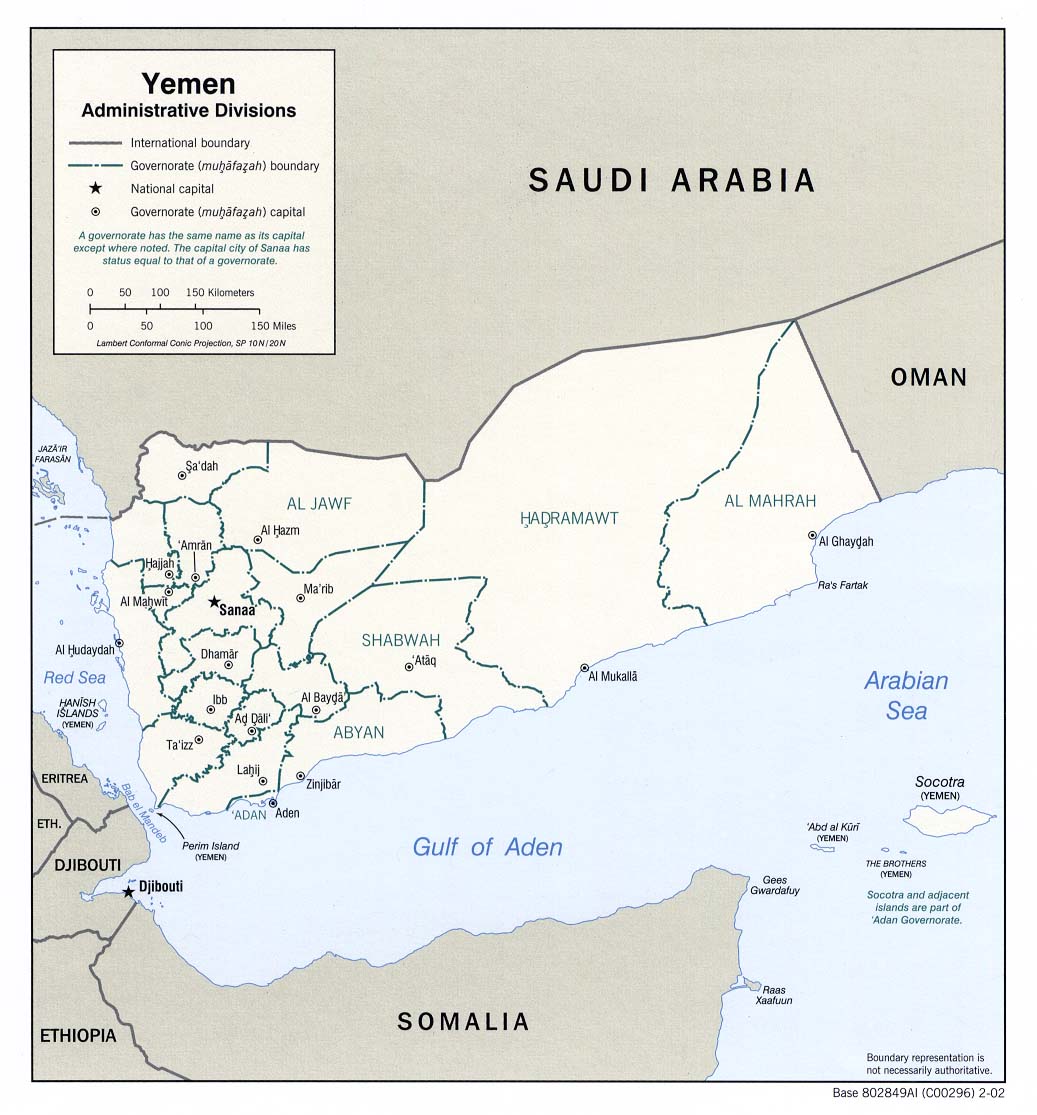
Administrative
divisions 2002 (also pdf format)
Administrative divisions
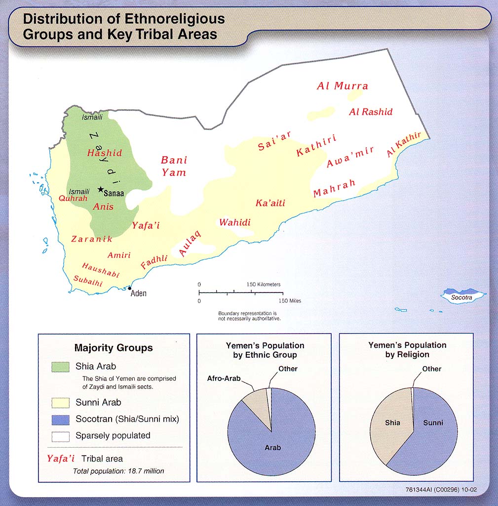
(Caution: this older version contains errors) Distribution of
ethnoreligious groups and key tribal areas From Yemen
wall chart 2002
Yemen
conflicts map (criticalthreats.org) May 2010
Map links to this
article
Oil
concessions in Yemen
Map with details of blocks and companies. (Source:
PEPA, 2012). See also earlier
map (circa 1997)
Territorial
claims in the border area
and overlapping
territorial claims
These maps, from the British-Yemeni Society
Journal (July 2000), relate to the border
dispute between Yemen and Saudi Arabia, which has now been
resolved.
Sanaa
city map (Google)
Aden
city map (Google)
Aden
region (Mapshop)
Aden CIA 1978
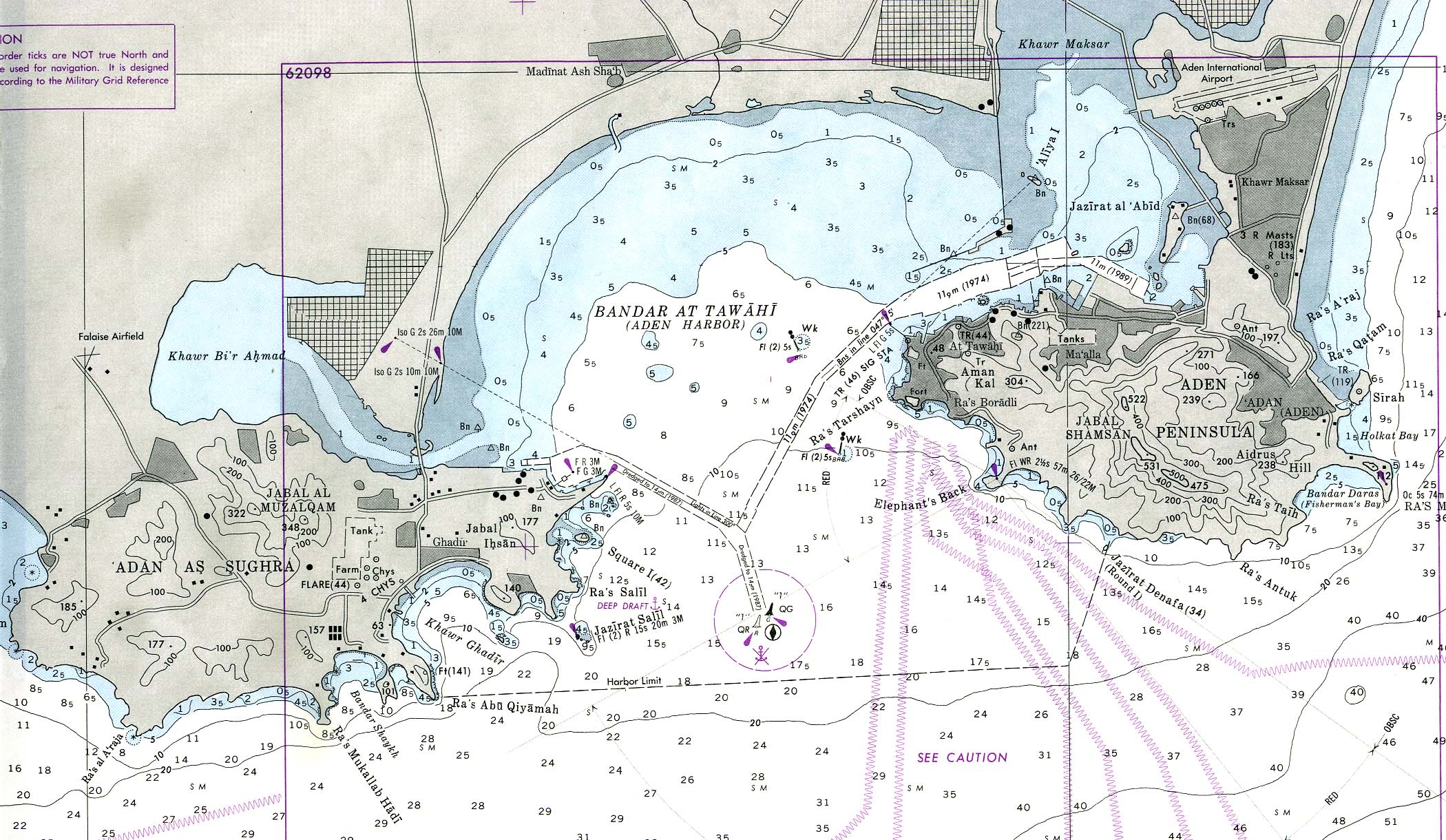
Aden
nautical chart US Defense Mapping Agency 1990 (Not for navigational
use)
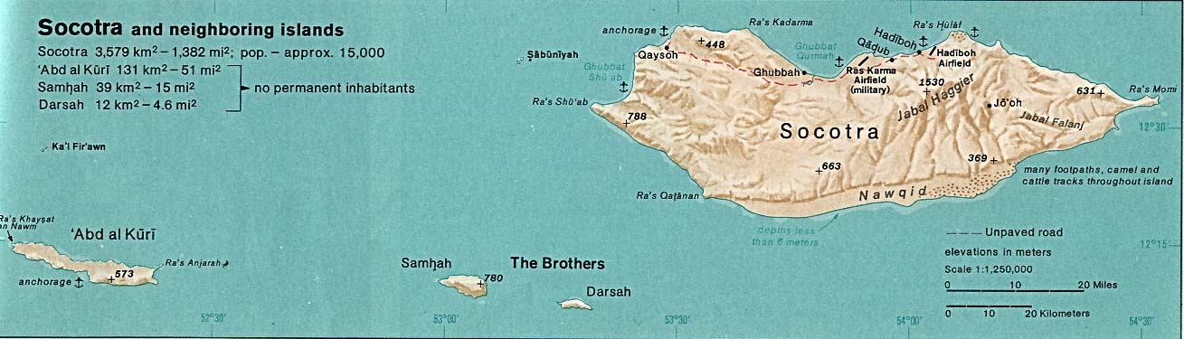
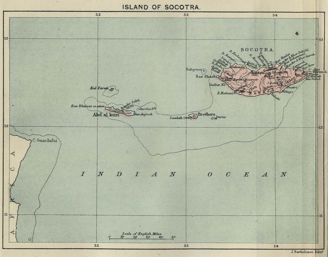
Socotra Indian Ocean Atlas, 1976
Socotra,
1886
Scottish Geographical
Magazine. Published by the Scottish Geographical Society and edited by
Hugh A. Webster and Arthur Silva White. Volume II: 1886.
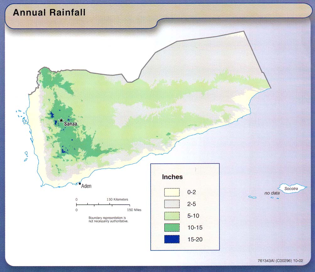
Annual
rainfall From Yemen wall chart 2002
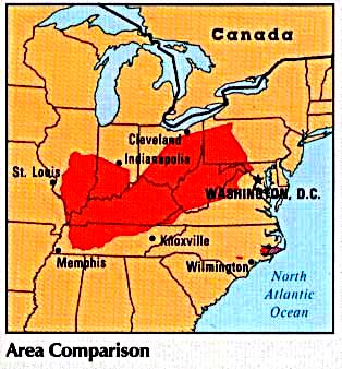
Area
comparison Atlas of the Middle East, 1993
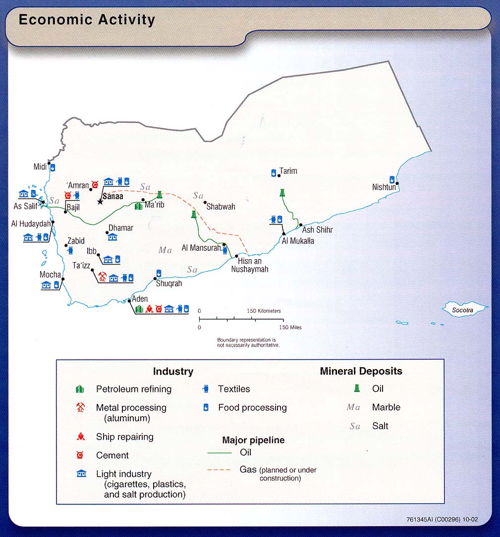
Economic
activity From Yemen wall chart 2002
Economic
activity Atlas of the Middle East, 1993
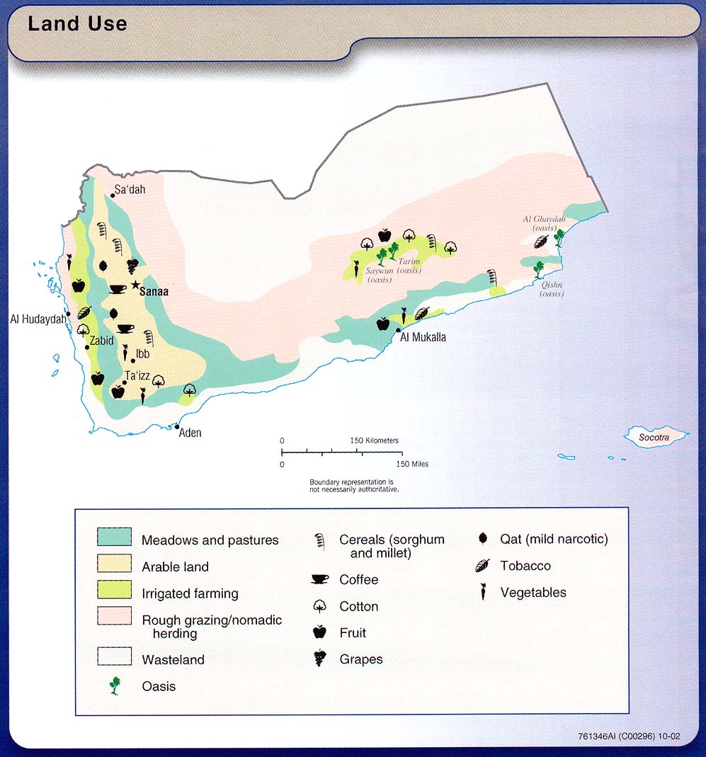
Land
use From Yemen wall chart 2002
Land
use Atlas of the Middle East, 1993
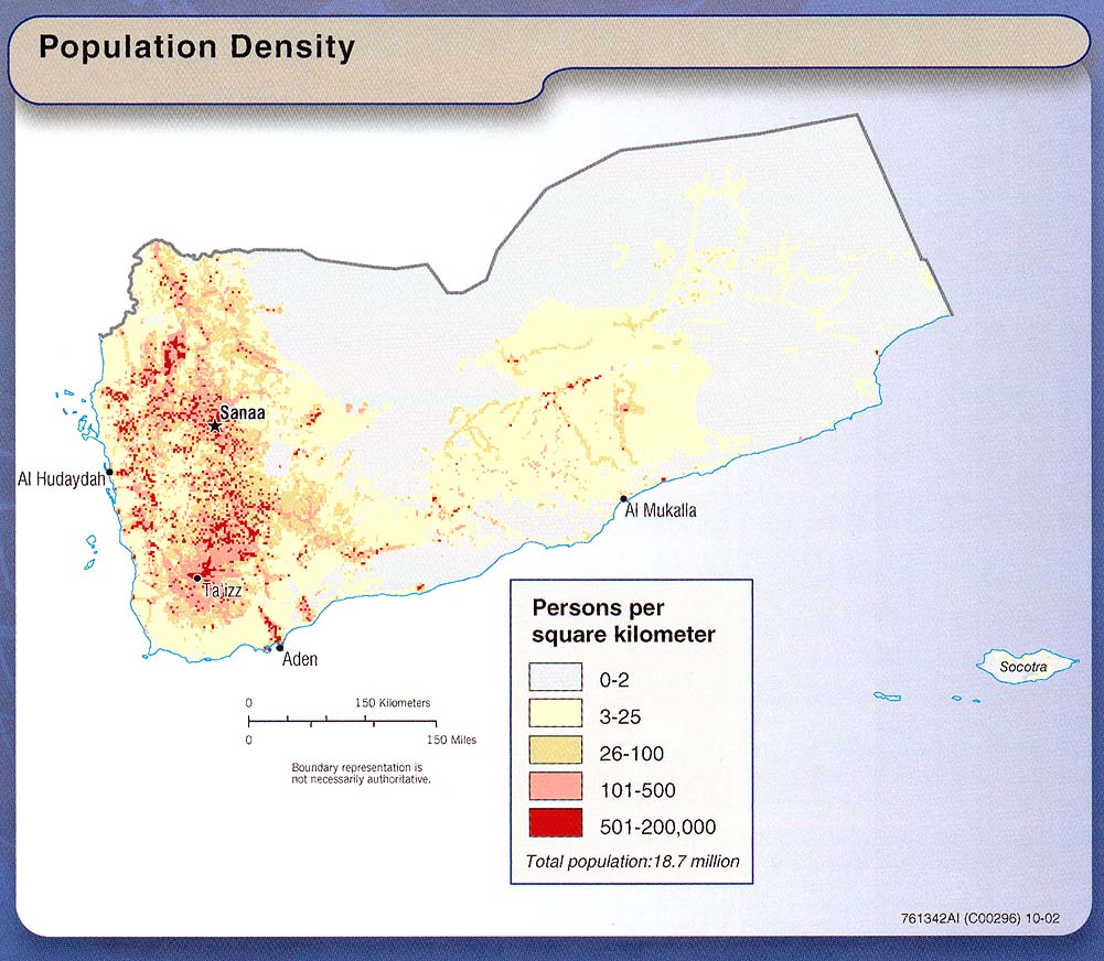
Population
density From Yemen wall chart 2002
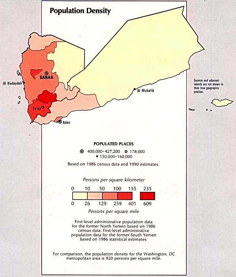
Population
density Atlas of the Middle East, 1993
Note: Maps listed on this page are stored at the
University of Texas except where indicated. |

![[Relief]](http://www.lib.utexas.edu/maps/atlas_middle_east/yemen_map.jpg)
![[Aden]](http://www.lib.utexas.edu/maps/world_cities/aden.jpg)
![[Land use]](http://www.lib.utexas.edu/maps/atlas_middle_east/yemen_land.jpg)