General maps
Maps on this page are at PASSIA or University of Texas except where indicated. To provide more complete coverage, this page includes some links which refer to Israel.
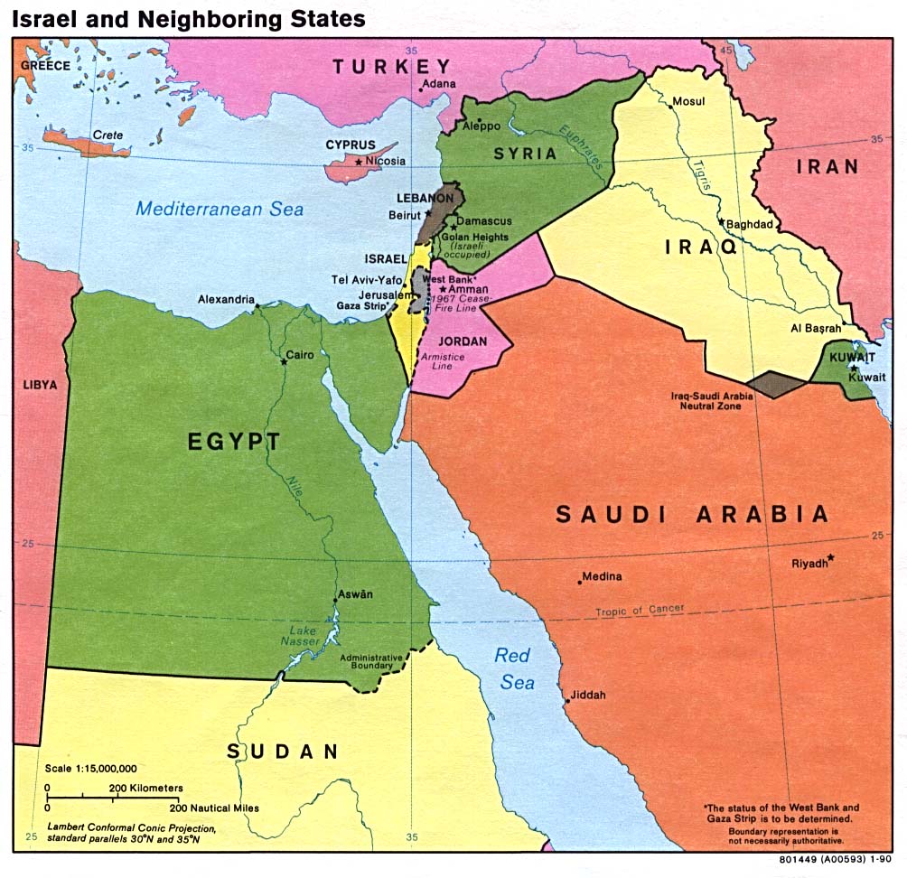
Israel and neighbouring states
Political map, 1990 (170 k)
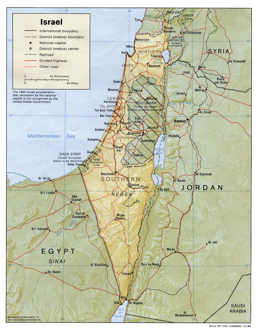
Shaded relief map
1988 (374k)
Small map
Showing main towns, 1997 (91k)
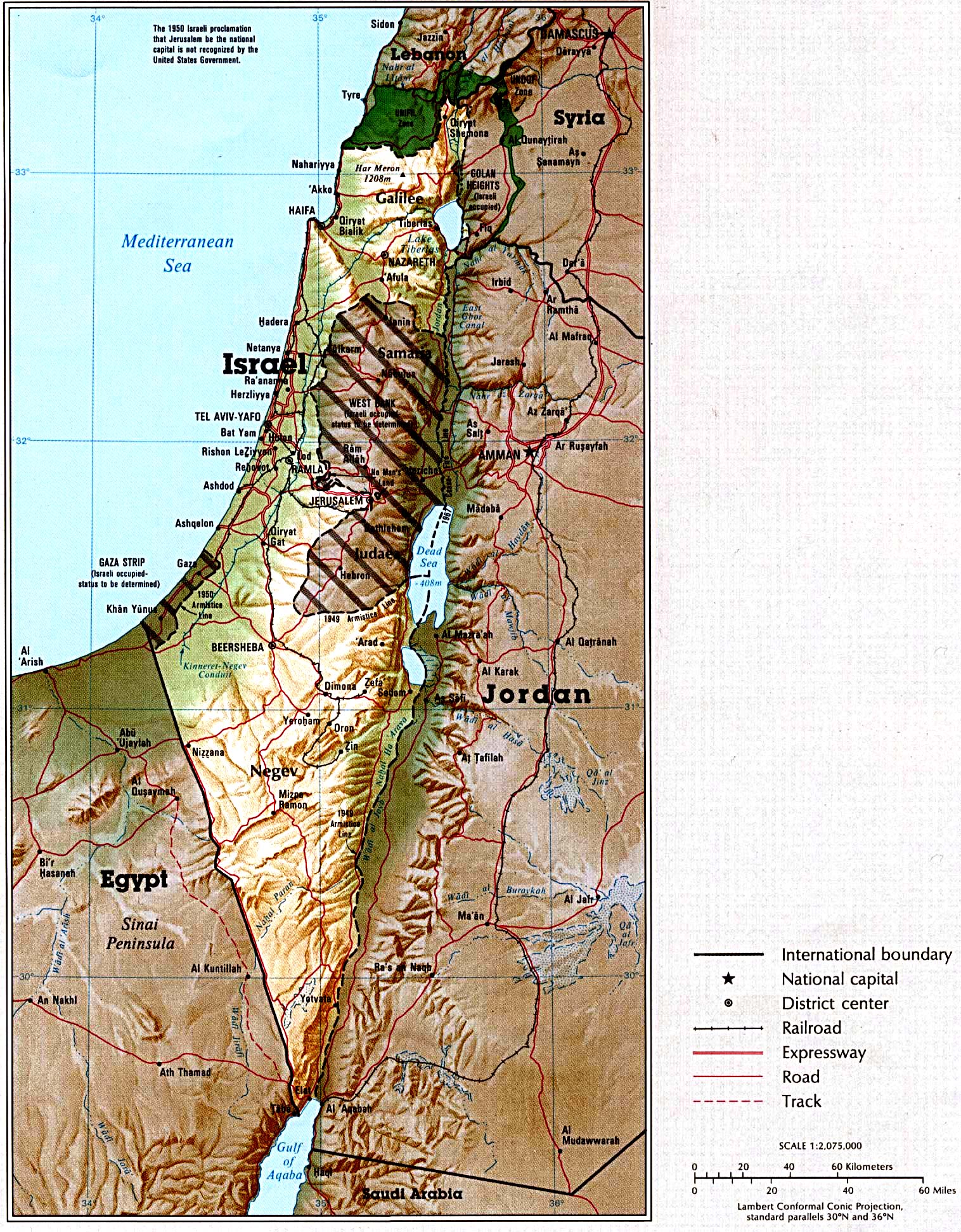
Country map
Large (819k)
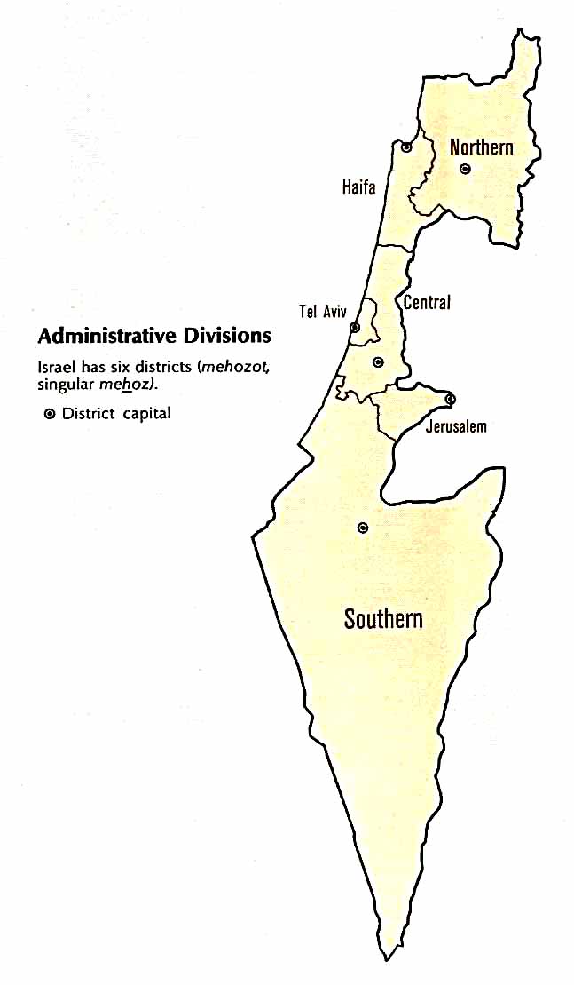
Israeli administrative divisions (41k)
Israeli economic activity (196k)
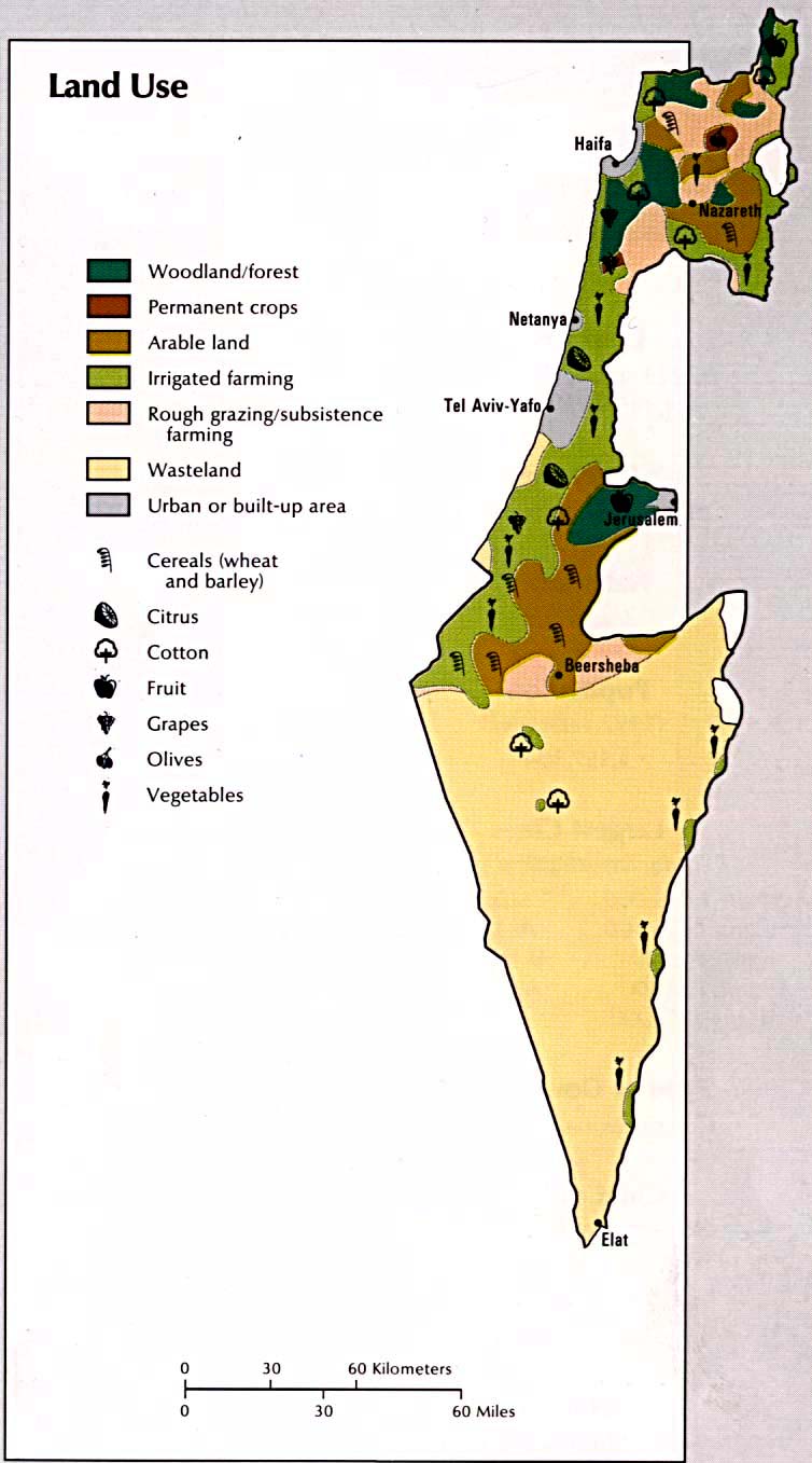
Israeli land use (107k)
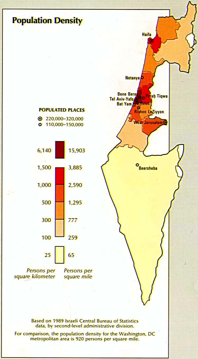
Israeli population density (114k)
Jerusalem-Jericho area
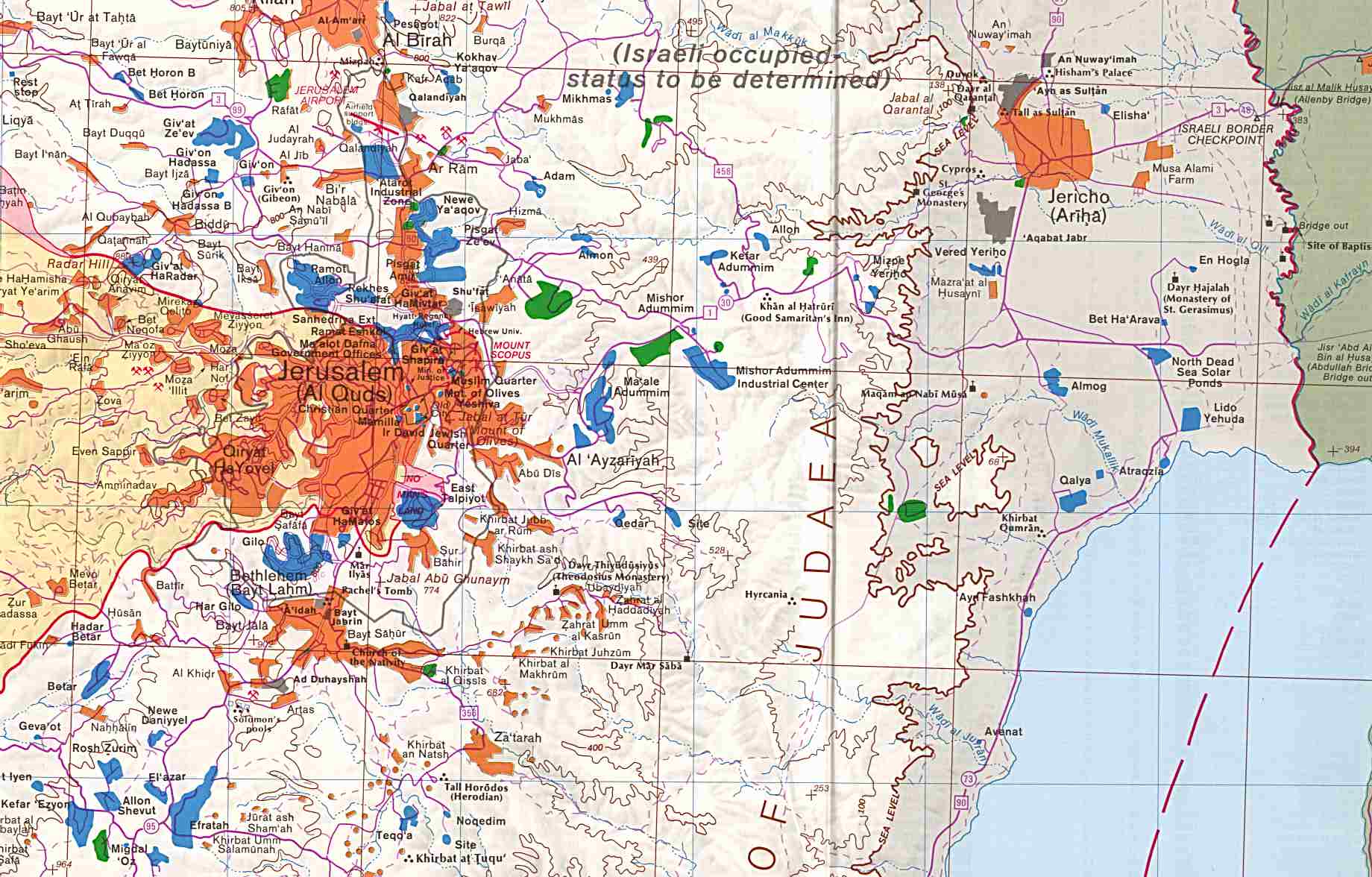
Towns and villages, 1992. Original scale 1:150,000 (219k)
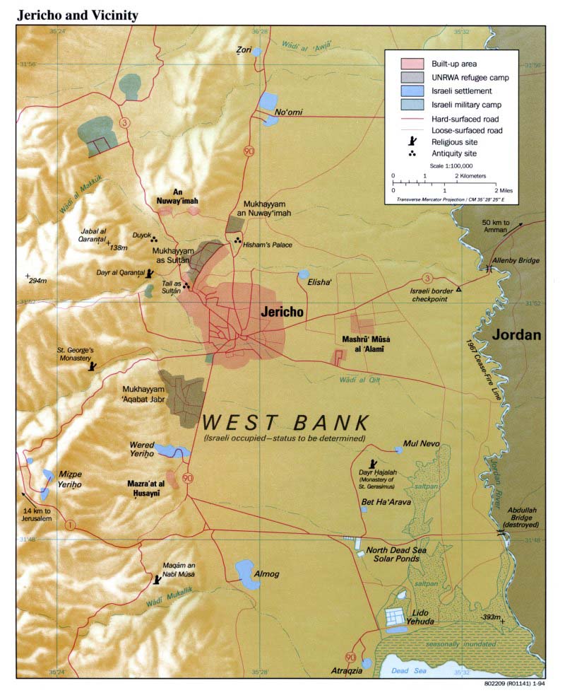
Jericho area
Roads, villages, etc, January 1994 (294k)
Partition and occupation
First Zionist colony in Palestine 1878
Jewish Yishuv settlement 1881-1914
Zionist colonies at the beginning of the British Mandate 1920
Palestine under British Mandate (1) 1923-48
Palestine under the British Mandate (2) 1923-48
Royal Commission (Peel) plan for partition 1937
UN Partition recommendation November 1947
Zionist and Palestinian landownership 1945
Distribution of population (Palestinian and Jewish) 1946
Zionist military operations outside UN-proposed Jewish state April-May 1948
Arab territories seized by Israel in violation of partition plan 1948-49
Rhodes Armistice demarcation line 1949
Peace process
The "historic compromise"
Palestinian Negotiations Affairs Department
Israeli proposals
Palestinian Negotiations Affairs Department
Clinton's proposals
Palestinian Negotiations Affairs Department
Water resources
Palestinian Negotiations Affairs Department
Projection of further Israeli redeployment - according to the Sharm al-Sheikh Memorandum, 1999
Settlements
Occupied territories
Undated, showing Israeli settlements and Palestinian refugee camps (384k)
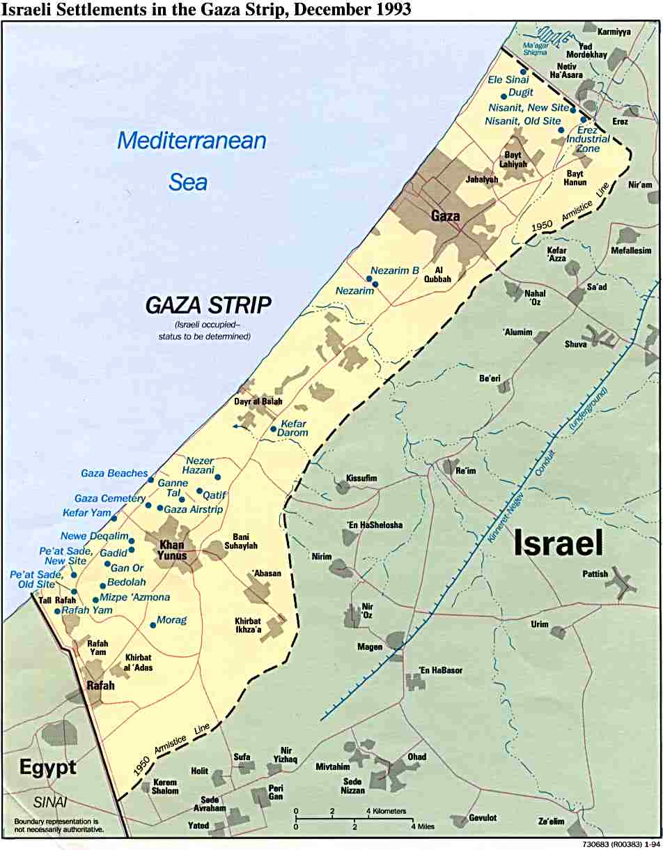
Gaza
Israeli settlements, December 1993 (75k)
Gaza
Israeli settlements, February 1992 (242k)
West Bank
Israeli settlements, December 1993 (216k)
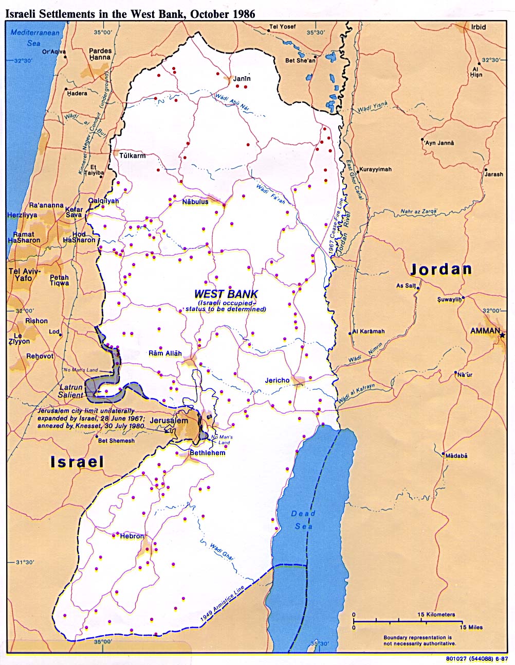
West Bank
Israeli settlements, October 1986 (256k)
West Bank
Israeli settlements, September 1983 (289k)
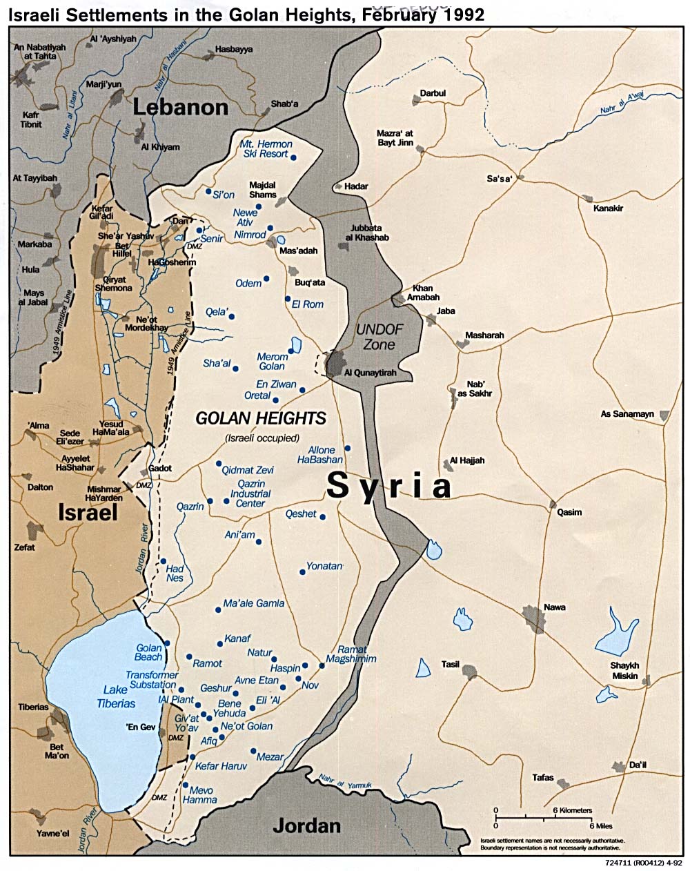
Golan Heights
Israeli settlements, February 1992 (241 k)
First Zionist colony in Palestine 1878
Jewish Yishuv settlement 1881-1914
Zionist colonies at the beginning of the British Mandate 1920
Jerusalem: Old City - area expropriated in 1968, plus settlers' properties
East Jerusalem 1995 - Israeli settlements
Refugees
Palestinian refugee camps
Registered UNRWA camps in Lebanon, Syria, Jordan, West Bank and Gaza, November 1993 (133k)
Occupied territories
Undated, showing Israeli settlements and Palestinian refugee camps (384k)
Jerusalem
Historical maps of Jerusalem
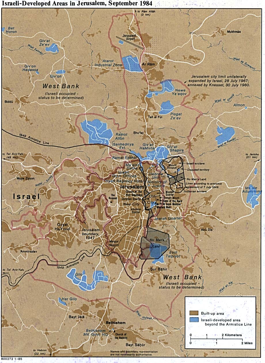
Jerusalem area
Israeli-developed areas, 1984 (299 k)
Jerusalem: municipal boundaries 1947-2000
Municipal area 1967
Jerusalem - Palestinian and Israeli areas (including settlements). Undated
Proposed Jerusalem boundaries (a) UN Resolution 181, November 1947
Proposed Jerusalem boundaries (b) UN Resolution 181, November 1947, as extended by Israel
Partitioned Jerusalem 1948-67
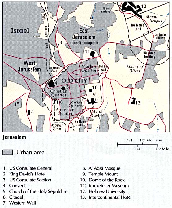
Jerusalem
Places of interest to visitors (67k)
Old City 1989, showing Jewish, Christian, Muslim and Armenian quarters
Old City - area expropriated in 1968, plus settlers' properties
Old City - before Israeli occupation
Old City - area usurped by Israel since 1967
East Jerusalem 1995 - showing Israeli settlements
East Jerusalem - land expropriation 1967-95
East Jerusalem - town planning
Gaza
Gaza Strip 2000
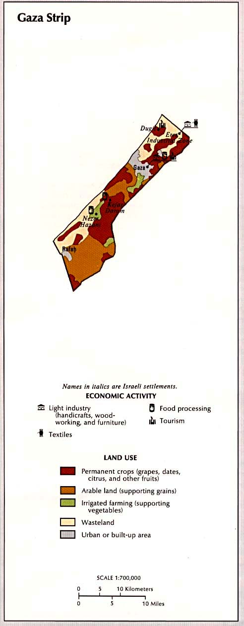
Gaza
Land use and economic activity (57k)
Gaza
Small map showing main towns, 1997 (43k)
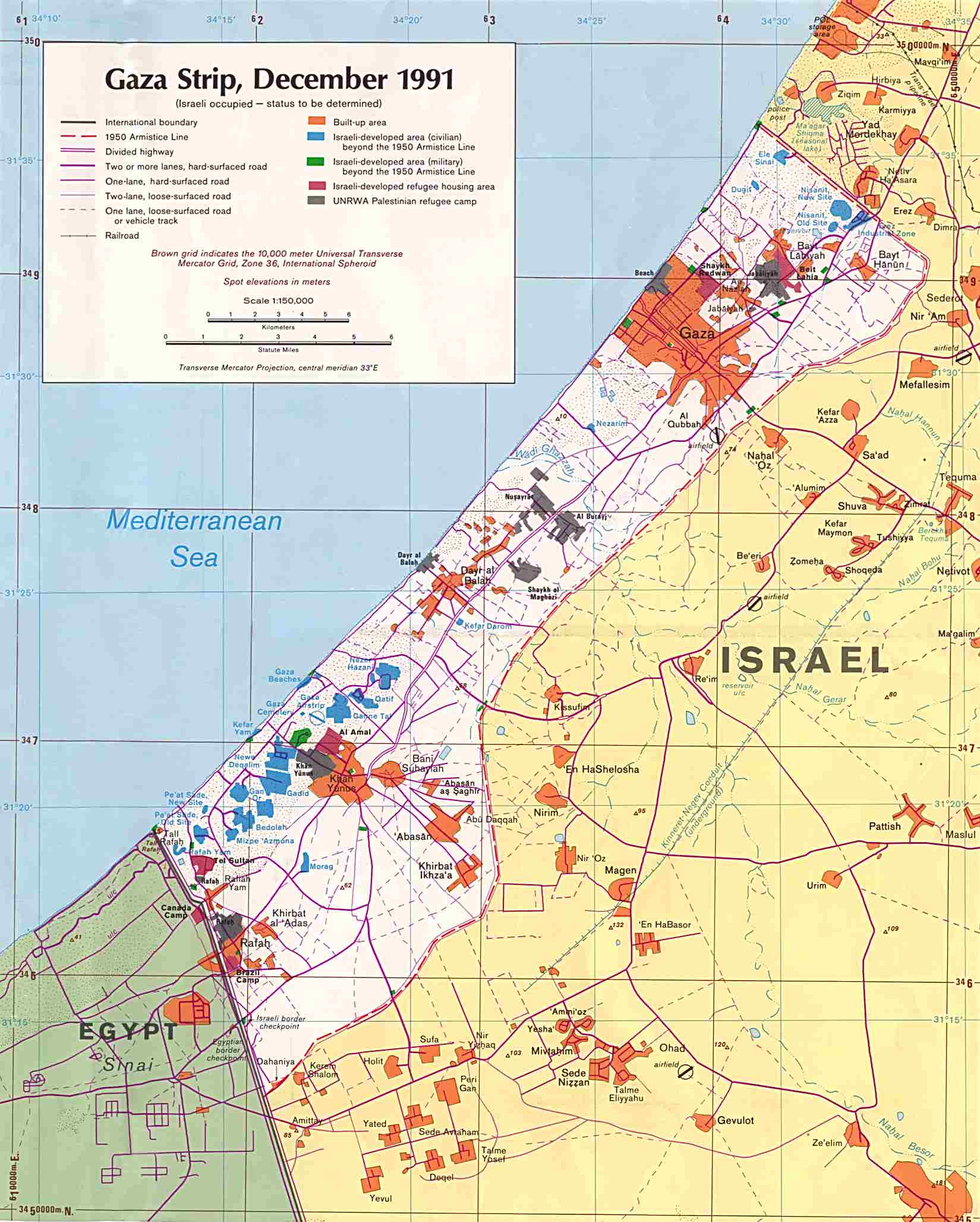
Gaza
Large map showing roads and urban areas, December 1991 Original scale 1:150,000 (238k)
Gaza
Israeli settlements, December 1993 (75k)
Gaza
Israeli settlements, February 1992 (242k)
Gaza and the West Bank
Land closures and requisitions, January 1994 (339k)
Gaza and the West Bank
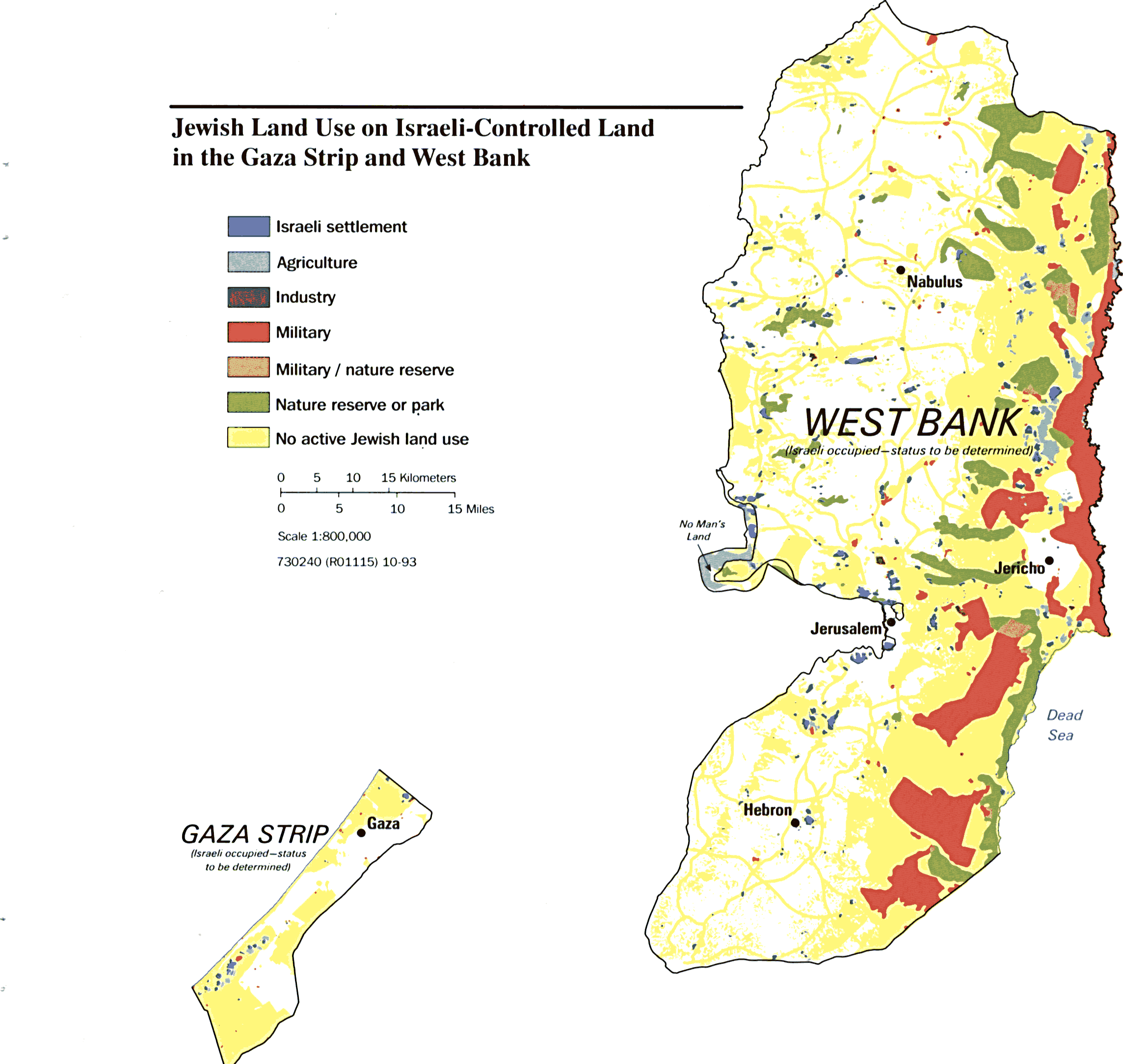
Israeli land use - agriculture, military, nature reserves, etc - October 1993 (235k)
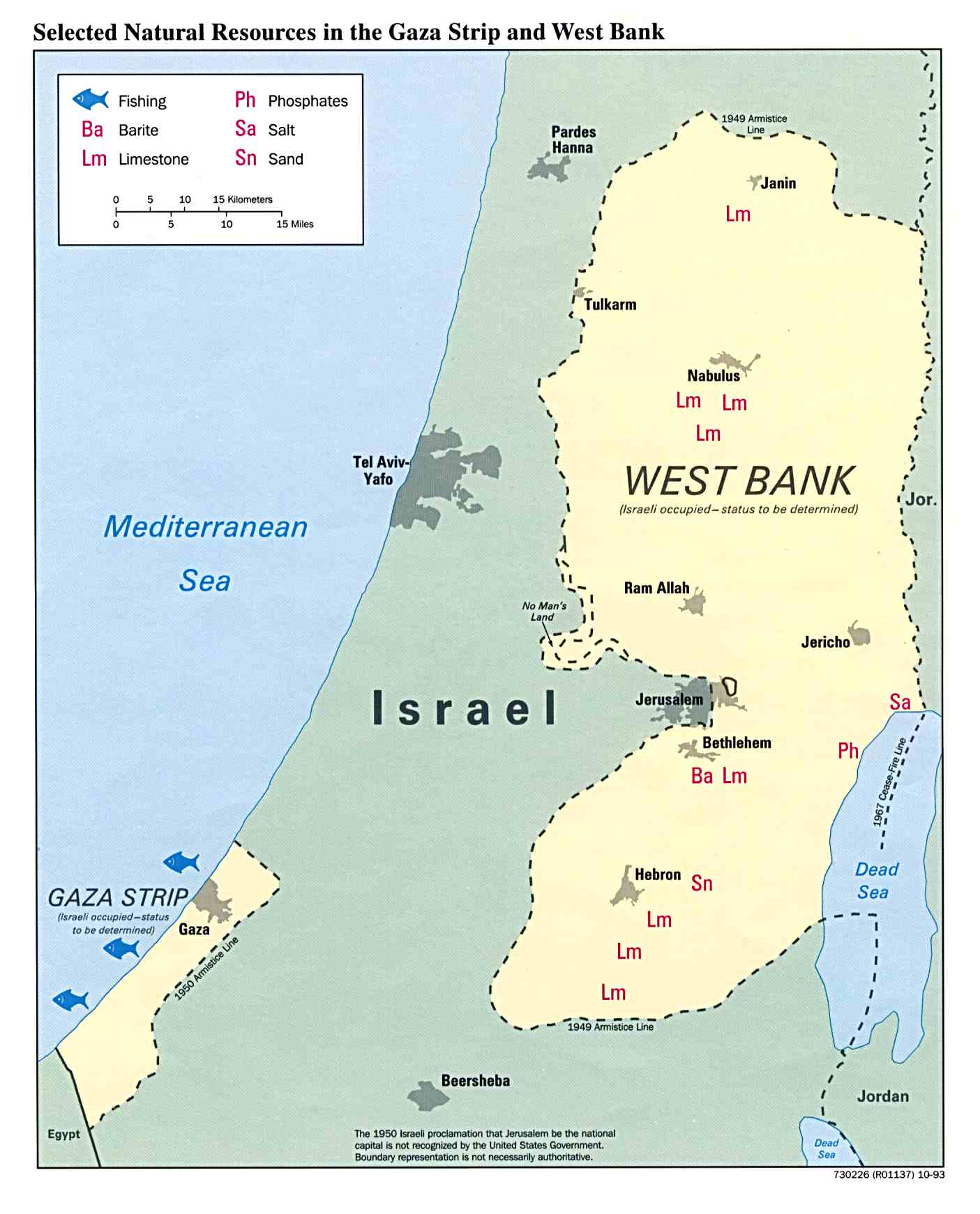
Gaza and the West Bank
Selected natural resources, January 1994 (134k)
West Bank
West Bank
Small map showing main towns, 1997 (96k)
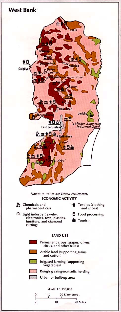
West Bank
Land use and economic activity (103k)
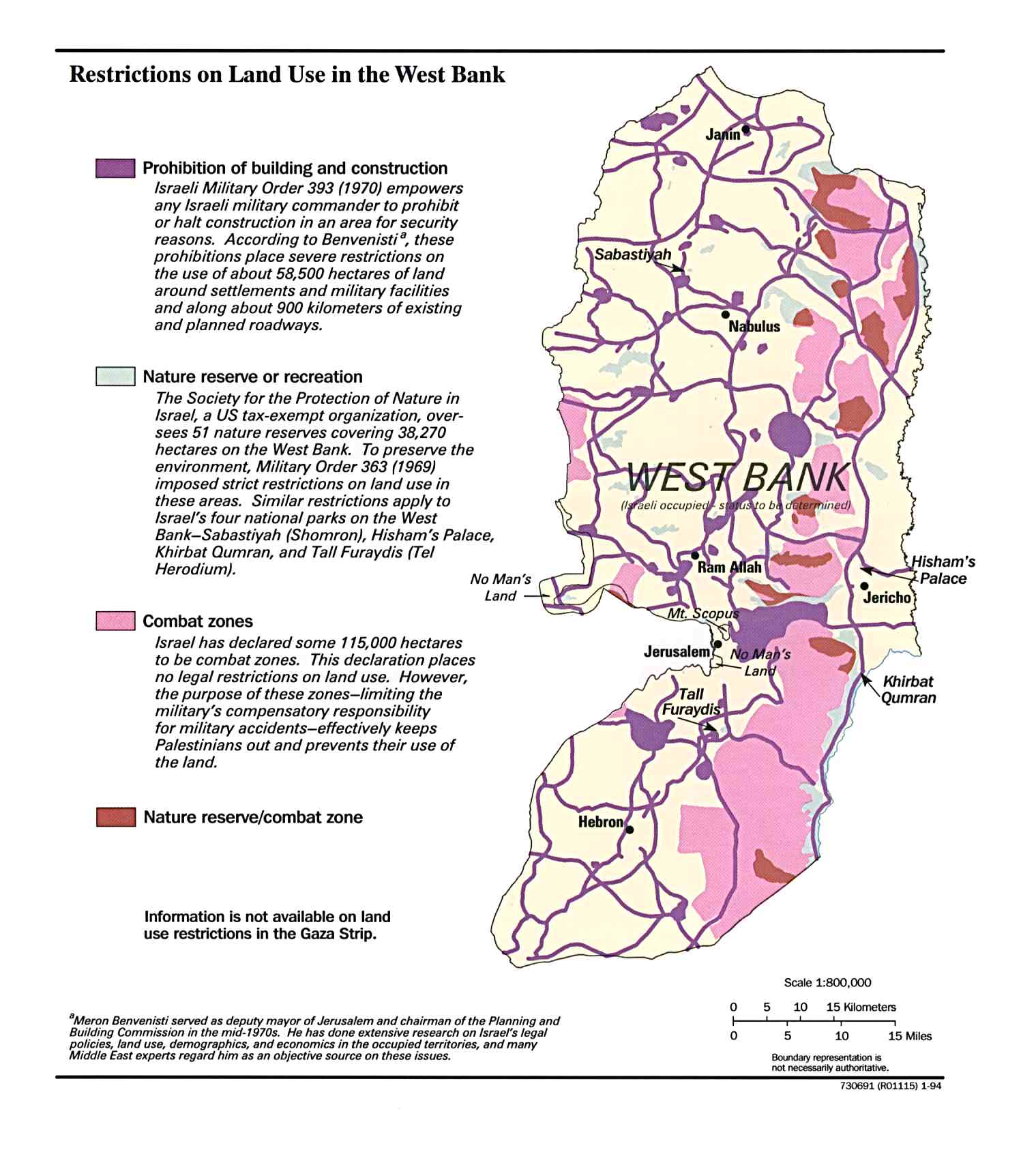
West Bank
Restrictions on land use, December 1993 (191k)
West Bank
Israeli settlements, December 1993 (216k)
West Bank
Israeli settlements, October 1986 (256k)
West Bank
Israeli settlements, September 1983 (289k)
Gaza and the West Bank
Land closures and requisitions, January 1994 (339k)
Gaza and the West Bank
Israeli land use - agriculture, military, nature reserves, etc - October 1993 (235k)
Gaza and the West Bank
Selected natural resources, January 1994 (134k)

