General maps
Detailed map of Iraq
Probably the best map of Iraq on the web (mideastweb.org)
General map of Iraq
2002. High-quality PDF file - 529k (UN Cartographic Section). Also jpg version (134k)
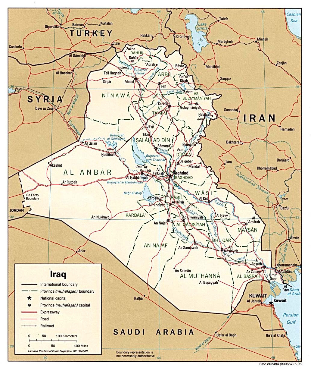
Political map
1996 (295k)
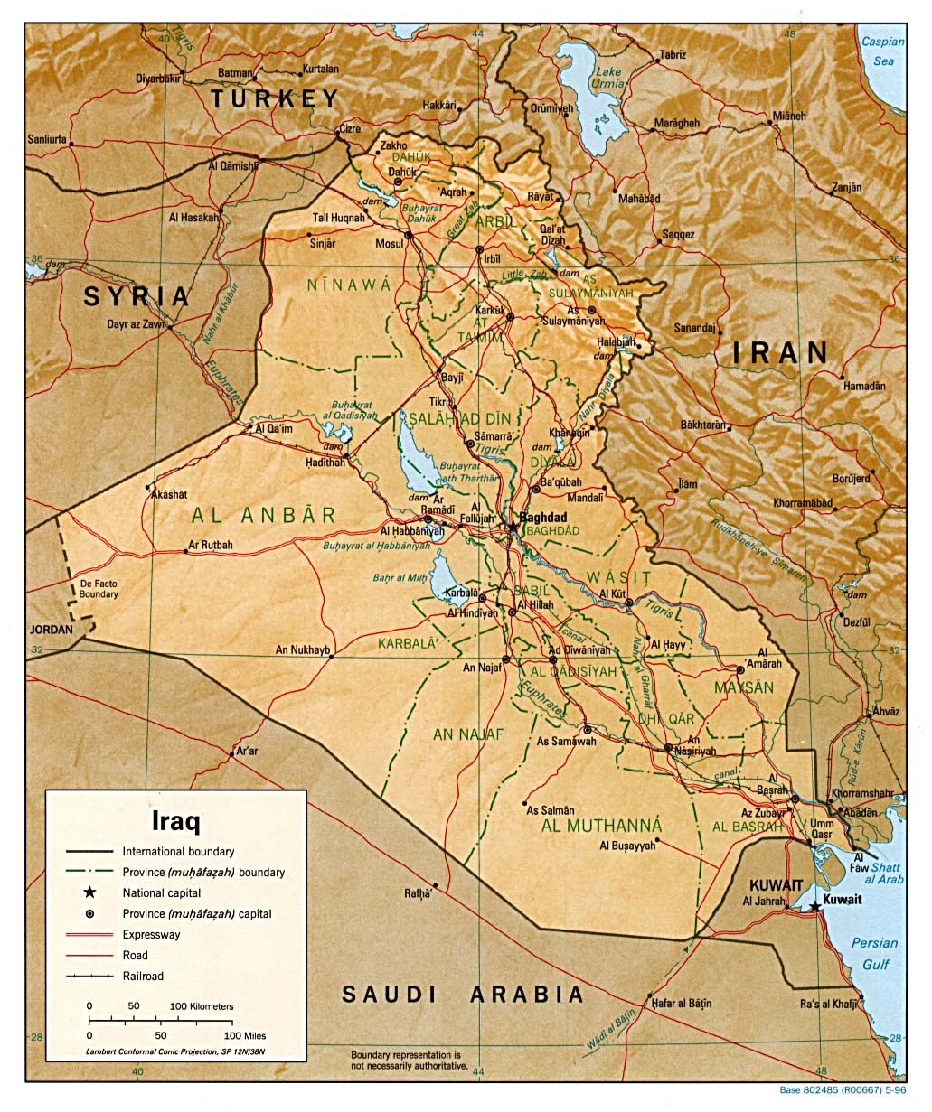
Shaded relief map
1996 (307k)
Shaded relief map
CIA, 1993 (580k)
Small map
1997 (53k)
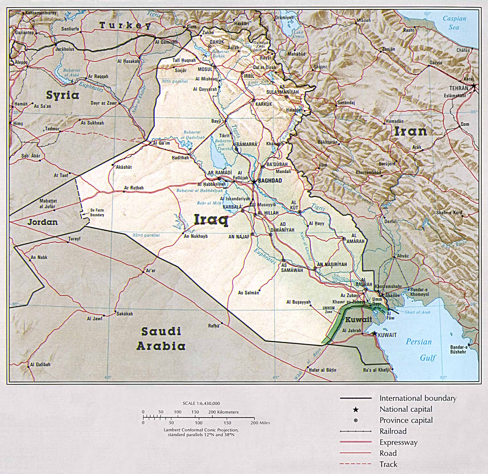
Country map
(580k)
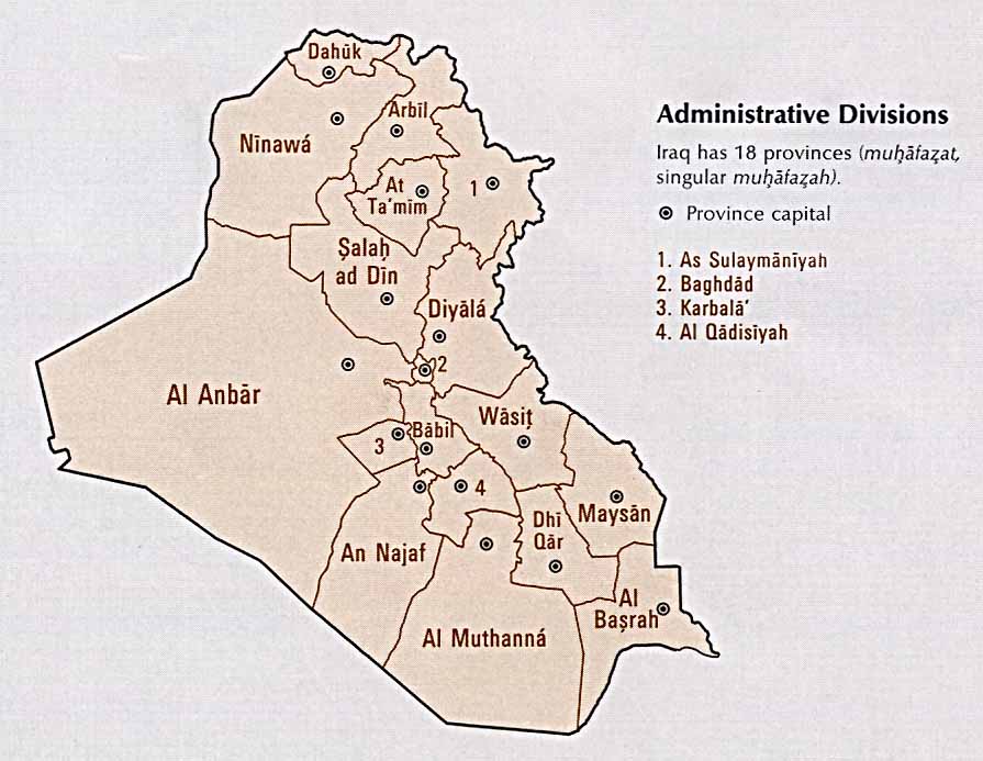
Administrative divisions
CIA, 1993 (69k)
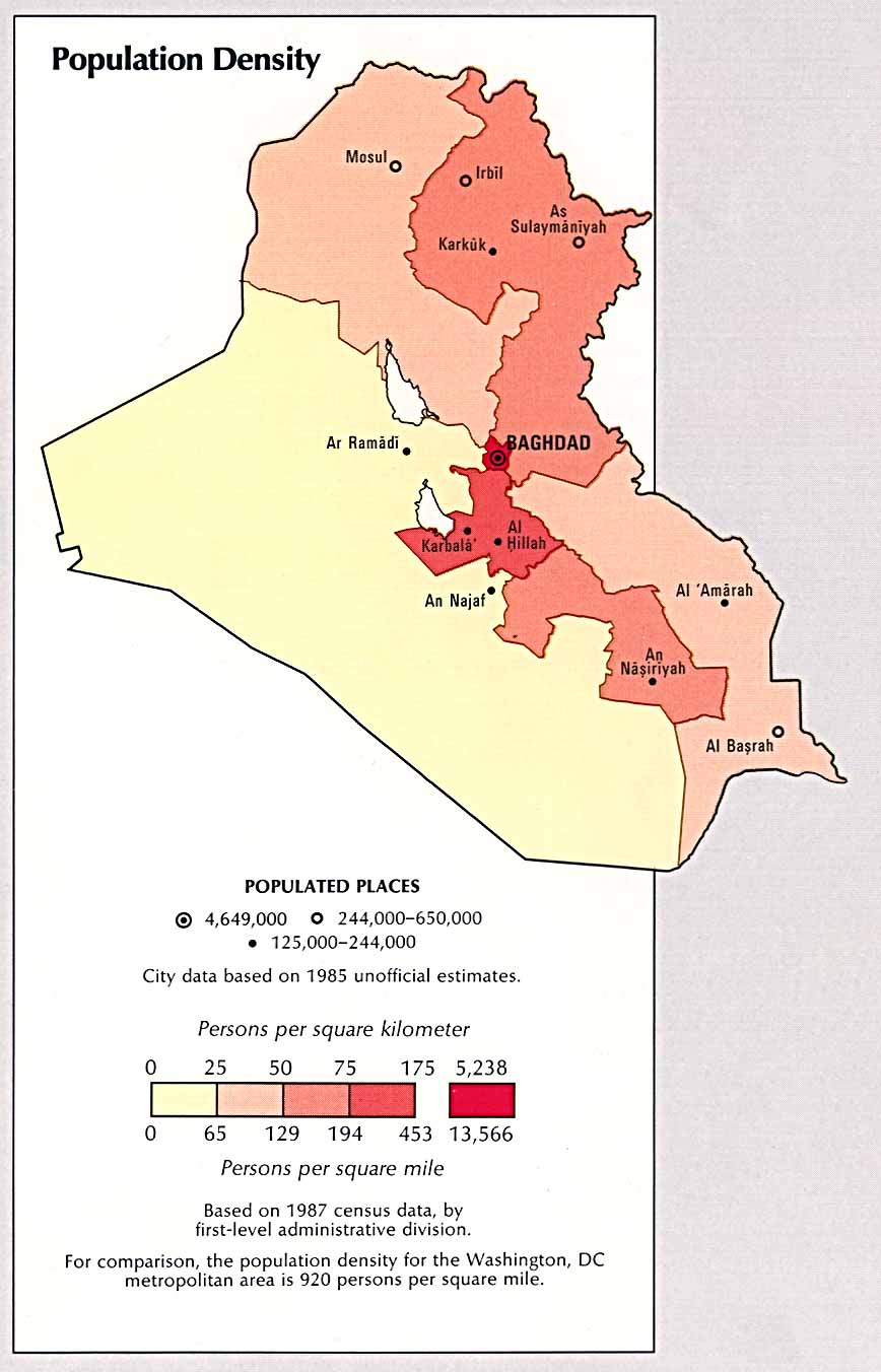
Population density
CIA, 1993 (99k)
Iraq: nine years after the Gulf war
2000. Oilfields, refineries, Kurdish areas, no-fly zones. (Le Monde Diplomatique) [reliefweb.org]
Iraq planning map
5 Mar 2001 (PDF - 2,788k) [reliefweb.org]
Iraq: satellite imagery reference map
January 2003 (70k)
Iraq ethno-religious groups
1992 (92k)[reliefweb.org]
Iraq - distribution of religious and ethnic groups
1978 (PDF - 163k)[reliefweb.org]
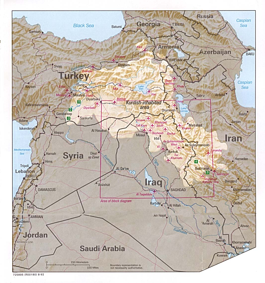
Northern Iraq
Iraq: Northern Region
2001 (168k)
Northern Iraq
1996 (23k)[reliefweb.org]
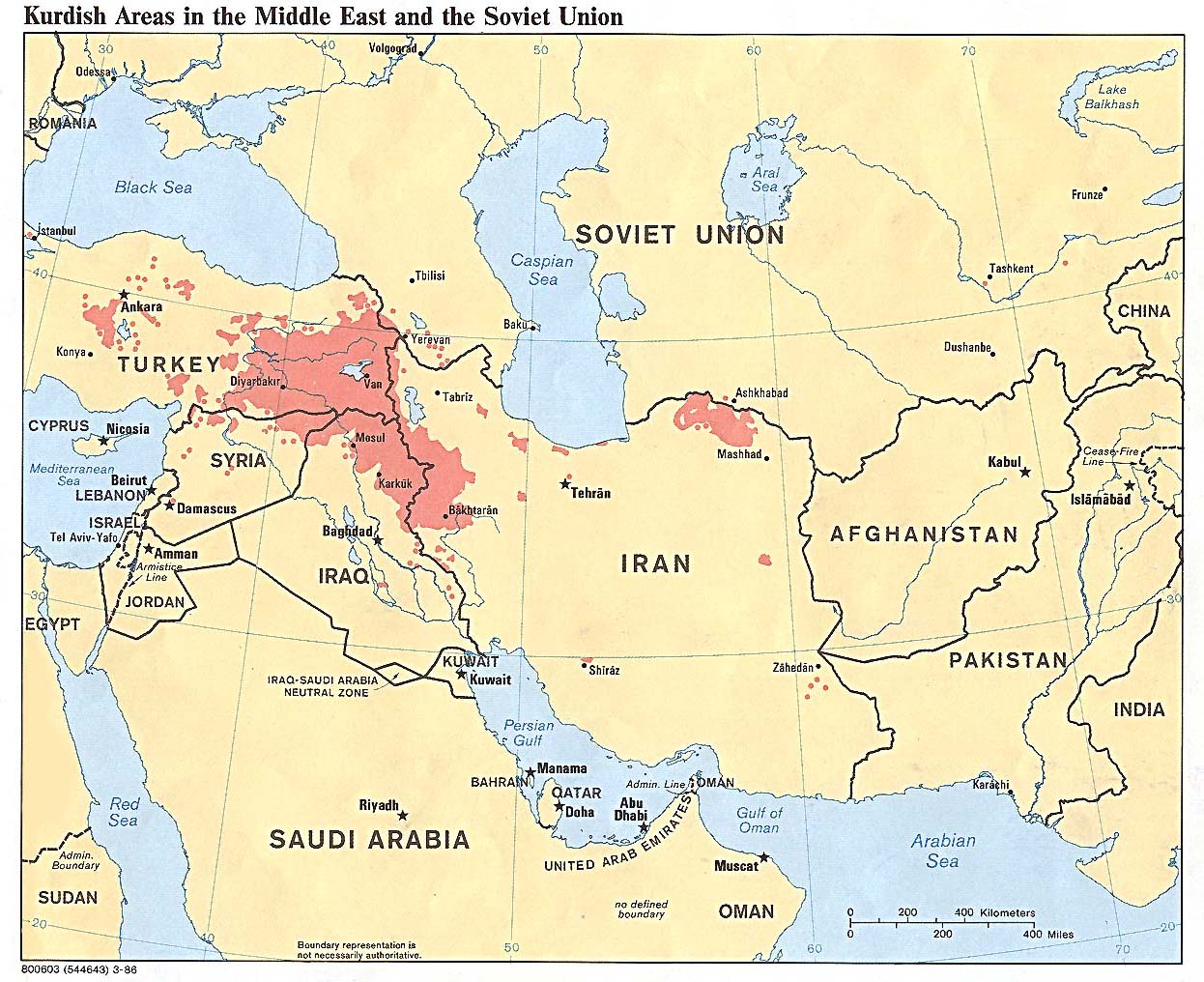
Kurdish areas
Middle East and the Soviet Union, 1986 (254k)
Kurdish lands
Location map, 1992 (235k)
Southern Iraq
Iraq: Southern Marsh Region
2001 (PDF - 562k)
Southern Iraq
1996 (23k)[reliefweb.org]
Basrah region
CIA, 1980 (400k)
Former Marshes
(and water diversion projects) in south-eastern Iraq (243k)
Baghdad maps
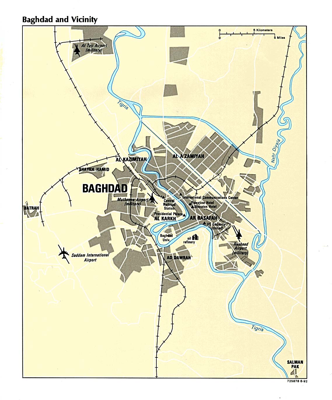
Baghdad and vicinity
Shows districts and key features in the city (mideastweb.org)
Central Baghdad
Street plan, by Kenny Hopper, University of Texas, 1998 (428k)
Major streets of Baghdad
Showing location of main buildings connected with the regime (mideastweb.org)
Baghdad
2003 (BBC)
Baghdad - Iraq
2001 (162k)(CIA)
Central Baghdad
Russian satellite image, with locations of important buildings [Washington Post]
Baghdad
1992 (206k)
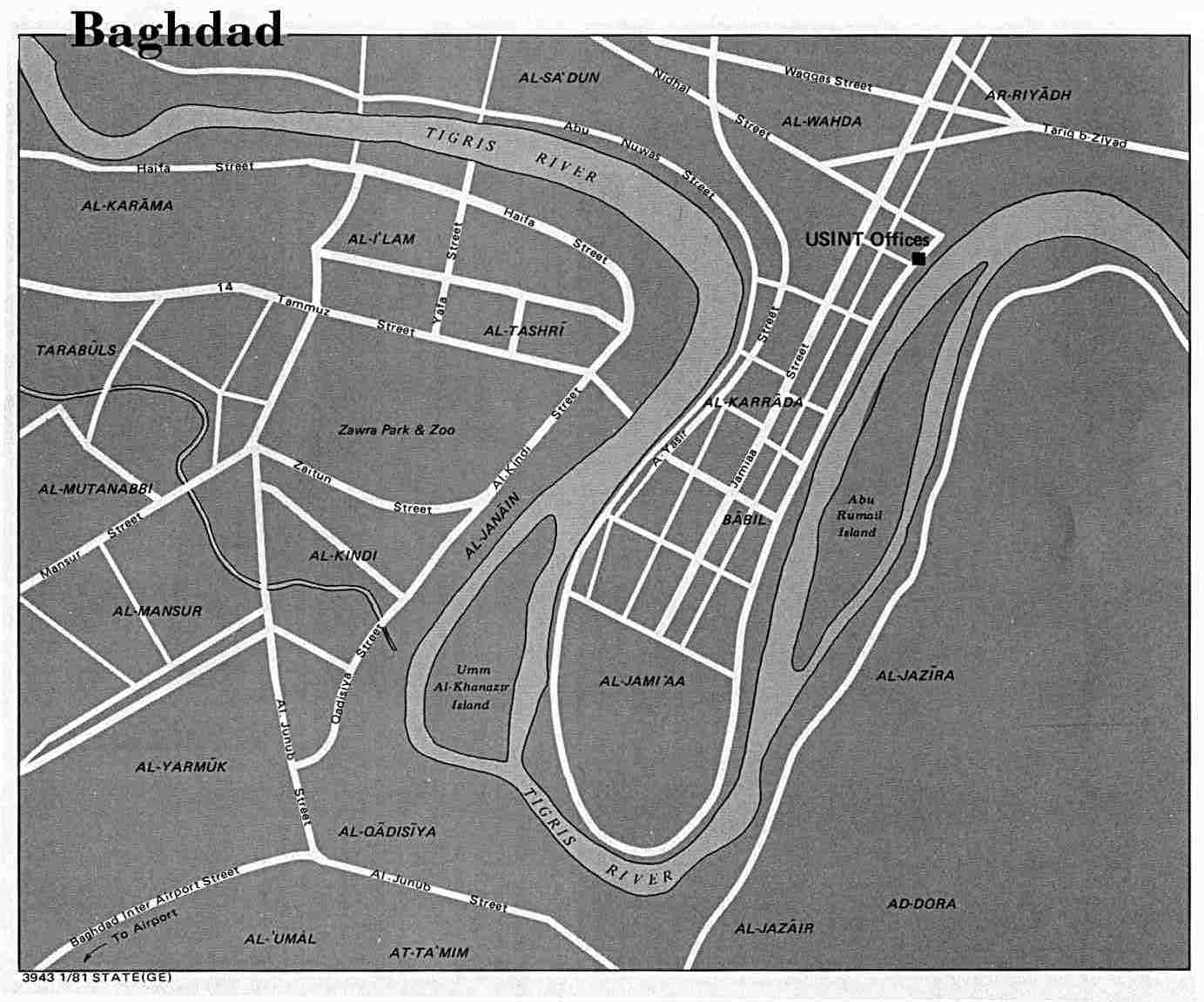
Baghdad
US Dept of State, 1981 (98k)
Baghdad region
CIA, 1980 (1136k)
Military maps
Military build up2003 (BBC)
Weapons sites2003 (BBC)
Presidential palaces2003 (BBC)
UK forces2003 (BBC)
Iraqi bases2003 (BBC)
Iraqi missile range2003 (BBC)
Dissident areas2003 (BBC)
Military installations
Aerial photographs [Federation of American Scientists]
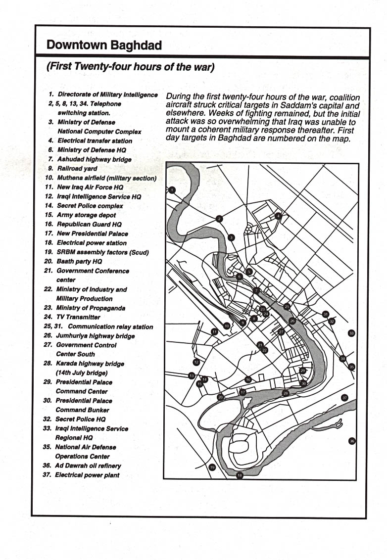
Downtown Baghdad: initial targets, January 1991
From Decisive Force by Richard G. Davis, U.S. Air Force, 1996 (201k)
Operation Desert Storm
The ground campaign
Allied Forces in the Gulf (CNN, 1998)
Central Iraq
Landsat Thematic Mapper satellite image, showing military sites [Washington Post]
Iraq: what's where
Clickable map, showing places of military interest, 1998 [CNN]
Iraq's arsenal
What the Unscom weapons inspectors found - and where [CNN]
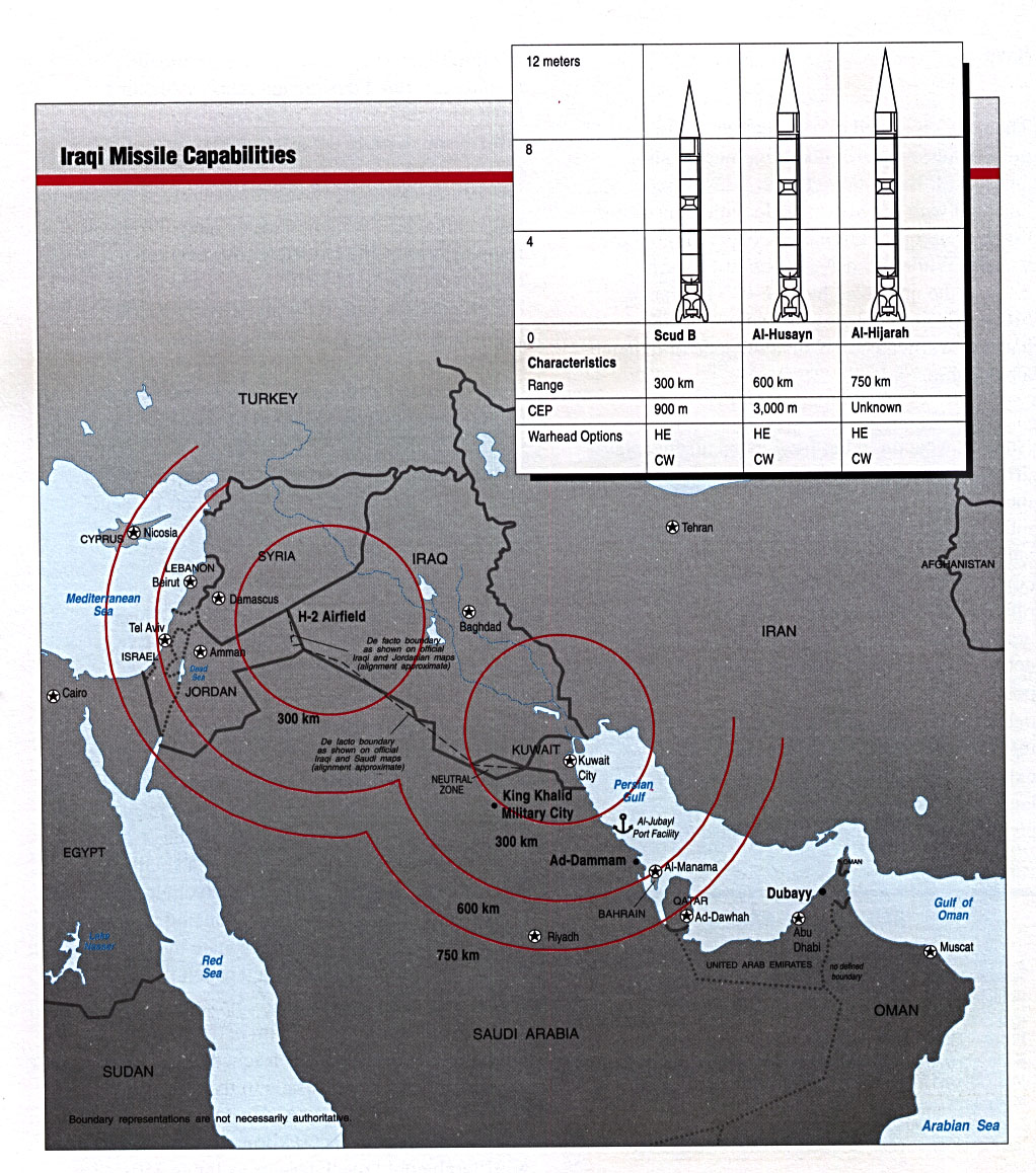
Missile capabilities
From "Conduct of the Persian Gulf War"; Final Report to Congress, US Dept. of Defense, April 1992 (338k)
Iraqi airfields
2002. (344k)(World Food Programme)[reliefweb.org]
Iraq
Clickable map with details ofsites targeted by Unscom weapons inspectors [Washington Post]
Basrah Region
Air chart TPC H-6B 1991 (US Defense Mapping Agency)
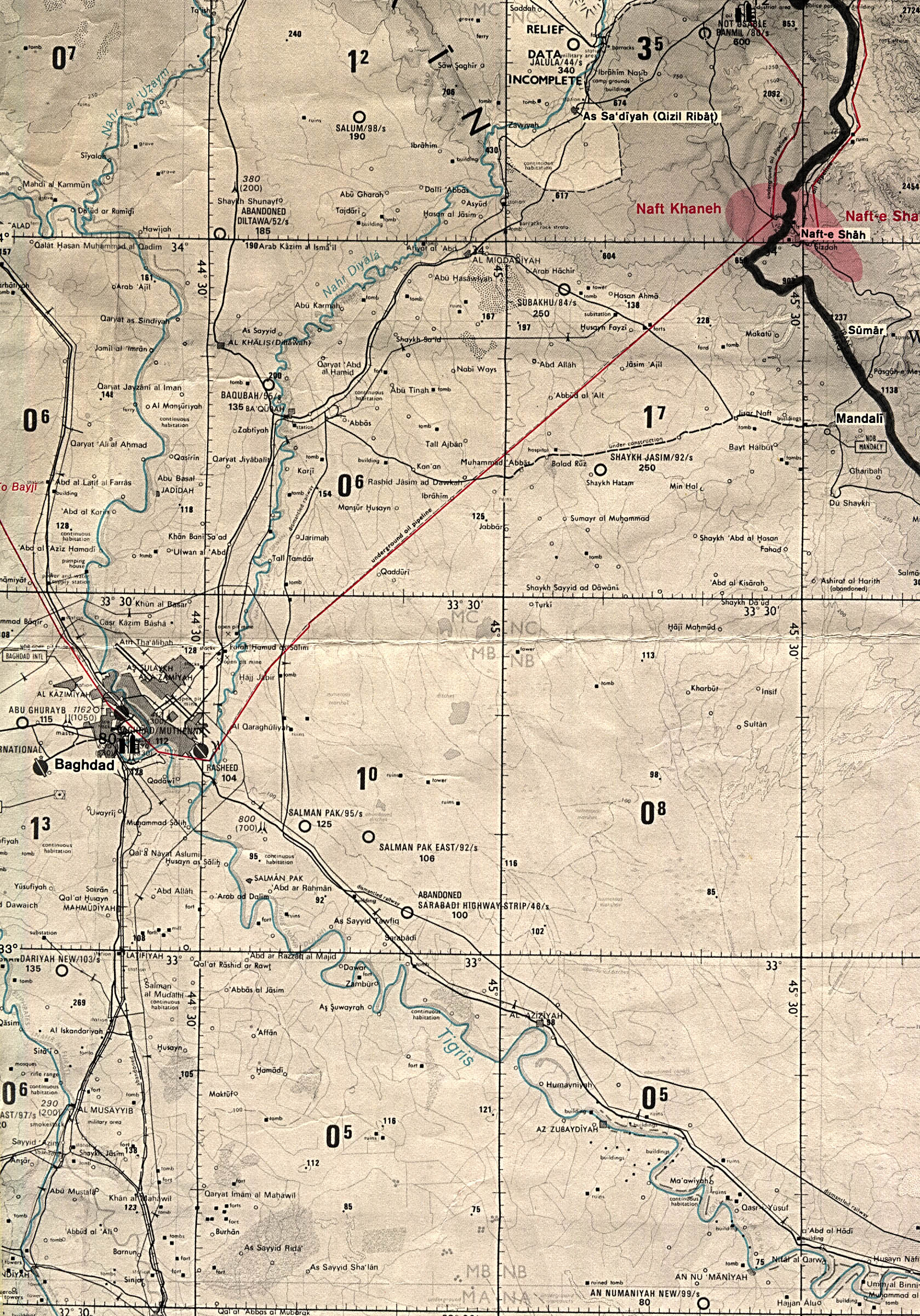
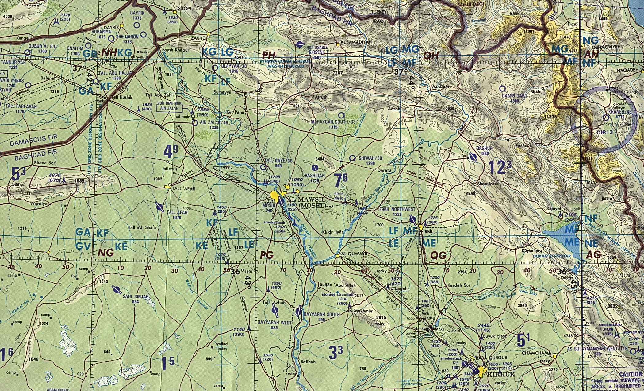
Mawsil [Mosul]-Arbil Region, Northern Iraq
Air chart TPC G-4B 1989 (US Defense Mapping Agency)
Baghdad Region
Air chart TPC G-4C 1991 (US Defense Mapping Agency)
Husaybah [Qusaybah] and Iraq/Syria Border
Air chart TPC G-4C 1991 (US Defense Mapping Agency)
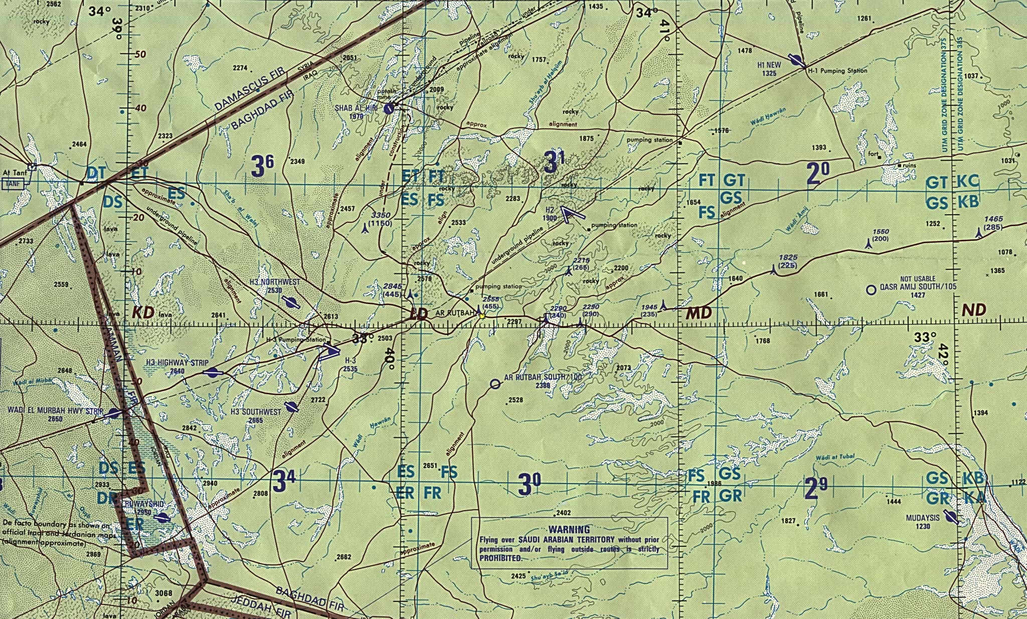
Iraq/Jordan Border
Air chart ONC G-4 1990 (US Defense Mapping Agency)
Kirkuk-Arbil Region
Air chart TPC G-4C 1991 (US Defense Mapping Agency)
Northern Iraq
Air chart ONC G-4 1990 (US Defense Mapping Agency)
Sulaymaniyah Region
TPC G-4C 1991 (US Defense Mapping Agency)
Western Kuwait and Neighboring Iraq
Air chart TPC H-6A 1991 (US Defense Mapping Agency)
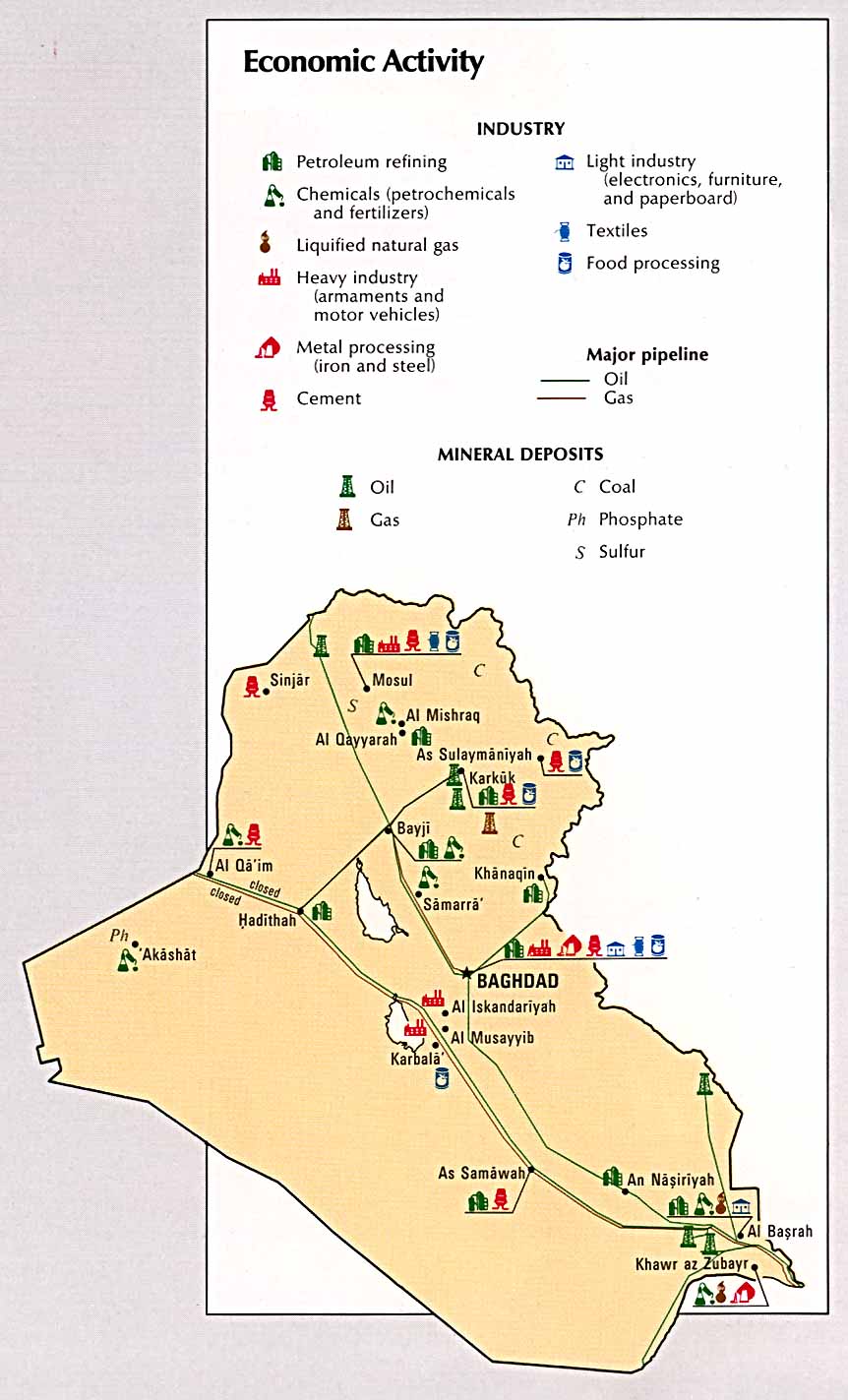
Economy and agriculture
Economic activity
CIA, 1993 (115k)
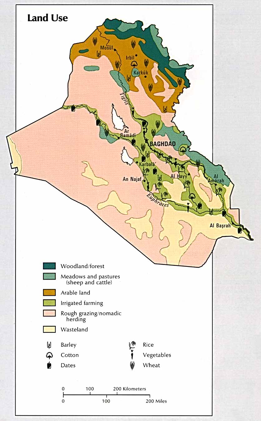
Land use
CIA, 1993 (111k)
Iraq - land utilisation
1978 (PDF - 102k) [reliefweb.org]
Iraq - economic activities
1978 (PDF - 113k) [reliefweb.org]
Population density
CIA, 1993 (99k)
Iraq - population
1978 (PDF - 103k)[reliefweb.org]
Iraqi oilfields
2003 (BBC)
Iraq: oil industry
2001 (PDF - 650k)[reliefweb.org]
Iraq: nine years after the Gulf war
2000. Oilfields, refineries, Kurdish areas, no-fly zones. (Le Monde Diplomatique) [reliefweb.org]
Iraq: electrical power infrastructure
5 Mar 2001 (188k)
Iraqi airfields
2002. (344k)(World Food Programme)[reliefweb.org]
Former Marshes
(and water diversion projects) in south-eastern Iraq (243k)
Land cover in Iraq
Derived from Landsat Imagery - 2000 (JPG - 90k) [reliefweb.org]
Wheat and barley production in Iraq
January 1991 (JPG - 60k)[reliefweb.org]
Iraq: analysis of vegetation condition
January 2003[reliefweb.org]
ICRC Water and Sanitation Programme
Iraq 1999-2000 (ICRC) [reliefweb.org]
Oil-for-Food in Iraq
8 Feb 2001 (PDF - 160k)(UNOIP) [reliefweb.org]
ICRC in Iraq 2000
2000 (PDF - 56k)(ICRC)
ICRC delegations and offices in Iraq
1995 (22k)(ICRC)[reliefweb.org]


![Mawsil [Mosul]-Arbil Region, Northern Iraq](http://www.lib.utexas.edu/maps/middle_east_and_asia/iraq_north_g4b_89.jpg)
![Husaybah [Qusaybah] and Iraq/Syria Border](http://www.lib.utexas.edu/maps/middle_east_and_asia/iraq_g4c_91.jpg)